|
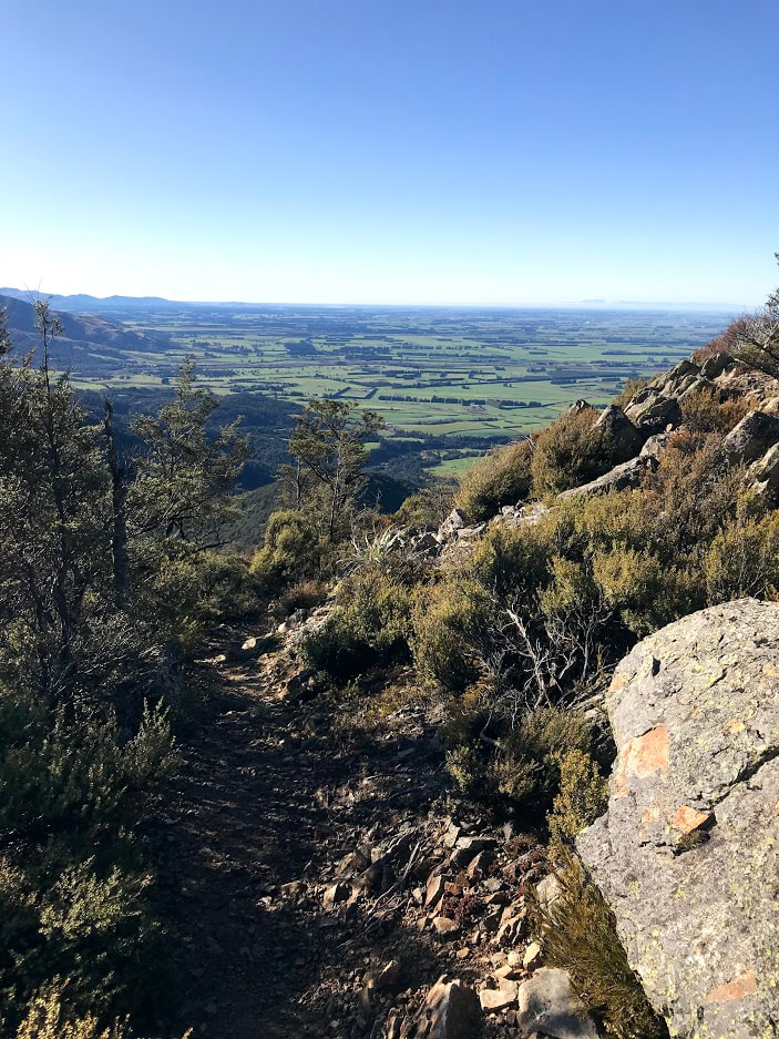
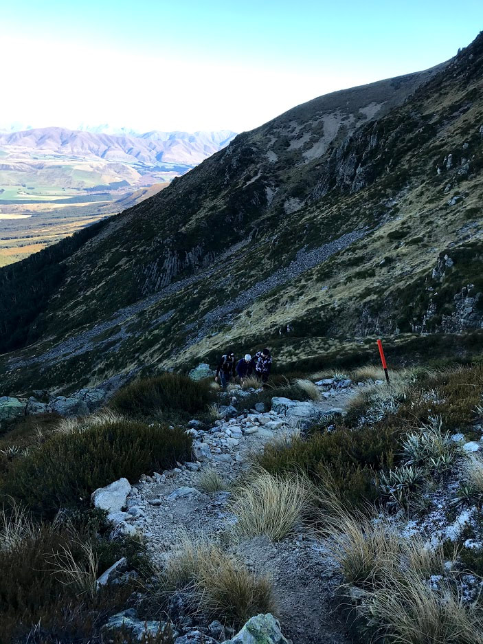
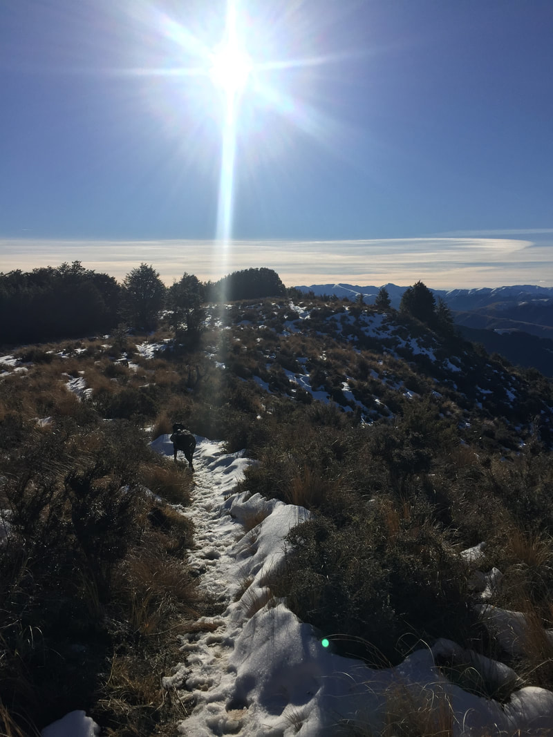
5/21/2020 1 Comment MT SOMERS - DAY WALK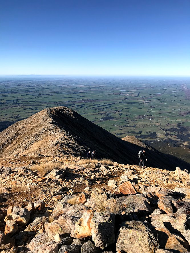 Looking back over the Canterbury Plains towards the Port Hills The wide variety of couples, families and friends we pass every time we venture out to Mt Somers is a testament to what a fantastic range of options this mountain offers to hikers. You can complete an easy overnighter into Woolshed Creek Hut; circumnavigate the whole mountain in a weekend or make your way up to the open plateau at the summit to enjoy expansive views of even Mt Cook on a clear day. Only 90 minutes south-west of Christchurch, as a youngster the small town of Staveley was known to me solely as the spot we were all bused to as kids for our Year 6 camp (and 7 years later a much rowdier Year 13 camp with many of the same students). I was excited to learn early on in my tramping life as an adult that just beyond the town was the start of a network of tracks I'd head back to visit almost yearly! Follow the signs past the Staveley store for Sharplin Falls and you'll find yourself at a large car park complete with flushing toilets and a small shelter. From here you can head north up towards Pinnacles Hut, along the river to Sharplin Falls or where we were heading along the South Face Track to the turn off with the Summit Track. The latter climbs steeply to begin with and is often muddy so poles are a big help through this first section. Once you've gained point 731 at Hookey Knob, the track evens out a little more before bringing you out of the beech forest for some open ridge travel to Staveley Hill. This section is well marked and easy to follow until you reach the signed turn off at 1085m.  Despite there being no snow this early in the year (May) the south side of the mountain receives little sun and the track became icy as we turned to make our way up to the summit. A poled route takes you through a stand of trees near the turn off before heading straight up the rocky south face. There is a clear track most of the way up and even if you lose it in places it's easy to pick up again between the poles. Once you gain the summit ridge, turn west and follow the route all the way to the trig at 1688m. The top opens out into a wide plateau large enough to host a game of force back without worrying you're going to fall off a cliff. A little further past the trig you'll find a monument pointing out the prominent peaks in every direction where you can stop and have a snack whilst dreaming of what it'd be like to climb Mt Cook (unless you've climbed it already in which case I'm concerned you felt the need to read this post to be honest). This is definitely an achievable climb for a range of abilities provided you've got a bit of fitness behind you. We passed 2 young kids climbing with their parents as well as getting the in laws up there ourselves. I feel DOC grossly overestimates the time for this walk in summer and I'd put it at a comfortable 3 - 3.5 hours from car park to summit for most people. We were 1.5h to the turn off and the same again to the summit. If you're looking for more of a challenge you can also approach this climb from Woolshed Creek Hut by following the Rhyolite Ridge Track to just below 1100m before navigating the open west ridge if you're confident using a map. If you have time, check out the falls on your return to the car park. 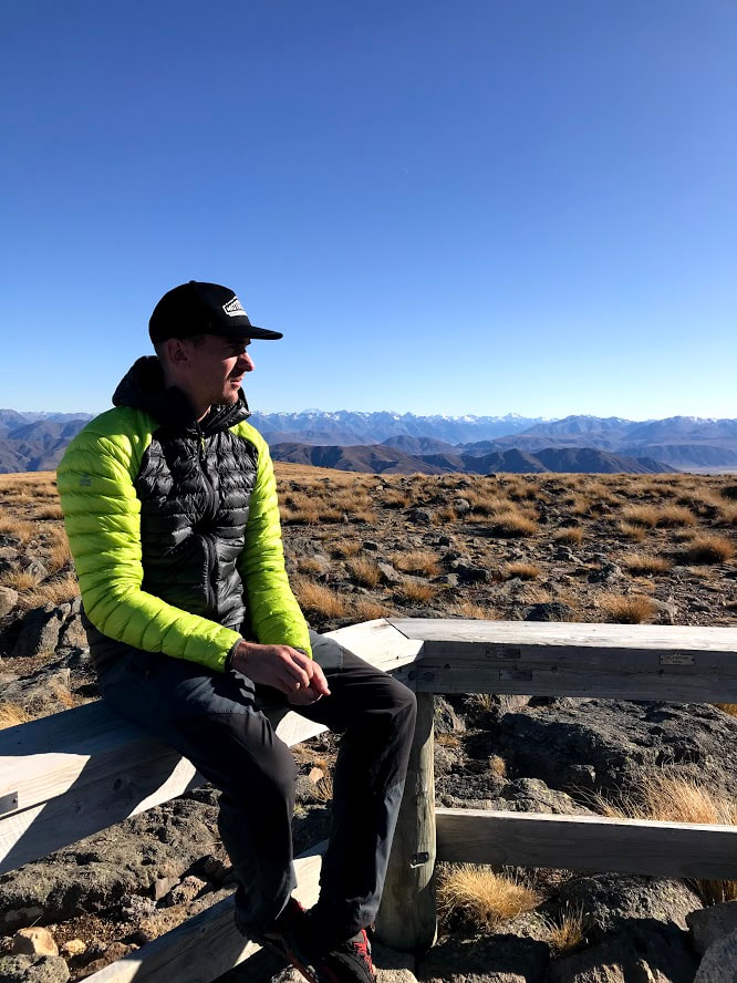 Taking a moment to relax at the top 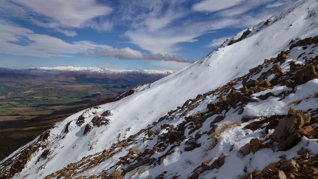 The summit ridge track in winter can require crampons as this side becomes quite icy 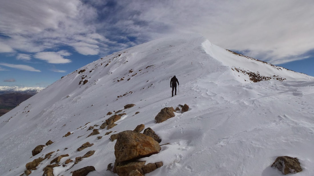
1 Comment
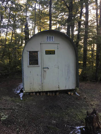
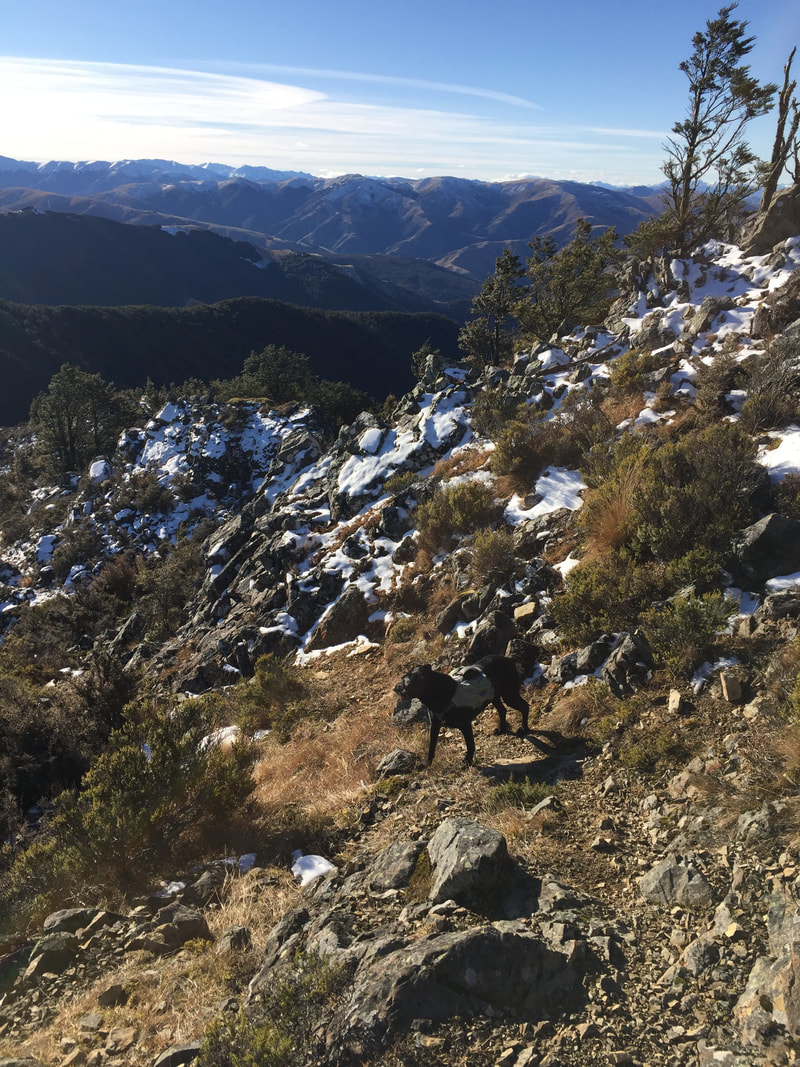
From here the track is above the bushline for a while giving stunning views in all directions before dropping down towards the intersection with the Whare route. The Whare route leads down to the popular, and much larger, Pinchgut Hut. I had been following plenty of footsteps in the snow up until this point which abruptly stopped when I turned west onto Bob’s Camp route. The route itself is well marked and easy to follow, with just the odd bit of windfall when I went through. The route drops down towards a small saddle before climbing gently up towards an area of open tops just above the biv site. The biv itself is located about 10 minutes from here in beech forest near a small stream. The hut is a cosy two-bunk affair that used to be located in Upper Salmon Creek before being relocated to its current site. There is a good camping area at the Biv so don’t be put off by the small size if you’re happy to tent it up. Water is available from the nearby stream (this may run dry at the height of summer). There is also a large outdoor fireplace that appears to get regular use (although I couldn’t find an axe when I visited). One of the great things about this area is that it is dog friendly so I was joined by my furry friend for the trip. Time: 2h 45m - 5 h one-way depending on your fitness Distance: Just under 10km with about 1000m ascent into the biv.  |
CategoriesAll Arthurs Pass National Park Avalanche Peak Bealey Spur Bob's Camp Biv Cannibal Gorge Hut Canterbury Foothills Carroll Hut And Kelly Range Cass Saddle Lagoon Saddle Castle Hill Peak Crow Valley And Crow Hut Edwards - Stanley Rivers Fowlers Pass To Lake Guyon Gloriana Peak And Ada Pass Hut Hakatere Conservation Area Hanmer Springs Hope Kiwi Jollie Brook Circuit Kahurangi National Park Kepler Track Lake Sumner Forest Park Lathrop Saddle Little Mt Peel Manuka Hut Marlborough Maukuratawhai Mt Barrosa Mt Bruce Mt Cassidy Mt Potts Mt Princess Mt Somers Mt Tapuae-o-uenuku Mt Te Kinga Mt Torlesse Mystery Lake Nelson Lakes Packhorse Hut Poulter Hut Roys Peak St James Sylvia Tops Tablelands Circuit - Salisbury Lodge The Five Passes The Three Passes Travers-Sabine Circuit Tribulation Hut Waiau Pass And Blue Lake Wanaka West Coast |
 RSS Feed