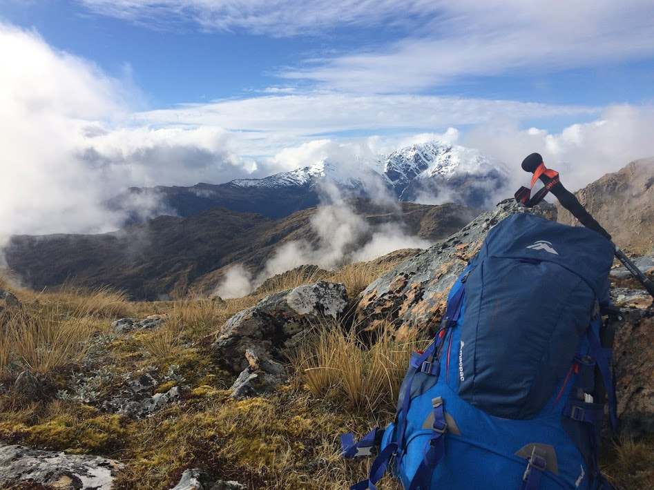
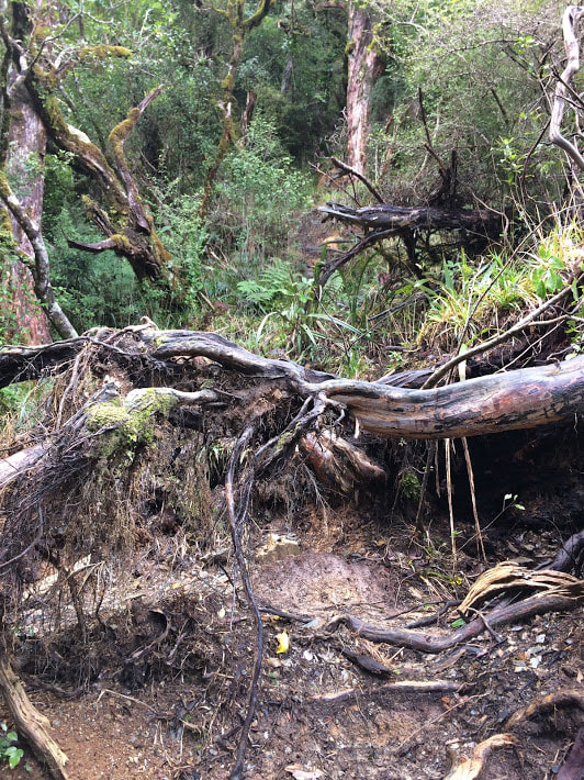
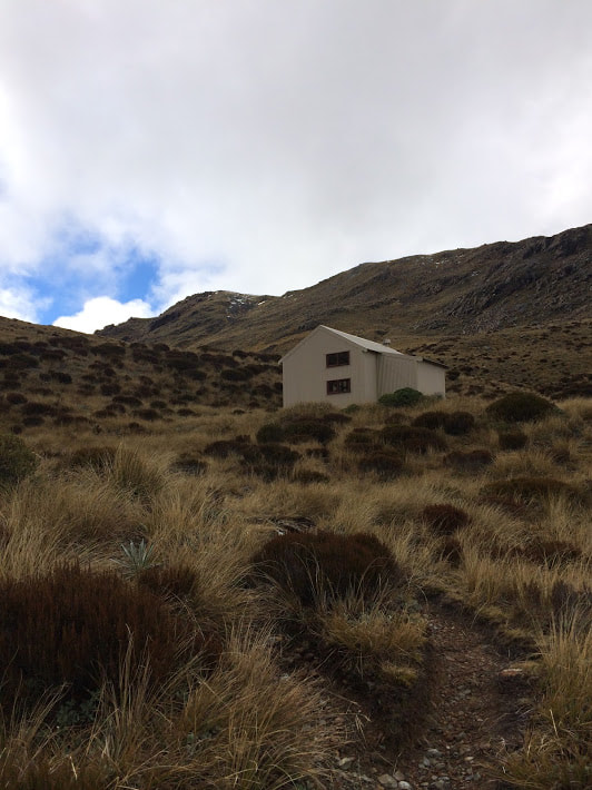
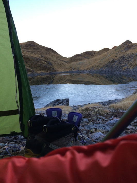
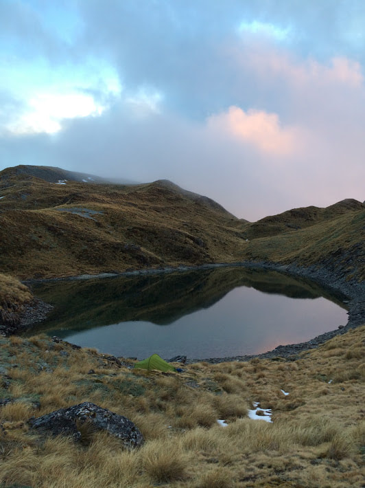
 View from the top of the Kelly Range There are so many walks, tramps and climbs in Arthurs Pass that I should really stop being surprised when I find another corner that I'm yet to discover. Sitting on the Otira side of the park, Carroll Hut was the perfect option for a solo overnight mission at the beginning of September. There had been plenty of snow falling in the weeks prior so I was surprised to drive over Porters and find the snow line sitting well above 1300m. The upside was that I could leave my crampons and ice axe in the car and take more chocolate instead. On the west coast side of Otira, take a hard left immediately after the first bridge onto a gravel 4WD track which leads to the car park at the start of the track. If your car has low clearance it might pay to park on the far side of the road and walk the short distance instead as some heavy machinery had been gouging holes in the access way. You will get attacked by sand flies as soon as you exit your vehicle - don't say I didn't warn you! Thankfully my gear was all sorted but I still managed to lose some blood just trying to yank my gaiters on before hightailing it to the start of the track. Typically for the area, the track heads straight into a steep but steady climb up an often quite rocky trail. If you've been up Avalanche Peak, which most visitors to the area generally start with, then you'll have a good idea of the quad burn to come. Whilst there are no steep drop offs, some fallen trees and a good bit of mud require some scrambling, climbing and semi-controlled sliding in places. I had a pretty good sweat on after fifteen minutes and appreciated the sparsely placed horizontal sections of track that allowed me to catch my breath and actually take my pack off at one point during the ascent. DOC suggests 2-3 hours to the hut but this is dependent on if you're just up for a day trip or staying overnight and carrying the requisite gear. I took less than two with a 13kg pack and a couple of five minute breaks but the incline was definitely challenging. Once you break out of the bush and gain the tussock the track winds around towards a waterfall high above Kelly Creek. From here you pop up and over the bluffs and find the hut sitting on a small plateau near the saddle. A tidy little 10 bunker with fantastic views from the loo, Carroll Hut made for the perfect lunch stop before I began along the range to the south-west. You could easily base yourself at the hut and climb Kellys Hill, an impressive looking summit at 1408m for an alternative day trip or overnight excursion. 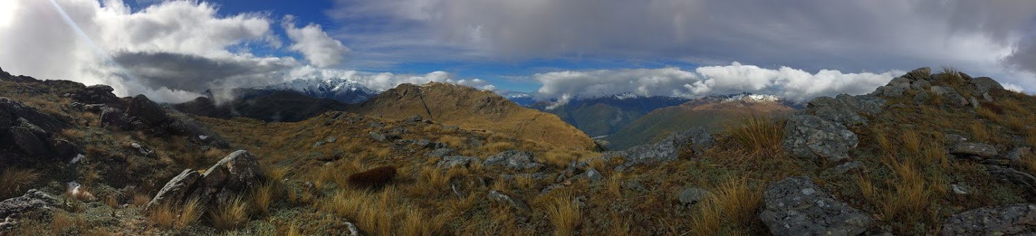 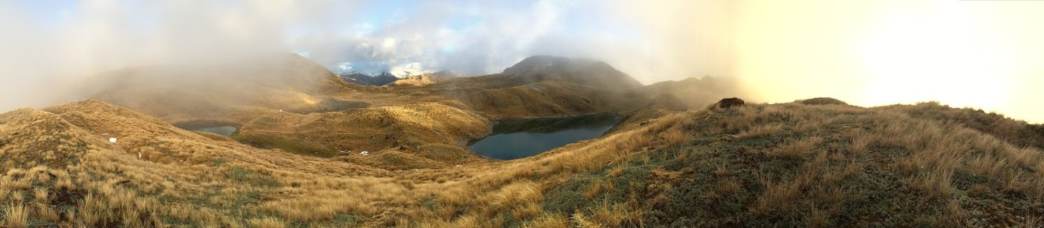 I left my intentions in the hut book and set out towards Kellys Saddle where I planned to find the route heading along to the tarns where I was going to camp that night. When I got to where I could see the map showing the way I turned and walked along the ridge in the direction of point 1385. Unfortunately there was no sign of either a route marker or a track up on the top which struck me as a bit strange. It was a clear day and I was pretty confident of my bearings so I followed the map along where I thought the track would have been (more on this later) until I arrived above the four alpine lakes I had been searching for. The tarns are nestled in a valley of tussock and rock which was incredibly picturesque but offered the challenge of finding a flattish spot for my tent. I ended up right beside the edge of one of the tarns on the stony bank where someone had already flattened out a bit of a tent site (I'd recommend an inflatable mat). Getting tent pegs in wasn't easy though so I was glad for my tiny Macpac Sololight which doesn't take much to set up. It was from here that I finally found the aforementioned track, not where the map had it but further north and lower down from the ridge. I know what you're thinking but I used the GPS on my Map Toaster App to mark the actual track on the way back just to make sure I wasn't having a navigation fail. I went to bed early since it was bloody freezing and got dark around 6pm. I woke a couple of times in the night feeling a bit cold and when the sun finally came up the tarn was frozen over along with my tent. The process of de-icing it took a couple of hours so it wasn't until mid-morning before I was packed and ready to find out where the track went. Marker poles that were sometimes difficult to spot in the bright sunlight led back past the tarns before sweeping around the side of the ridge and coming back up from the north side of Kelly Saddle (see map below). Although the gradient was easier it was actually further than I had walked the previous day and took about the same amount of time (1 hour each way). This would be a great trip to try if you have a moderate level of fitness and want to experience tramping up on the tops without the worry of having to find water. To find the route from the hut just keep following the original track the whole way over the saddle as it turns and heads to the tarns a few hundred metres past where current topo maps place it. I'd be pretty keen on a swim in the summer months so maybe pack a towel as well. TIme up to hut - 1hr 55m Hut to Tarns - 1hr Tarns back to car park - 2hrs 40min 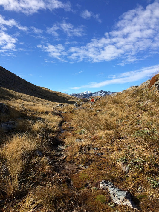 Following the marked track on the way back to the hut
2 Comments
|
CategoriesAll Arthurs Pass National Park Avalanche Peak Bealey Spur Bob's Camp Biv Cannibal Gorge Hut Canterbury Foothills Carroll Hut And Kelly Range Cass Saddle Lagoon Saddle Castle Hill Peak Crow Valley And Crow Hut Edwards - Stanley Rivers Fowlers Pass To Lake Guyon Gloriana Peak And Ada Pass Hut Hakatere Conservation Area Hanmer Springs Hope Kiwi Jollie Brook Circuit Kahurangi National Park Kepler Track Lake Sumner Forest Park Lathrop Saddle Little Mt Peel Manuka Hut Marlborough Maukuratawhai Mt Barrosa Mt Bruce Mt Cassidy Mt Potts Mt Princess Mt Somers Mt Tapuae-o-uenuku Mt Te Kinga Mt Torlesse Mystery Lake Nelson Lakes Packhorse Hut Poulter Hut Roys Peak St James Sylvia Tops Tablelands Circuit - Salisbury Lodge The Five Passes The Three Passes Travers-Sabine Circuit Tribulation Hut Waiau Pass And Blue Lake Wanaka West Coast |

 RSS Feed