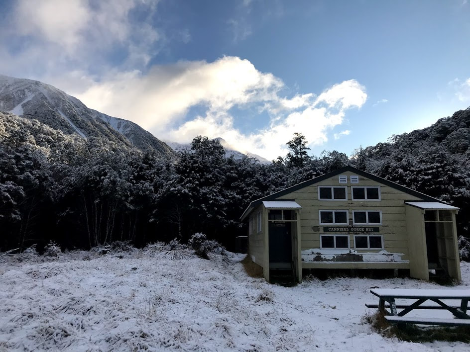
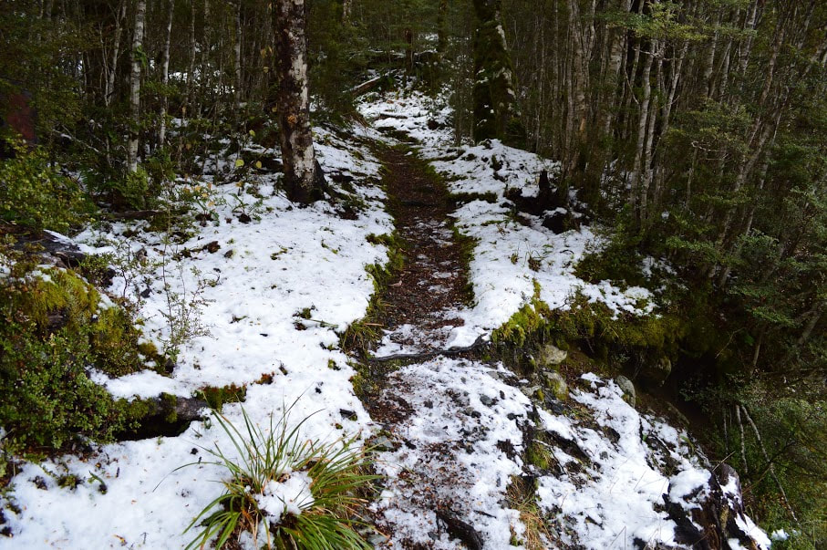
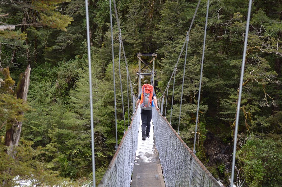
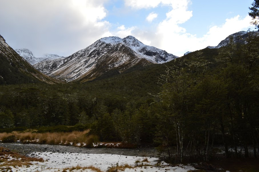
 Sometimes a poor weather forecast means the end of even the best planned trips, but thankfully with a good hut, the right gear and even better company, you don't have to stay home pretending like there's still things on Netflix you haven't watched. While the St James Walkway at 66km is one of the longer trips in the country, Cannibal Gorge Hut is an easy overnighter or day trip covering the first section of track. This was our second time visiting in winter after we had wandered past a few years back on our way to Ada Pass Hut. With a group of ten and the baby in tow, it made for the perfect location with snow in the forecast and shorter daylight hours to contend with. With a name like "Cannibal Gorge" I'm sure you're wondering if the area had a somewhat colourful history and you wouldn't be wrong. The gorge is known as Kopi o Kaitangata in Maori and was where traditionally a slave would be slaughtered to provide food for the rest of the party of travelers. Thankfully the rest of us can make do with good old freeze dried meals these days but it certainly makes you consider how tough you had to be to survive living in that environment all those years ago! 2.5 hours from Christchurch and in the middle of the Lewis Pass, a large car park and shelter marks the beginning of the track. There is a toilet here just next to the shelter in case you decided to smash back a large flat white from the McDonalds by Pegasus as you were leaving town - or if you just need to pee that is. DOC puts the 8km walk into the hut at 3.5 hours and part of our group was almost exactly on this with a few breaks along the way. From the car park make your way along sections of boardwalk as the track winds its way downhill towards the first swing bridge. This is a bit demoralizing to climb back up on the return trip as the last 2km really gets you in the quads when you've already started dreaming of a hot shower. 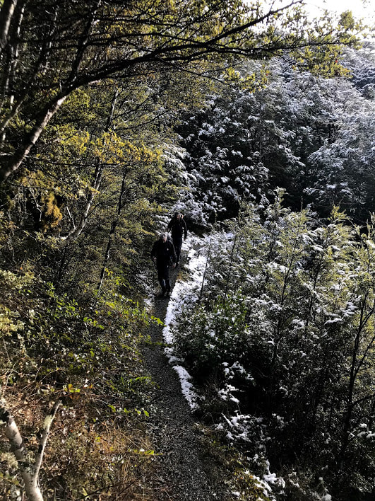 Once across to the far side of the Maruia River, the track remains a little higher above the bank as it winds north towards the hut. The track itself is well maintained and easy to follow even in snow as we had on the second day. There are a few spots climbing down and back out of the side streams where it can be a bit of a scramble up crumbling banks but mostly this is a easy to navigate and very runnable if you're that way inclined. Obvious signs will point out several spots which cut across avalanche paths but these only present a problem after significant snow fall. If you're at all in doubt about the snow conditions talk to your local DOC centre to get some advice before going. When the track eventually rejoins the river you're not far from the second swing bridge and the hut itself. We were 2.5 hours from car park to hut with no stops but some rather heavy packs so I would predict the super fit would fly through here in closer to 2hrs or alternatively if you're more of a novice expect to take the whole 3.5hrs. Cannibal Gorge Hut itself is a 20 bunk serviced hut with a fantastic coal fire and views out over a grassy clearing and back down the valley. There are two equal sized bunk rooms which makes it easy to split the snorers from the rest of the group or if you just don't like to talk to other people. We arrived in the early afternoon knowing that snow was due to hit a couple of hours later and we weren't disappointed. Although we only ended up with a few centimetres it was enough to make the walk out the following morning pretty magical. DOC does a great job of keeping coal stocked up for this hut but it sounds like some visitors have had issues getting the fire going. This is a very cold valley to be stuck in if you can't get that cranking so maybe do some research before you leave if you're not confident with your fire making skills! Total Distance: 16km Total Time: 5hrs return Pro tips: Mulled wine in winter is always worth the extra pack weight 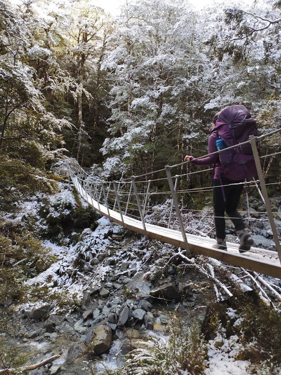
5 Comments
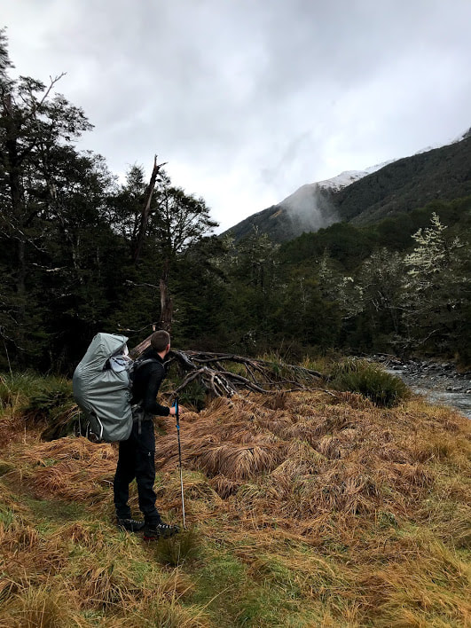
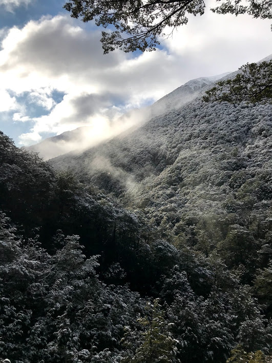
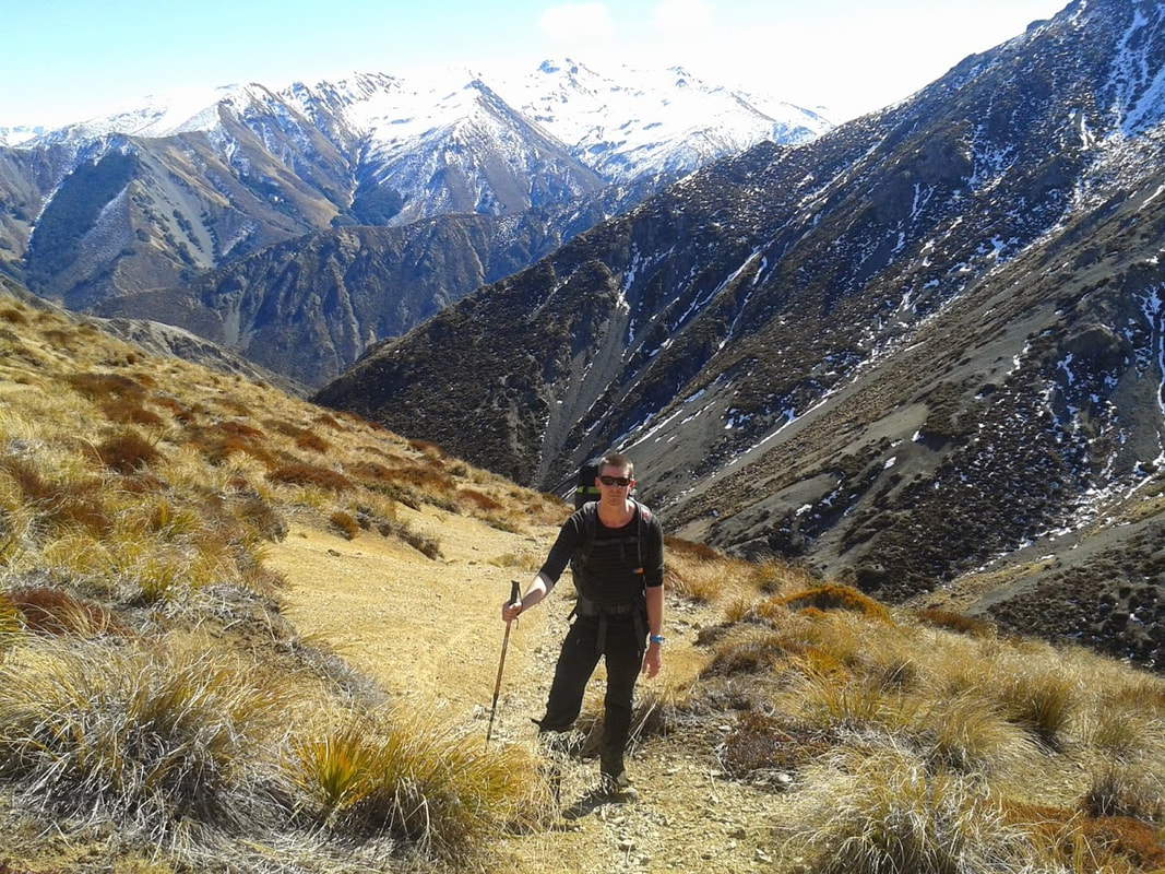
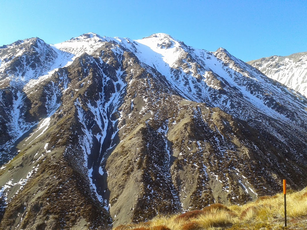
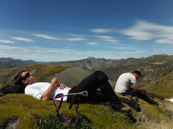
6/29/2018 2 Comments Maukuratawhai - Hanmer Springs In October last year I attempted to climb Maukuratawhai with my workmate, unfortunately we had to turn around due to some pretty terrible visibility so it was great to get back there this year and reach the top. Maukuratawhai (try saying that 10 times fast), is a prominent mountain sitting across the Clarence River just on the other side of Jack's Pass from Hanmer Springs. We had the four legged terror in tow as we drove up over the pass between Mt Isobel and Dumblane before parking at the turn off to Tophouse Road. There isn't really a track so finding a calm enough spot to cross the river involves a quick bash through the head high foliage to the bank and wandering along in the direction of the ski field for a couple of hundred metres. This river can become difficult to cross after heavy rain so take your time to check that it's safe before making your way out into the main current. I've never seen Izzy swim in a proper current before so I was pretty impressed with how easily she motored across to the other side - webbed feet seem to be the secret here. We regrouped on the opposing bank before frolicking (the dog) and trudging (us) our way to the base of the obvious spur. You can head straight at point 1086m from as far down as your legs can handle - the gradient is more gentle on the ridge than walking straight up the sides here. There is no great navigational challenge for the rest of the climb but you will need to skirt around some of the rockier sections of the ridge. For the most part going right or left at these sections is of equal gain although if you follow a dog up they'll probably find the easiest route up before you even get to it. 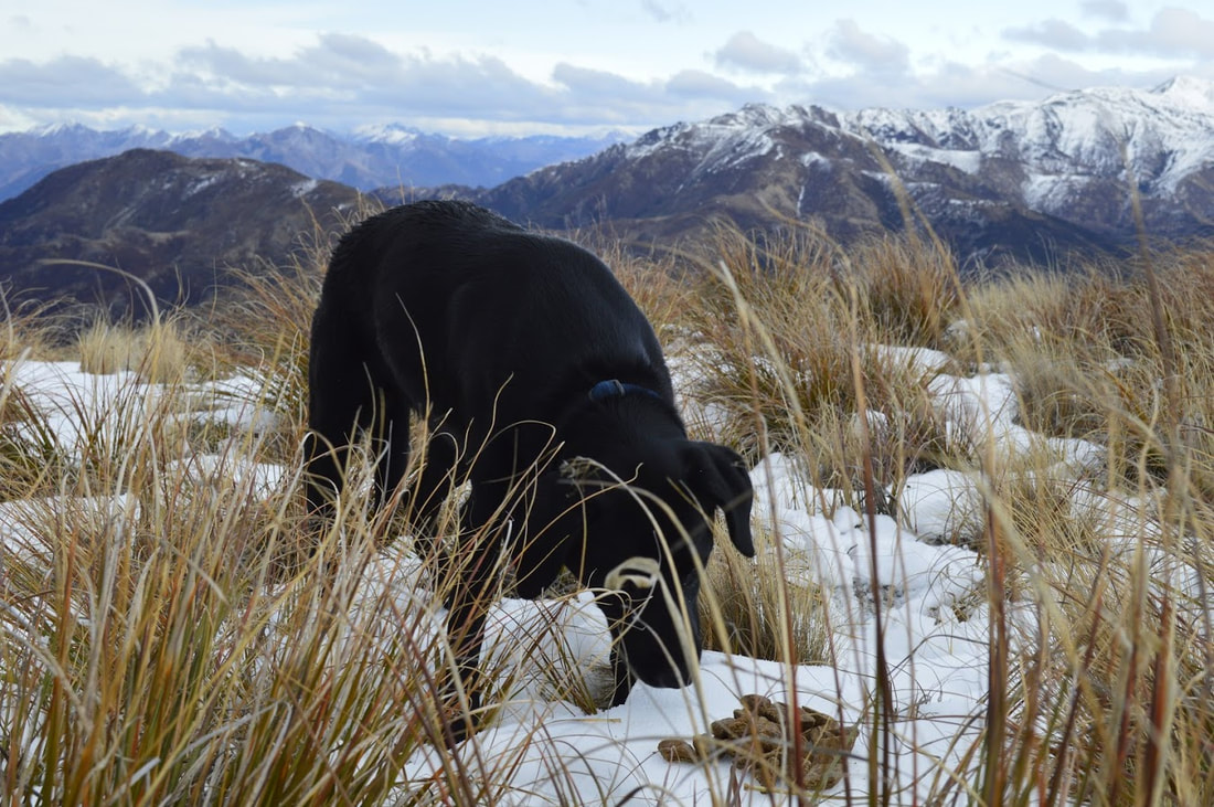 Things were going really well for us until we encountered snow from about 1300m. Areas of the mountain that hadn't seen much sunlight were icy and hard to walk on which left us wishing we had brought crampons with us. Thankfully there was plenty of exposed rock to keep moving safely but we would have been noticeably faster if we could have just stormed straight up the snow with spikes on our boots. Izzy feared a little better having inbuilt show shoes and had to keep waiting for us to catch up. From point 1362m to the summit is steep in places and provided more of a challenge with the snow and ice than I had anticipated having been up there in warmer months. We ended up taking around 2 hours from the river to the top at 1615m and 1 hour 15 minutes on the return journey. We were back in Hanmer with plenty of time to still enjoy the day but pretty happy with our efforts on a pretty cold and windy day. 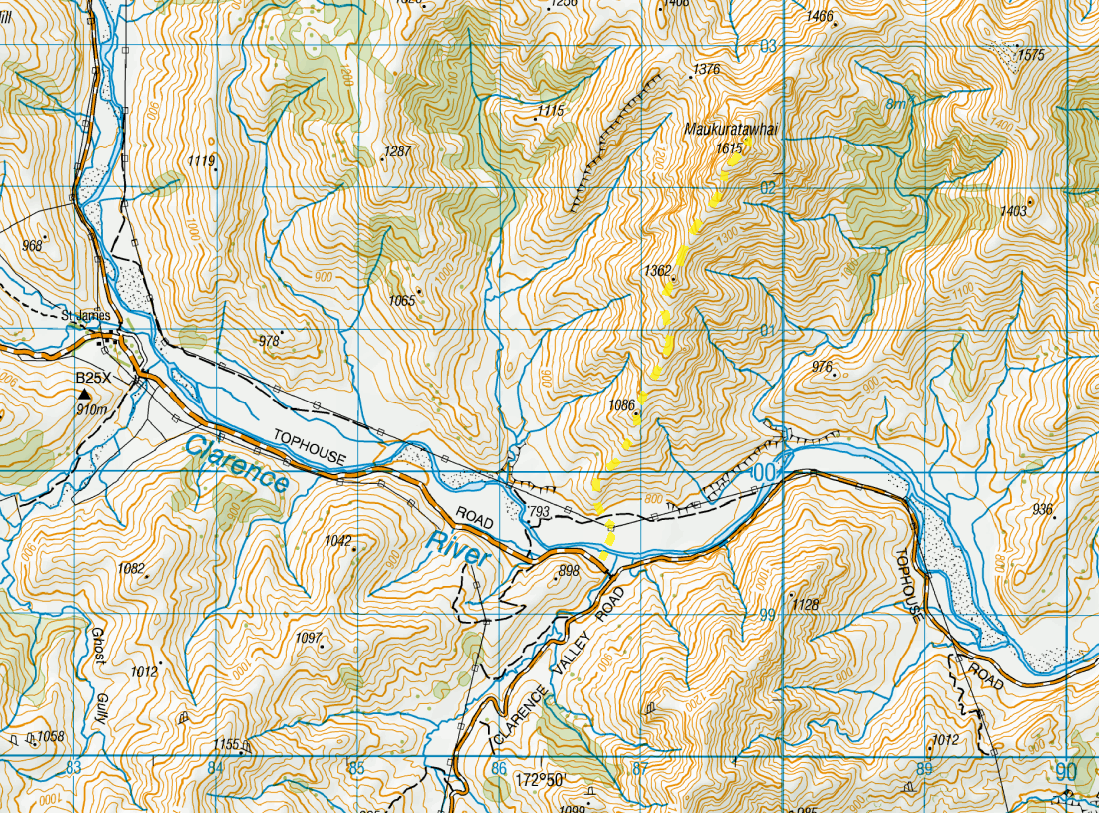  Maukuratawhai is the obvious peak to the right 6/29/2018 2 Comments Gloriana Peak and Ada Pass Hut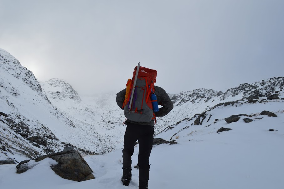 Heading up Gloriana Much like Edmund Spenser's epic "The Faerie Queene", from which the mountain takes her name, our attempt to climb Gloriana Peak was incomplete but a great weekend away none-the-less. In the Lewis Pass at the top end of the well known St James Walkway lies the Spenser Mountains. Evidently named by men who knew their English literature, Faerie Queene, Mt Una and Gloriana Peak overlook the track between the highway and the wide banks of the Waiau River. This is an area we have grown to love over the past few years but it was my first time on the easy going St James and I was excited to see how far up the mountain we might get with an average weather forecast and only two days up our sleeves. We left our little four legged terror in Hanmer Springs with family before jumping in our old blue station wagon for an early morning drive to the start of the track. Sam and I stared dejectedly out the windows at the approaching rain clouds from the back seat as the two boys in the front seemed oblivious to the ominous weather conditions. It was a shock to the system when we disembarked into freezing temperatures and the overwhelming quiet of the bush - Metallica had until then been blaring out of the speakers all the way up the pass. We shrugged on our packs with little enthusiasm and began crunching across the snow covered boardwalk into the cold and damp of Cannibal Gorge. Once we had warmed up and settled into the walk we made quick progress along the undulating track to Cannibal Gorge Hut where half a dozen fearless mice were cruising around on the floor hoping we might drop a scrap or two. It was far too early in the day to stop for more than a quick snack but the ice box of a hut and furry residents encouraged us to be on our way rather promptly. We had intended to walk to Ada Pass Hut and then leave the track in favour of bush bashing up to the first set of tarns on Gloriana to camp for the night. Then we would have an easier climb to the top the next day before legging it all the way back down and out to the car that same night. We knew all week leading up to the trip that the weather probably wouldn't come to the party but it was still disappointing to have rain and mist closing in heavily as we started out again from the hut. Snow continued to blanket the track in many places and it was still uncomfortably cold when we arrived an hour later at the smaller (read better) Ada Pass Hut. This hut had been talked up to the stuff of legends based on a prior excursion by two of our party and I was expecting big things. Nestled just above a quaint little stream with a stunning view towards point 1911, it certainly seemed promising on initial inspection. The real selling feature was of course the coal fire which apparently made the hut so hot one needed to run outside for snow baths just to keep from heat exhaustion. This may have strongly influenced our decision to leave the mountain for the next day and hope the weather would improve in the morning. Unfortunately for us there was no dry wood for miles in any direction and getting the fire going took the better part of four hours. 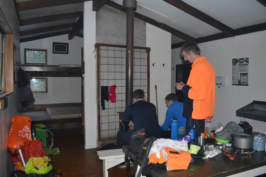 Inside Ada Pass Hut It was a very social night with a crowd of European visitors arriving as night fell and throwing all their soaking wet gear on top of our almost dry kit above the fire. Cheers guys. We slept well although temperatures never reached the level of being considered "hot". The morning dawned a little cloudy still but we decided to break out the GPS and follow our dense bush expert across the river and up the first ridge. Being the only member of our group of four under the height of six foot two, I had to work a little harder to keep up once we hit the slope but we popped out above the bush line a little over an hour later without incident. From here we faced steep rocky bluffs that had to be skirted around to the right in order to gain the first of three plateaus. The snow was soft and the sky was clearing as we walked across rocks and then the thick ice of the river running down from the tarns above. It was easy going in most places with the odd bit of snow grass making life difficult on the steep sections. We made our way immediately between the two separate tarns at the second plateau before moving slowly up through deep snow to the large lake below the summit ridge. By midday we were standing at 1700m looking up at the col and trying to stay sheltered from an icy wind. We pitched our tent intending to leave the majority of our gear in it and head for the summit with just the basics. In the time it took to do this however the rain started again and we called it for the day. It was just too cold and windy to keep going. We spent another 10 minutes taking photos and refueling before hightailing it back down to the valley floor and out. We pulled a 10 hour day to get back to the car for the sole purpose of getting dinner back in Hanmer before all the restaurants closed. It was an epic day of walking with some incredible views but we're already planning when to go back and actually knock off the summit. I always feel like a bit of a failure writing a post where we didn't get to where we wanted to but then again that's not really the point of tramping in the first place. I always learn something new every trip and this one was no exception - mini hot water bottles are the greatest thing in the world. 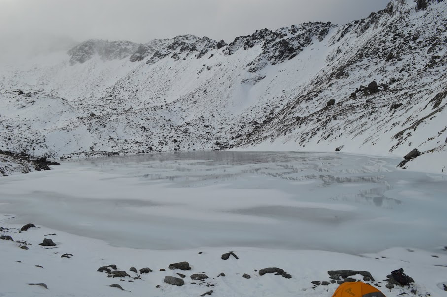 We may have been a bit optimistic about sleeping up here  We followed this frozen river most of the way up 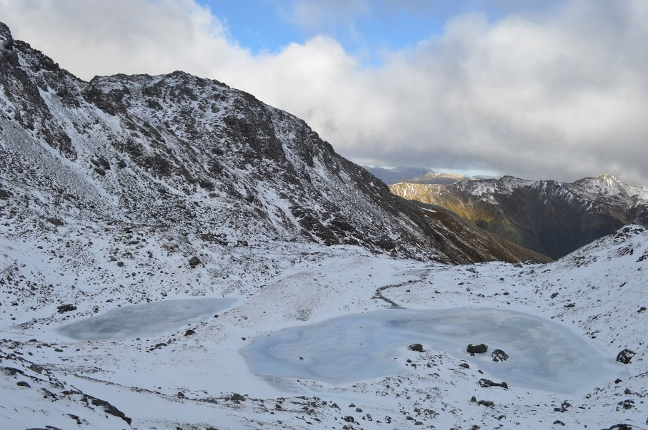 Looking back the way we'd come 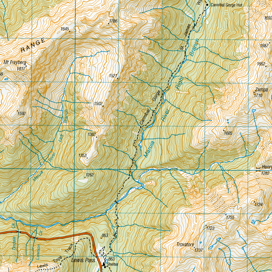 Park at the shelter and follow the board walk into the start of the track 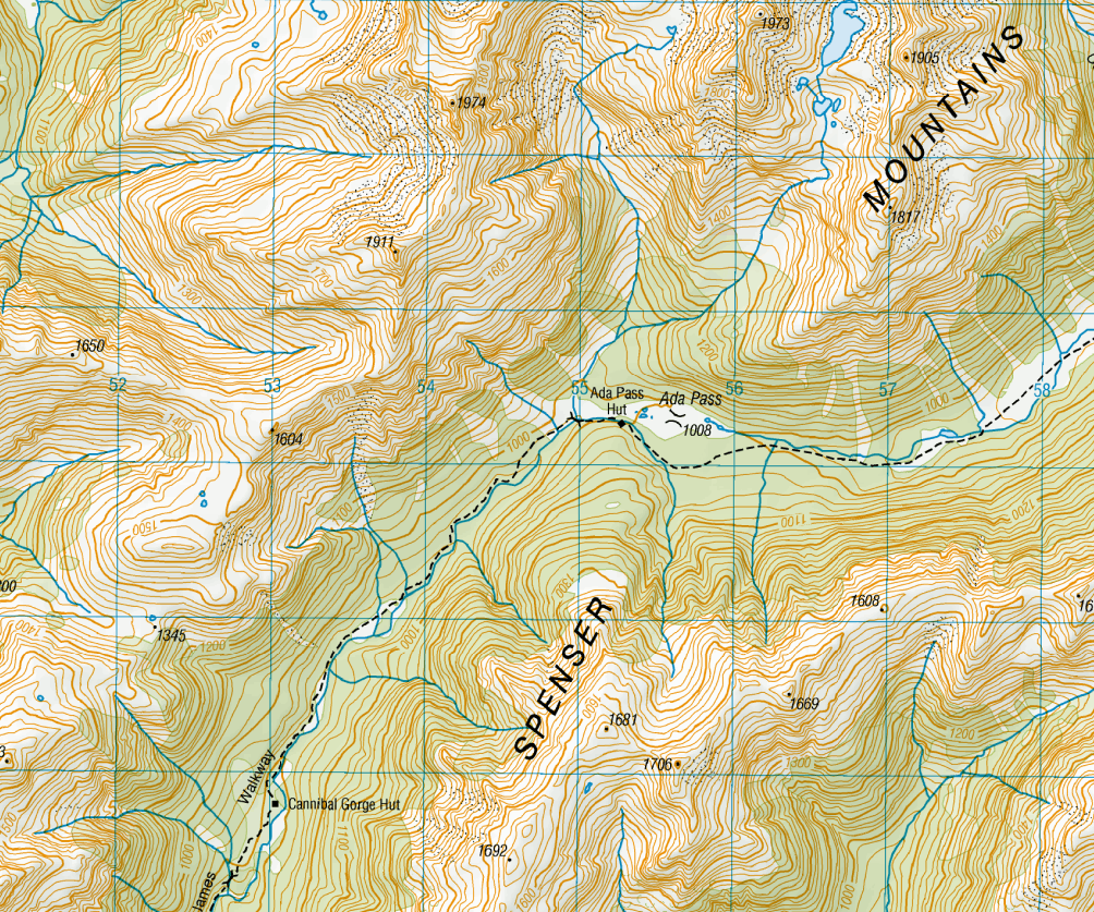 Cannibal Gorge Hut to Ada Pass Hut takes 1-2 hours  6/17/2018 2 Comments Fowlers Pass - Lake Guyon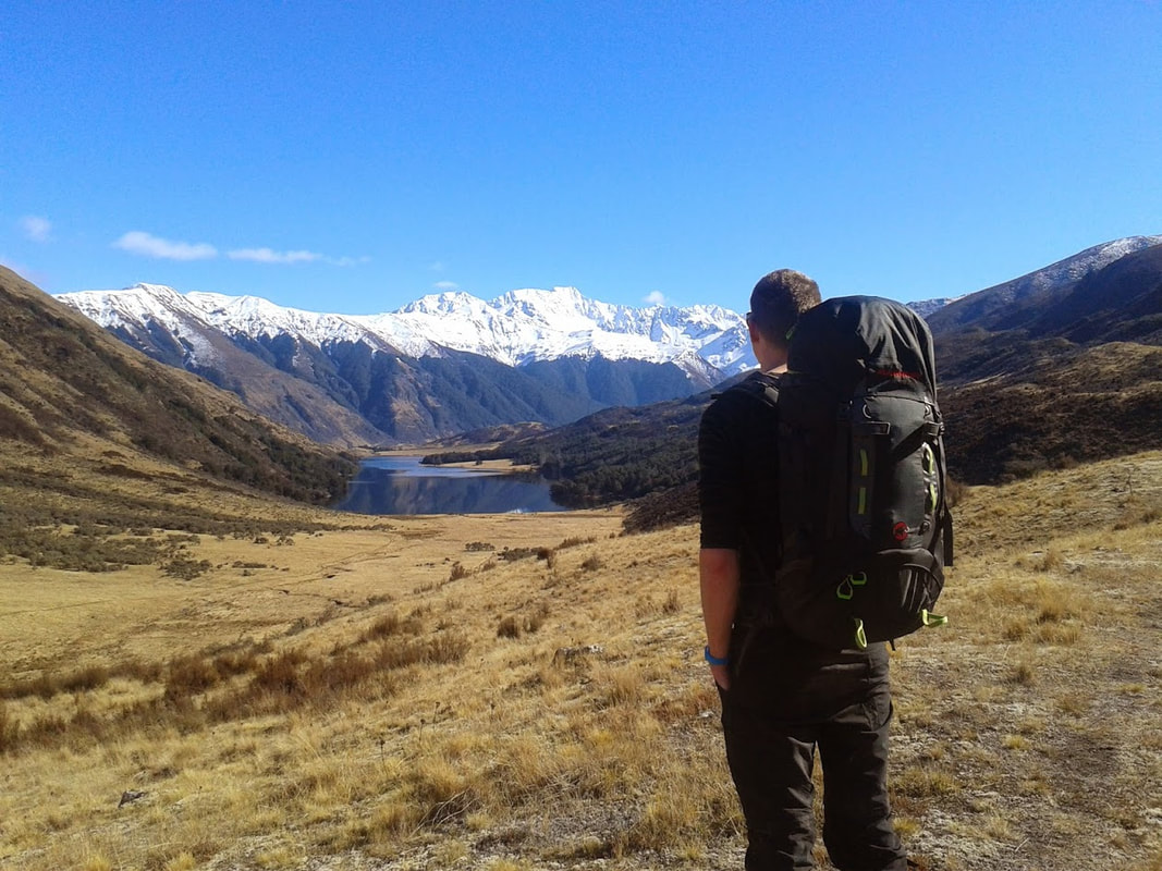 With our first weekend off together, there were high expectations not to waste the opportunity on insignificant activities like trying to find a house. We were already heading to Hanmer to meet some friends so after mountain biking the morning away we packed the car up and set out over Jack's Pass to take on Fowler's Pass. By take on, I mean meander at a leisurely pace over a gradual climb with great weather and way too much chocolate. Leave your car just off Tophouse Road at Fowler's Hut and begin the easy trek up to the top of the pass. It's all uphill to start with but the rest of the walk is relatively flat and easy going. We hit snow relatively early but the track was clear enough to walk without getting cold feet as we wound our way steadily up to the top of the pass. It was my first tramp in soft shell pants - as opposed to the old thermal leggings and thin hiking pants combination - and I was pretty impressed with how much more comfortable they are. I wouldn't recommend them in the height of summer but they dried quickly after river crossings and kept my legs warm through the colder parts of the walk. We took around 90 minutes to reach the highest point of the pass between Mt Stanley (1852m) in the north and Mt Clara (1945m) in the south. The going is much steeper on this side but the mountain bike tracks weaving through the tussock indicate that you could still ride it if you were that way inclined. A poled route leads you down into the valley and through a series of small river crossings. None were above knee height and the river was slow at the time but I haven't been through here following a lot of rain. As the valley opens up you catch your first glimpse of the historic Stanley Vale Hut down on the flats. You are still at least half an hour from the hut at this stage but the hills are well and truly over and the walk is pleasantly scenic on a clear day. We have visited the hut several times so we turned north again and hugged the lower slopes of Mt Laura as we made for Lake Guyon. There is a track here still although the topo map shows only the one leaving from Stanley Vale - the two eventually meet just before the lake. Lake Guyon Hut sits in a little clearing halfway up the north-east side of the lake and boasts 4 bunks, an awesome fire and a long drop with a stunning view of the lake. If you are heading in on the weekend there is a high chance the hut will be in use as it is frequented by trampers, hunters and cyclists on the St James cycle trail. A back up tent would be a good call. We arrived just as it was getting dark - a solid four hours from the car, and set to a Thai Green Curry that could be classified as a weapon of mass destruction. The team at Back Country Cuisine obviously have mouths made of steel as we were unable to finish the delicious yet sweat inducing meal despite pouring a whole packet of mashed potato into the mix. Approach with caution. 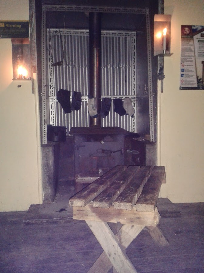 The frost on the ground in the morning confirmed our theory that it had gotten well below freezing during the night. Thankfully our sleeping bags and the fire stood up to the test well and we slept quite comfortably. Not being the type to stick around indoors on a nice day, we packed up camp, downed some porridge and were sweeping out the hut a little after 9 in the morning. We retraced our steps a little slower as there were some unfortunate blisters from the previous day. It was decided that the socks should be blamed and not the fact that we hadn't done any serious walking for two months. Even so we were almost the same time back out to Tophouse road as we took the hot line straight up to the top of the pass and strode out down the other side. Conveniently the car (and mountain bikes) were all still there waiting for us.
Total time: 8-10 hours return Total Distance: Approx 32km Accessibility: Drive from Christchurch (2hrs) or Hanmer Springs (30 minutes) direct to the start of the track. 6/17/2018 2 Comments Edwards - Stanley Rivers, St James Pool Hut on our third night In October 2012 we took on the rather daunting (at least it felt that way at the time) task of walking part of the St James cycle trail from the Edwards River to Lake Guyon via the Stanley River and returning along the west face of Mt Maria. This incredibly picturesque track is located a short drive north from Hanmer Springs over Jacks Pass. We arrived just as night was falling and left our car at the locked gate a couple of kilometres past the turn off to the ski field. With head torches in place and no idea how long it would take to get to our tent site for the night, we donned packs and got moving. The four wheel drive track was dry and easy to walk on as we made our way steadily up the Edwards River. Our destination was Cow Stream, a small river around 10km up the valley which was rumoured to have some impressive hot springs. Scotties, a small 4 bunk hut, lies less than 30 minutes further in, under the shadow of Mt Douglas. We were gambling on the pools being worth a night in our tiny, two man tent and we weren't disappointed. When we reached the river we found two concreted in pools, bubbling with hot water, below a grassy plateau perfect for the tent. A few tea light candles around the main pool created some ambiance and we settled in to soak our legs after a solid evening stroll. 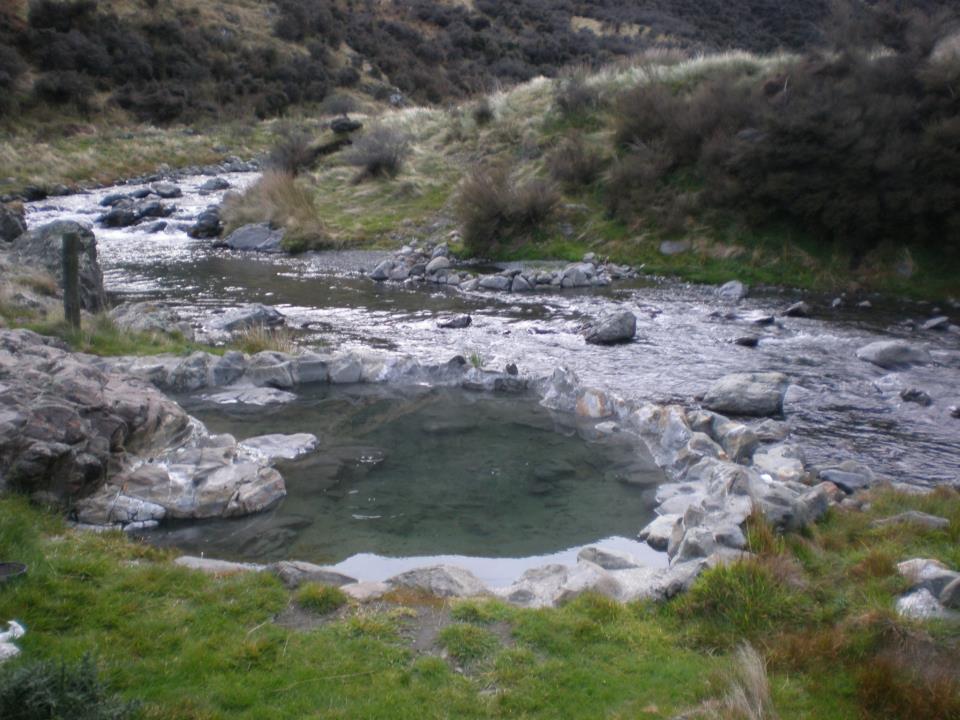 These are totally worth a slight detour off the track The next day dawned warm and clear along with a million sand flies ready for their breakfast. We decamped at the speed of sound and were marching down to the river at quite a reasonable hour. We stopped at Scotties only to refill our water bottles and made our way gingerly across the river before Charlie's Hill. The water was quite swift and my new trekking poles got their first real work out standing up to the knee-high torrent. From here we trudged up and over Charlie's saddle and onto the Racecourse. This wide, swampy plain looks like a walk in the park but takes a good hour to cross. From here we dropped down onto the single track which follows the Stanley River all the way to Lookout Hill. We lost the track for some time around here and simply followed the river until we finally sited Stanley Vale Hut. This two bedroom, historic, abode is an awesome place to stay with beautiful views and plenty of room for cooking and drying clothes. Unfortunately we hadn't made it there first, meaning a short stop for food was all we could afford before pushing on again. We were counting on making it to Lake Guyon and staying in the DOC hut instead but a dozen hunters, their trucks and dogs had the place fairly overrun. Tired and a little disappointed with another night in the tent we set up camp a little further around the lake after a solid 10 hours on our feet. With the rain setting in we cooked a quick dinner of mystery foiled delights from the local Indian store (we've never tried this again!) before drifting off to sleep beside the water's edge. It must have rained heavily all night because when we woke in the morning the lake level had risen and the track had turned into a fast flowing stream in most places. The soaking tent was strapped to the back of Jeremy's pack and we made light work of a bowl of porridge before leaving camp. As soon as we started walking we began to appreciate the amount of water that was pouring off the hills. Streams ran everywhere across the track and mini waterfalls had appeared in the middle of paddocks as we passed. We skirted around the top of the lake and made our way west again to meet the Waiau River in all of its flooded glory. 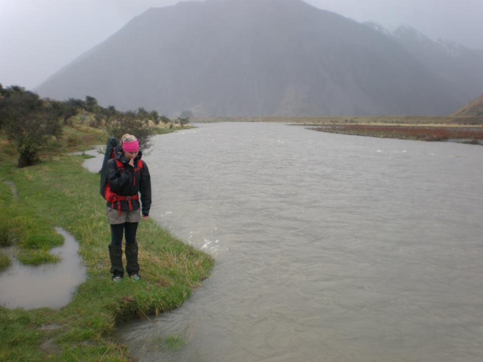 This is me standing on the track... The rain continued to saturate us as we turned south and headed along the river bank towards Pool Hut, our intended destination for the night. Water engulfed the track and in places the river was so close to washing over it I could have been swept down stream with a badly placed foot step. We made good time all the way to Little Lake where we found some discrepancies between the track and our map. With the new trail just recently built, the route to the bridge is now somewhat changed to the old one on the map. Preferring to rely on my own navigation skills we took off cross country and cut a path through The Downs until we found the new bridge location just around the corner from where it was on our map (2010 edition). However, if your route finding skills are a little basic I would recommend just following the new track around and back down to the river. Especially if your map is pre-2011 as things are not quite as they seem - including the exact location of the bridge. After crossing over the swollen river we had a steep climb up Saddle Spur before making our way back down onto the flats. The track was in really good condition but the constant stream crossings became more and more nerve racking as we closed the gap between us and Pool Hut. By the time we reached Dumpy Stream the first thunder clap reverberated around the surrounding mountains. Heads down, we powered as fast as we could in the direction of the hut. The last stream crossing was the worst with both of us using the poles and each other to wade through the raging waters. When we reached Pool Hut the storm was in full force and we dove gratefully through the door into the dry interior. DOC had beaten us to the fire and removed it leaving in its place a dirty mink blanket from the Warehouse that was hanging in the rafters. Usually I wouldn't touch such an item with a stick but after weighing up my options I decided hypothermia was scarier than the manky dolphin blanket. It added some cosy insulation to my sleeping bag as we snuggled into some warm clothes and took a much needed nap. 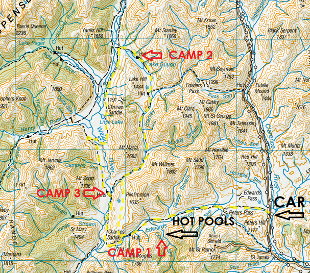 It had taken around 7 hours to reach Pool Hut from Lake Guyon and we slept pretty well that night. The morning brought the added element of a dumping of snow from overnight but we were determined to be back in Christchurch at a reasonable hour regardless. Breakfast consisted of several hot drinks as we drew courage from our coffee to face the freezing outside temperatures. We left bright and early and made our way down past Old Bridge Hut of the no walls historic hut persuasion. Over McArthur Bridge we made our way back to Scotties and the familiar Edwards River. It took a lot longer finding a safe place to cross but meandered our way back up stream towards the waiting car. The walk out was a long one, especially when you hit the rise where Peter's Valley Track splits in two directions and have to trudge up hill for half an hour. We kept up a steady pace and finally sited the car late afternoon.
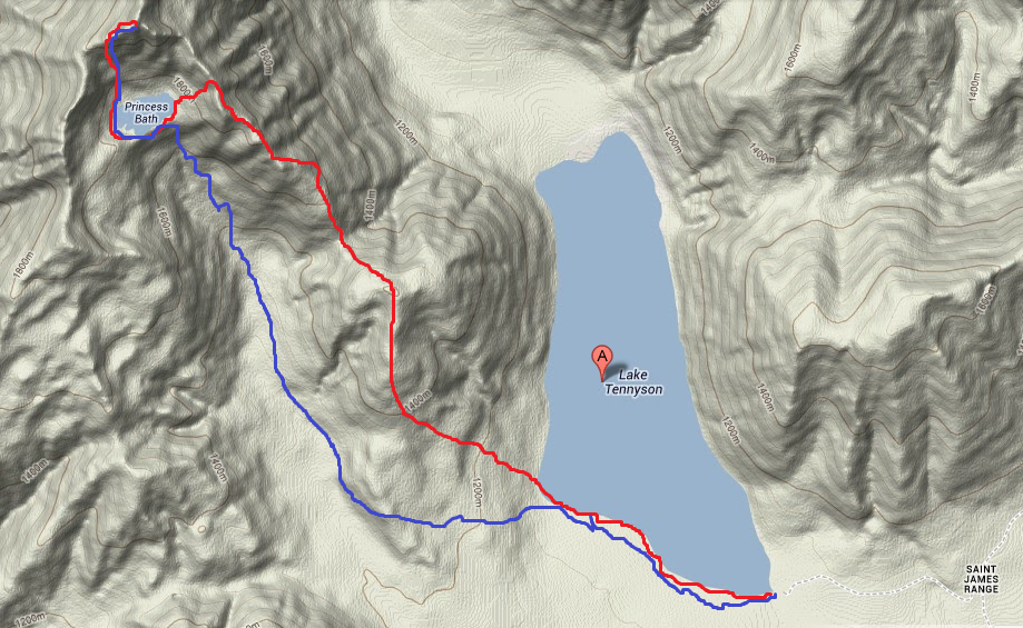
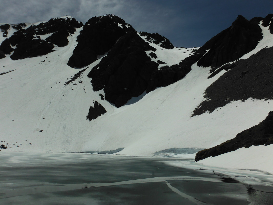
While it was mostly easy tramping the whole four days, the distances we covered would only be enjoyed with a good level of fitness. To find the hot pools you need to follow the track until you hit Cow Stream where you turn left and head up the hill until you run out of flat land. The pools are a short walk down from here but there are plenty of tracks to follow once you find the right area. 2/5/2018 2 Comments Mt Princess and Princess Bath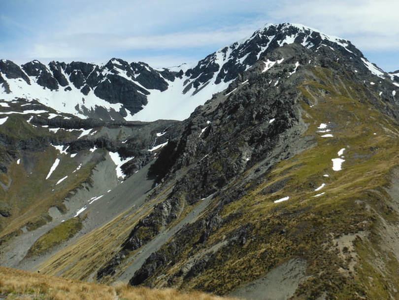 Looking across at Princess Bath Over Jack's Pass from Hanmer Springs and an hour along the bumpy stretch of Tophouse Road lies the banks of Lake Tennyson. This is a great spot for camping in the warmer months and is surrounded by great day walks and overnighters in every direction. We left the car at the camp site on the south-eastern tip of the lake and began our day-long return journey to the peak of Mt Princess. We had chosen to take the route up Mt McCabe from the lake and along the south-eastern ridge although you can attack it from the other side also. We discovered later on you could even walk in from the valley floor and make your way up beside the waterfall straight to the bath if the weather was favourable. The four of us were prepared for a long day and with ice axes in tow and we began our ascent at 9.30am. We had perfect blue skies and warm sunshine as we made our way across a small stream running out of the lake and around the sandy shoreline. In the interest of keeping our boots dry for a few more hours we carried them across and laced up on the far bank. There is no track when you reach Mt McCabe on the far side so we shot for a path up the steep hillside that avoided most of the Matagouri. We were aiming for a section of the ridge where a break in the trees allows an uninterrupted journey to the top. It ended up being steeper than initially thought but once out of the scrub we wandered easily along to the summit of McCabe. This is one of the more achievable parts of the day and took around 2.5 hours from the car moving at a leisurely pace. The sun was well up now and we took a break to cool down and re-hydrate before taking on the next uphill towards Mt Princess. From McCabe we managed the short descent down to a saddle before heading straight into a steep climb on the other side. We were still well below the Bath at this stage and it felt like it was going to be a long day with the summit of Mt Princess hidden behind the ridge. After 20 minutes going straight up we hit snow for the first time. From here the ridge became more difficult to negotiate as the rock is sharp and crumbles off with every second step. There is plenty of room to pick your way along this stretch without worrying about falling but we ended up needing both hands to climb in a few places. Unfortunately some boots came away a little worse for wear in this section as the rock tried to slice straight through to our socks. As we came up over the Bath for the first time and were able to look down onto the water we realised that she was mostly iced over. While there was little snow on the ridge we were standing on, the slopes leading into the Bath were covered all the way to the water. The scree is easy to slide down at this point whereas continuing along the ridge becomes even more challenging. We walked down the first section before glissading into a nice run out near the waterfall. The snow was soft so we had high hopes of an easy final ascent to the summit from the Bath. Some exploring was called for as we tested water temperature - hypothermia inducing, and looked for a little talked about route down from the waterfall to the valley floor. The initial plan was to climb to the top and then retrace our steps back down to the bath and then back up the scree slope to the ridge we had come from. Realising how much extra climbing would be involved we were reasonably keen to find an alternative path that was mostly downhill. After adding some extra layers we made our way around the partially frozen lake to the slope just west of the peak itself. The snow runs all the way to the ridge without hitting any rock from here. The ice axes were all but unnecessary as we sank in almost up to our knees in places. I let the boys kick steps in shifts as my feet are too small to be of much help to them. It was slow going but we kept a steady pace for 45 minutes until hitting the ridge. From here it is much easier to walk along the rocky tops for another 10 minutes until reaching the summit itself. You don't appreciate how much higher the summit is from the Bath until you look back down on it. The Bath is at just over 1700m so the final climb to the top is another 400 vertical to get to the 2126m summit. We took some time to appreciate the view and have a snack before beginning the descent back the way we had come. As with all snow slopes we sent Jeremy down first to test the glissading options and to see if he would stop before hitting the ice covered water below. He made it down in less than 60 seconds and came to an easily controlled stop at least 40m from the edge. With the test dummy safe and well the three of us followed, only having to avoid the odd rock or two near the bottom. Thankfully it was still sunny and warm and our pants dried out in record time. 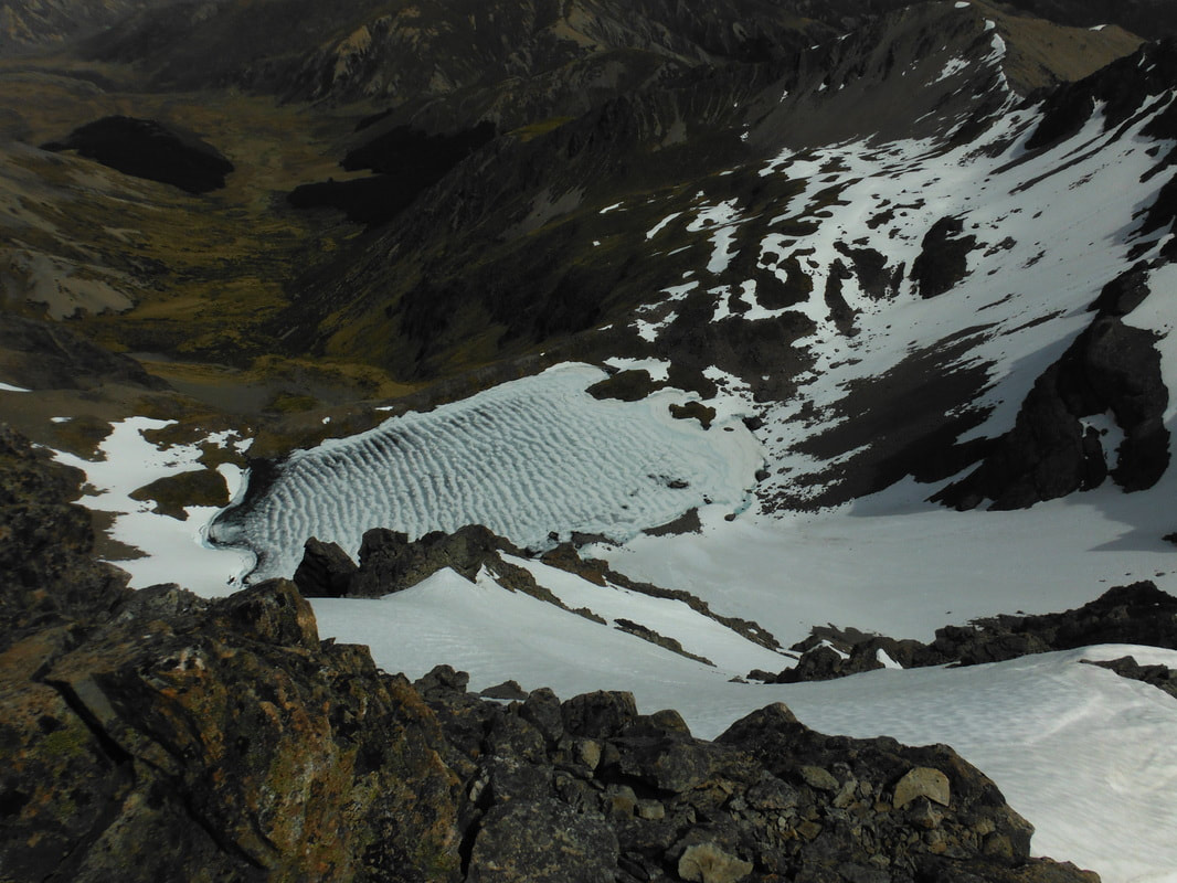 Looking back down at Princess Bath from the summit The waterfall track supposedly has rock cairns to mark the way down but we only found one near where we crossed the waterfall itself. From here we made our way out onto the shingle scree on the south-eastern ridge which allowed us to descend to the stream bed below. This was a steep option for getting down but not difficult to negotiate at a slow pace. The scree isn't great to run on, much more of a controlled slide for the most part. Once in the valley we marched south-east through tall grasses while debating how to get back to the lake. The further we got along the stream the less we wanted to climb over McCabe again so we waited until there was only a small rise between us and the car before turning east again. A gap in the trees allowed us to weave our way across to the lake side and a tramp across swampy land back to the car.
Total trip time - 9.5 hours (5.5 to the summit, 3.5 return via valley) High for the day - 28 degrees Gates to fight over opening on the return trip to Hanmer Springs - 3 |
CategoriesAll Arthurs Pass National Park Avalanche Peak Bealey Spur Bob's Camp Biv Cannibal Gorge Hut Canterbury Foothills Carroll Hut And Kelly Range Cass Saddle Lagoon Saddle Castle Hill Peak Crow Valley And Crow Hut Edwards - Stanley Rivers Fowlers Pass To Lake Guyon Gloriana Peak And Ada Pass Hut Hakatere Conservation Area Hanmer Springs Hope Kiwi Jollie Brook Circuit Kahurangi National Park Kepler Track Lake Sumner Forest Park Lathrop Saddle Little Mt Peel Manuka Hut Marlborough Maukuratawhai Mt Barrosa Mt Bruce Mt Cassidy Mt Potts Mt Princess Mt Somers Mt Tapuae-o-uenuku Mt Te Kinga Mt Torlesse Mystery Lake Nelson Lakes Packhorse Hut Poulter Hut Roys Peak St James Sylvia Tops Tablelands Circuit - Salisbury Lodge The Five Passes The Three Passes Travers-Sabine Circuit Tribulation Hut Waiau Pass And Blue Lake Wanaka West Coast |
 RSS Feed