|
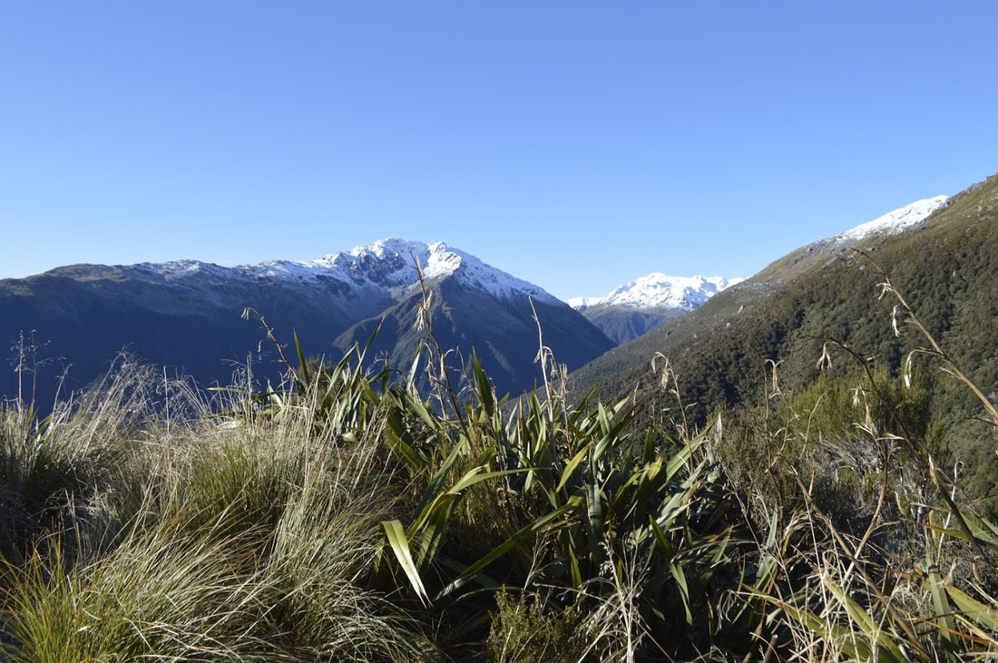
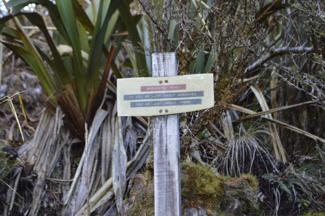
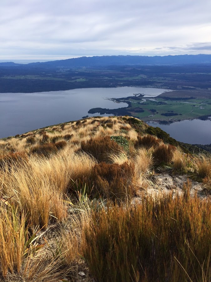
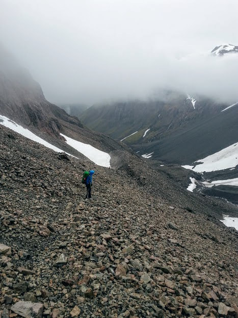
6/17/2018 2 Comments Lathrop Saddle, West Coast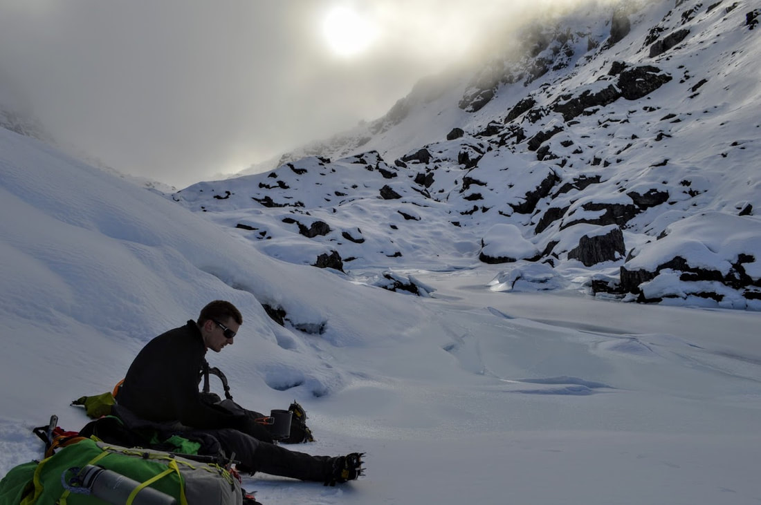 This post was intended to be a trip report on the Lathrop Saddle/Zit Saddle circuit on the west coast of the south island. That's not the case but we had a lot of fun and ticked off a few firsts for the memoirs. The trip started late on Friday night as we left work with a car full of gear and drove over to the coast. Arthurs Pass was blanketed in snow on our way through and by the time we parked up at the start of the Styx Track temperatures were below zero. What would have been a relatively peaceful sleep in the car was interrupted about 1am when some enthusiastic locals arrived for some four wheel driving and light refreshments. Alas, I wasn't feeling on top of the world as we set out at first light the next morning across the frozen muddy fields before the track proper. Having walked out of the Styx only a few months earlier, we were well familiar with the first four hours of the terrain into Grassy Flat Hut. The ice covered rocks and frigid river made for a more technical walk than our previous experience but we were feeling good upon reaching the hut for some lunch with the sun finally warming the valley a little. With the climb up to Browning Biv still ahead of us we only stopped for five minutes before finding the turn off and starting up towards the saddle. The path is great all the way to the river and then things get harder very quickly. A rock scramble ensues for the better part of an hour until the track veers away from the water and up, up, up. Think nature's stair master meets low level rock climbing and you'll be questioning having left the beautifully flat Styx Valley in the first place. After 45 minutes of sucking air and convincing myself I was almost there, I was greeted by a home made sign at the side of the track. "Browning Biv. If you're just about buggered, you're just about there." 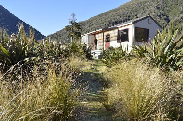 Grassy Flats Hut The view was worth the climb as we stopped for a quick drink at the tiny Biv and surveyed the river now some distance below us. So far our times were well within what we had read on other trip reports and we thought we had plenty of time to pop over the saddle and down to Top Crawford Hut on the other side based on other people's times. Unfortunately that was not to be the case as we would find out a few hours later. It was another hard slog up the spur through a reasonably overgrown but easy to follow track that took a straight line to the saddle itself. We didn't hit snow until almost 1500m and it wasn't until we were well on the saddle that we needed to pull out crampons and axes to keep moving. We had been another hour and a half at this point and the chances of making it down the other side before dark were becoming increasingly slim. As we dropped over the south side of the saddle we found that the snow on this side was sitting a lot lower down the slope and created some steep, slippery slopes to negotiate before hitting the bush again. The route heads right from here with sparsely placed poles (a bit of a contrast from the Styx side which is really well marked) and we sidled around and down the slope rather carefully on the frozen snow. From here we front pointed straight down for three pole lengths as the sun started disappearing behind the mountains. We could see the hut down on the flat but the track winds down and through some bluffy terrain which was slow going in the snow. By the time it was totally dark we could no longer see any markers but had dropped into the safety of the bush line. I hadn't really appreciated the lack of lumens my head torch provided until I was trying to navigate down this section of the route. We were both a bit reluctant to keep moving as it was clear that our overall goal of making it to Zit Saddle and back to the car in only 48 hours was unrealistic with so much snow so we found a flat spot to camp instead. We didn't have a tent for the trip so we had brought along a bothy bag in case we needed some emergency shelter. The night was clear so we ended up sleeping on the bag and the rest of our gear and packs rather than inside it but it was nice to know if we got cold we could throw it over ourselves again. After melting some ice and snow for dinner we settled in for a romantic night sleeping under the stars in between the tussock. I had a new appreciation for how warm my Fairydown 20 below sleeping bag was after sleeping soundly for 10 hours only to wake and find every piece of gear frozen solid - including the outside of our sleeping bags. Having realised that putting frozen boots on is near on impossible we set about defrosting them over the open flame of our cooker - probably voiding the warranty and doing permanent damage at the same time. 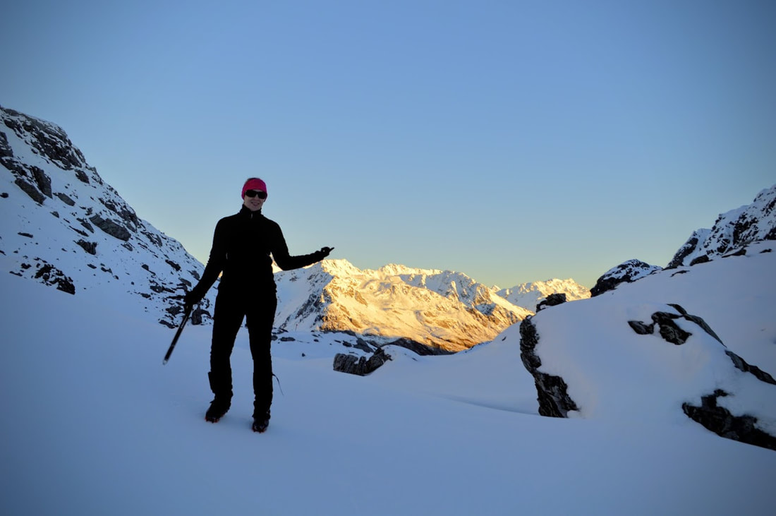 We had decided the previous night that in the interest of not worrying my Mum it would be best to turn around rather than keep going and be a day overdue at the other end. Trying to do a four day tramp in three days was always going to be 50/50 so we weren't entirely surprised to be trekking back up to Lathrop Saddle that morning. Conveniently our steps had frozen overnight creating a perfect staircase back to the tarns and over the other side. With nothing but time for a change we made a leisurely journey back past Browning Biv and down to Grassy Flat Hut where we demolished most of the food we hadn't gotten around to eating the previous day.
With no one but us in the hut for the night we made the most of the varied reading material and fire before turning in for our first sleep on an actual mattress in three nights. The walk out the next morning was, as always, motivated by thoughts of a hot meal back in Hokitika. But first we had to slip and slide our way back down the river and all of the frozen rocks along it. If you're looking for 101 ways to break an ankle - head this way in winter and have fun. Back at the car it was disappointing to know we'd have to be back with more time to complete the whole circuit but it was nice to have a cheeky night spent out in the open just to test the comfort ratings on those sleeping bags for a change. If you're thinking of heading this way in winter you'll need to be confident with your ice axe and crampons and give yourself extra time to get over the saddles through the snow. The route is well marked to Lathrop Saddle (and then not so well from there on) but expect a certain degree of bush bashing along the way. We were 10-11 hours to where we camped and would probably recommend 13 hours from start to finish if you're trying to do this in one day in winter. Car park to Grassy Flat Hut: 4 hours Grassy Flat to Browning Range Biv: 1 hour 45 mins Browning Biv to Lathrop Saddle: 1 hour 30 mins Crossing Lathrop Saddle: 30 mins Daylight in winter: 9-10 hours
2 Comments
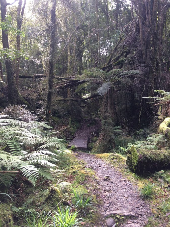
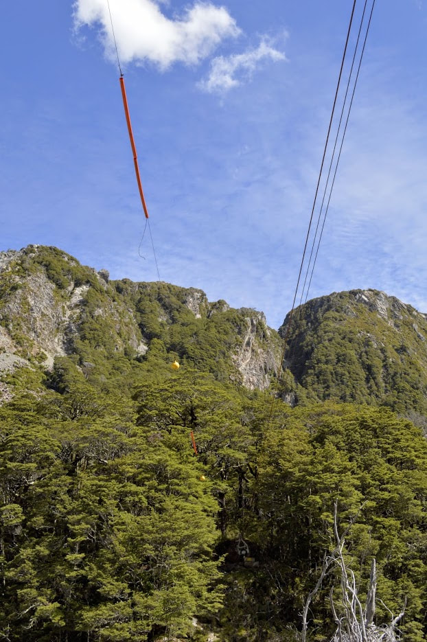
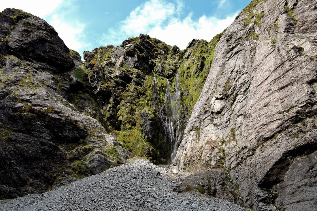
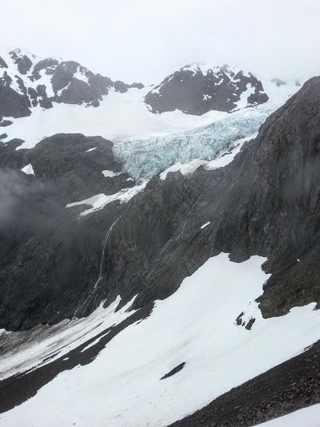
6/10/2018 2 Comments Mt Te Kinga - West Coast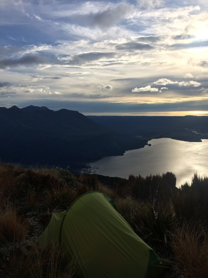 After being pushed west of Arthur's Pass due to bad weather on the other side of the divide, I was looking for a good overnighter before heading back to Christchurch at the end of a week of tramping in the area. I had initially planned on spending the week by myself but Instagram intervened and I ended up driving out towards Lake Brunner with a girl I had just met online and who my husband was convinced was probably going to be a 40 year old man. One of the hardest things I've found in the last few years is finding like minded women who genuinely enjoy the outdoors (and can carry a pack), so meeting up with Leila was a bit of a novelty after spending most of my tramping trips with a bunch of rowdy guys! We met in Arthurs Pass mid morning and were at the start of the track before lunchtime. There is plenty of parking and public toilets at the end of Cashmere Bay Road in Te Kinga and we left the car here amongst a few camper vans and a growing swarm of sand flies. The track heads more or less straight up the mountain and once we made it passed the more well worn portion leading to the lookout things got decidedly more interesting. I had read a story the night before about a couple getting lost on the descent from the summit after they started to lose light and at the time had been a bit bemused at how they managed this. I think we lost the track three or four times as we were diverted around fallen trees through dense west coast bush and I began to feel a little more sympathetic towards their situation. The track is essentially well marked but it pays to take your time locating it again when you hit these obstacles and maybe don't get distracted talking! The climb is just over 1000m of elevation in a reasonably short distance making the incline a whole lot of type two fun. As a day walk with a light pack this wouldn't present too much of a problem for most people but with tents and all of our other camping gear my legs were definitely feeling it after an hour. DOC suggests four hours to the summit and this is a pretty fair estimate especially if you're staying the night or know you'll need to take breaks on the way up. With no water at the top, we were hoping that we would find some on the way otherwise the old freeze dried cuisine wasn't going to go down too well. Luckily the track did eventually pass close to Jays Creek about 2/3 of the way up (see map below) and we were able to fill up everything we had before continuing on.  Once at 1196m the summit itself is still a good distance away and facing a pretty bracing wind we decided to turn back to find a flattish sheltered spot to pitch the tents. As it turned out this was probably the biggest challenge of the day - after I turned the wrong way trying to get to the Lake in the first place that is. I had a reasonably small one man tent but Leila's was a good deal bigger so some serious scouting had to be undertaken to find the all important level sleeping platform without a tonne of rocks scattered through it. We eventually located two passable (my door opened straight into a substantial flax bush) spots and set up camp for the night. Apparently the 30th of August is still very much winter and once the sun was gone even the freeze dried stuff was looking super appealing in all its hand warming glory. Despite being not so subtly stalked by a persistent Weka all evening it was hard not to enjoy the view of lights reflecting on the dark lake and the mountains surrounding us on all sides. On a totally clear night this would be a pretty great spot for star gazing and spotting "the pot" (that's a kiwi astrological term). Unfortunately there wasn't much of a sunrise which is probably for the best since I'd brought three spare batteries for my camera and forgotten my memory card. The trip back down to the car wasn't a lot quicker than the climb up since the track is reasonably steep the whole way so you can't get much of a stride on until near the end. Total time: 6.5 hours return Tent sites: questionable New Instagram friends that weren't serial killers: One (well so far so good) 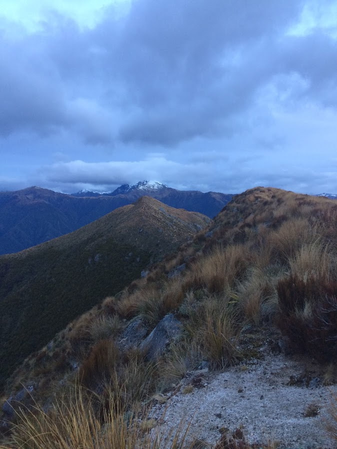 2/5/2018 1 Comment The Three Passes - Canterbury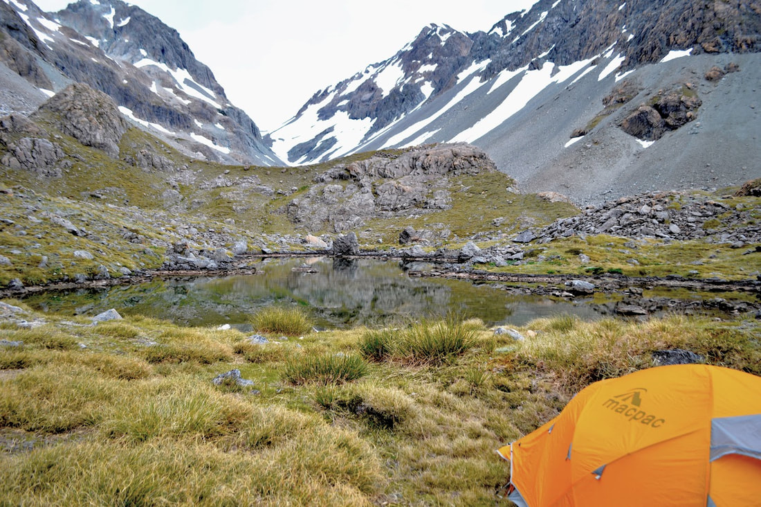 Ariels Tarns at the top of Harman Pass There are a few classic New Zealand trips that have been on the to-do list ever since we started exploring the harder to reach parts of Aotearoa. The Three Passes is a 4-5 day tramp across the beautiful Southern Alps, taking you from the wide open rocky banks of the Waimakariri River all the way to the lush green valleys of the West Coast. The obvious issue is then of course how to get back to where you started. With only four days off work over New Year's and an aversion to hitch hiking after not showering for several days, Dad finally came to the rescue. We would leave our car at Klondyke Corner and meet him three days later at the bottom of Lake Kaniere - all going to plan. The first part of the plan went out the window when the third member of our party called in sick at 3am the morning of our departure. Having worked right up until New Year's Eve we barely had time to pack our gear, let alone change anything - the three man tent was going to have to do. We made a small detour on the way to Arthur's Pass to pick up another Beacon (since our missing comrade was responsible for this essential piece of kit) and leave a detailed map of where we intended to be and when. 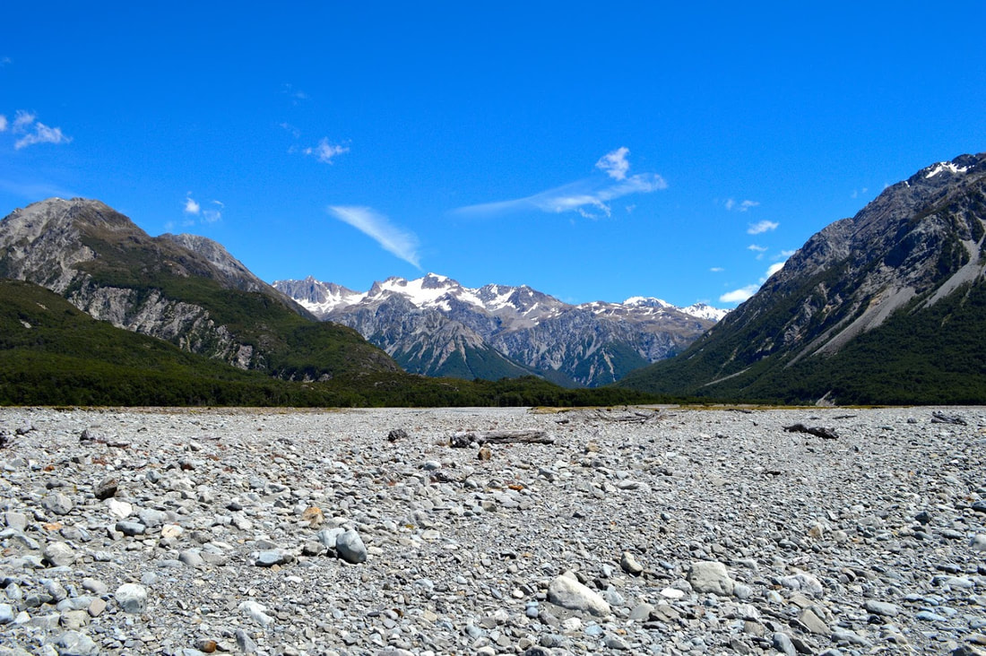 Walking up the Waimakariri River on Day One By 12pm we were bumping up the gravel road to the car park at Klondyke Corner with a couple of hitch hikers in tow. They had been into Harman Pass and out via Julia Hut a few days earlier and needed a lift from the main road to their car. Assuring us that we would smash out the first day's walk in no time, we bid them farewell and set off up the river under a burning midday sun. The low river level allowed us to shoot a relatively straight line for the corner just past Anti-Crow Hut and we passed several groups heading out after spending New Year's Eve in the Crow Valley or up at Carrington. If the river level is higher it would pay to make your way to Anti-Crow Hut and follow the track from there to the river where you need to cross below the bluffs. If you cannot find a safe spot to cross here you probably need to wait for the river level to drop as you may get yourself into trouble. I made a mental note to enjoy the fine weather as the next two days were forecast for rain on both sides of the divide. Our destination for the night was the top of Harman Pass and the Ariel's Tarns so we were happy to make it to Carrington at 3.45pm with plenty of daylight and energy left. This is the obvious stopping point if you're going to take 4 or 5 days to do the trip and the hut is a very accommodating 36 bunks in capacity. After chatting to the only couple there (where was everyone - it's the middle of the holidays?!) and grabbing a bite to eat we set off on the track to the Clough Cable Way. Positioned just below the Taipoiti River, the cable way allows safe passage over the rapids if needed. We were lucky enough to be able to cross easily through the water as I have a thing about heights - and falling from them. From here we turned up the near branch of the Taipoiti and began the long rock hop up to Harman Pass. The heat was almost claustrophobic in the narrow valley and it was all I could do to be distracted by the near mythological beauty of the place. Stunning waterfalls cascade from the high walls either side of the river and alpine daisies lay nestled in beds of soft green moss or sprout from the sides of boulders. Peter Jackson obviously missed this place when picking film locations, although it's probably for the best that it gets minimal human disruption. As we popped out at the top of the pass, poles marked the way to our campsite to the left, and down into Mary Creek on the right. When we arrived, we found one lone gentleman ensconced in a little rock hotel for the evening and two pristine pools of freezing cold water. The Ariel's Tarns are a stunning spot to spend an evening and we cooked a surprisingly sumptuous dinner (with actual meat) looking up at Mt Isobel and Whitehorn Pass. At about 6am the next morning the first ominous drops began to hit the tent and spelled the end of our weather window and my ability to take photos. We decamped, donned the heavy duty rainwear, and set off towards the permanent ice of Pass number 2 for the trip. When we actually hit snow, it was soft and slippery so we threw our crampons on to speed up the journey to 1753m. Visibility wasn't ideal but we found our way easily through the chunky scree and over the other side where a track could be found winding down into the valley below. Between gaps in the cloud cover we caught glimpses of the Cronin Glacier beneath Mt Rosamond as we skidded our way down the wet scree. Although not particularly dangerous, this section of the route may be an uncomfortable introduction if you haven't had to slide down shingle slopes before. A good rule of thumb is to just go with it... unless you're precariously close to a cliff... then get the hell away from the cliff. We were fairly damp by the time we reached the river and as the track had petered out into nothing we began boulder hopping our way along it instead. This was a slippery and energy draining exercise but with the rain still unrelenting we were reluctant to stop for a break. When we rejoined the track just east of Park Morpeth Hut, it felt like a highway. By the time we arrived at our first shelter for the day we were soaked through and well overdue for a coffee. Another sodden tramper had just turned up after coming over Browning Pass and we took a break to swap information about the track in either direction.
It was only 2.30pm so despite the temptation to stay at Park Morpeth we shouldered our wet packs and continued up the Wilberforce to Browning Pass. I'll admit I didn't believe I was looking right at Browning until I had eliminated all other possibilities, it looks more like a mountain than a potential alternative to Arthur's Pass. The wide zigzagging track maintained a generous gradient for the first two thirds of the climb and I was lulled into a sense of disappointment at how easy the going was. The last 200m was a completely different story as the distance we had traveled, the rain and a distinct emptiness in my tummy all contrived to make the final slog much more interesting. The bluffs directly below the top of the pass were steep and difficult to negotiate in the rain as the rock was understandably slippery. I took a lot more time picking a stable route to the top than would have been necessary in the dry. As we finally topped out and caught sight of Lake Browning through the rain and mist I was rejoicing for having brought a massive tent. We set it up in a hurry and collapsed inside to finally dry out and eat properly for the first time in 7 hours. It hadn't been a particularly long day by tramping standards but we were both reasonably sore and ready to smash some calories that night. The rain never stopped. 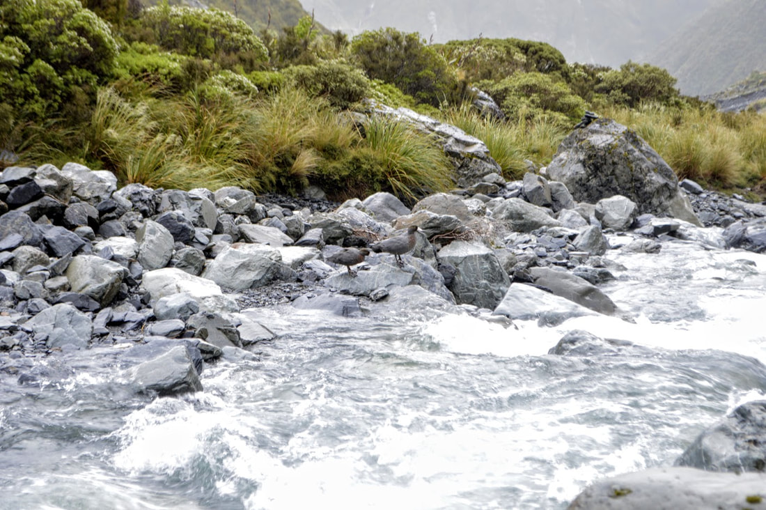 A Pair of Whio relaxing amongst the rapids When we woke up on day three of our journey, the tent was sitting in a puddle of water (thankfully the bottom was totally waterproof), none of our clothes had dried overnight and even less of the lake was visible through the cloud. Putting on cold wet pants first thing in the morning wasn't ideal but after we had stuffed the dripping tent into our packs and set off again we soon warmed up. The poled route led around Lake Browning towards the north before descending steeply into the Arahura River. Water was flowing over the track as we dropped down into the valley to commence even more boulder negotiation - if you're into rocks, the three passes is the trip for you. By the time we were halfway to Harman Hut the rain began to ease and then stopped altogether. We also came across a pair of Whio, the endangered Blue Duck, surfing the rapids and diving for food. All throughout the track, traps are dotted around to keep the area predator free for these little guys so it was cool to actually see a couple. We hadn't planned to spend long at Harman but I couldn't pass up the chance to dry out some of my gear. After half an hour we were refueled and significantly less water logged as we made our way towards Styx saddle. The track is pretty amazing from here on out, wide enough to walk side by side in places, with the exception of the muddy swamp at the top of the saddle. With no rain and plenty of room to stretch our legs we arrived at Grassy Flats Hut mid afternoon, well ahead of schedule. Walking out would have been an option but we weren't being met until the following morning so we ditched the tent in favour of the hut for the night. Grassy Flats is easily accessible from the Hokitika side and as such is full of hunting magazines and, God bless someone, a Marian Keyes novel. I whiled away the evening quite happily with my book and the leftover pick-n-mix before settling in to the most comfortable of our three sleeps. 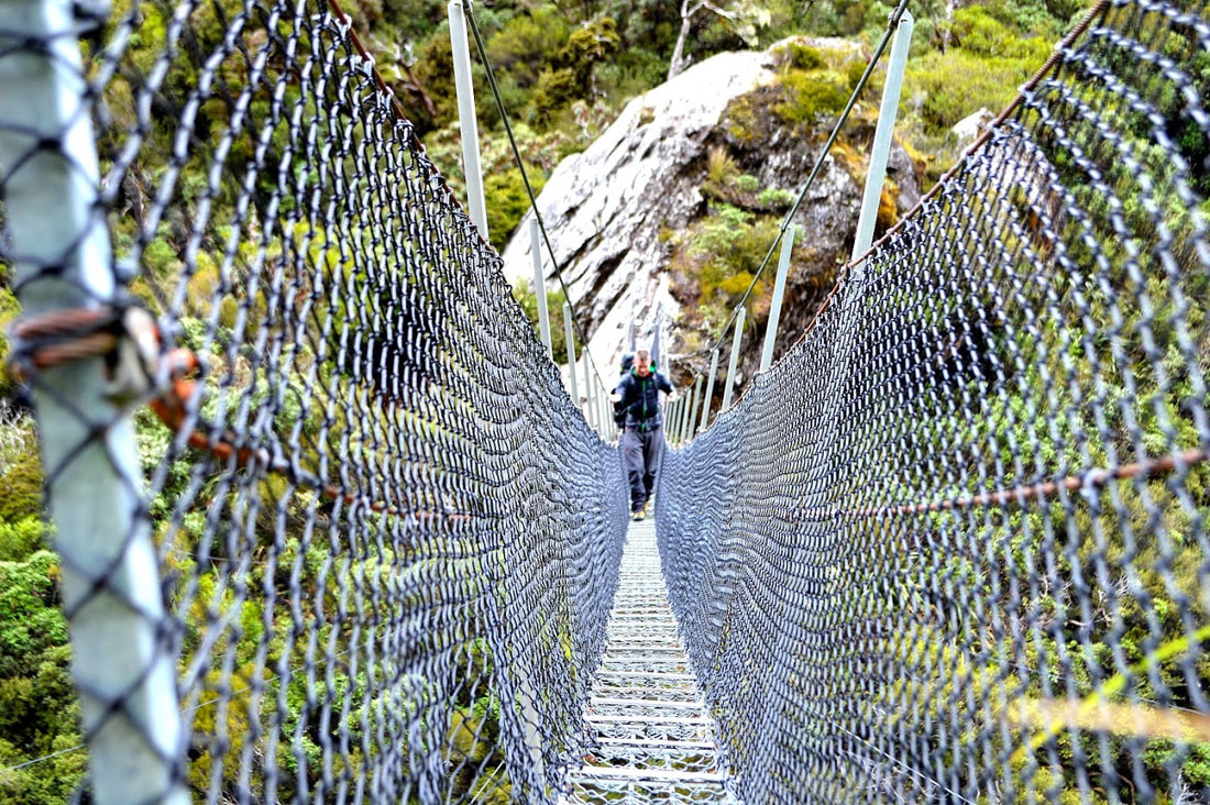 Swing bridge just past Harman Hut We were up early, eager to meet Dad and be in Hokitika by lunch time. With the weather looking great we left our rain jackets in our packs and marched off down the well worn track. Although the path is beautifully groomed much of the way, a few slips made life interesting as we passed over crumbling banks and down a few steep drops to pass side streams. The large slip at the very end of the track, where it meets the 4WD track, was easy to negotiate following the true right side with low river levels. It felt great to see Dad's truck waiting for us at the road end and we stopped for a well earned beer in town before heading back to our car in Arthur's Pass.
The DOC route guide for this trip gives really good information and realistic times for each leg of the journey. We went in average weather but we knew that the actual total rainfall wasn't enough to bring the river levels up on the west coast - this is definitely something you need to check before you go. Day One Klondyke Corner to Carrington Hut - 3hrs 45min Carrington Hut to Ariel's Tarns - 2hrs 45min Day Two Ariel's Tarns to Whitehorn Pass - 1hr 40min Whitehorn Pass to Park Morpeth Hut - 4hrs Park Morpeth Hut to Browning Pass - 1hr 30min Day Three Browning Pass to Harman Hut - 2hrs 15min Harman Hut to Grassy Flat Hut - 2hrs 30min Day Four Grassy Flats Hut to Road End 3hrs 30min |
CategoriesAll Arthurs Pass National Park Avalanche Peak Bealey Spur Bob's Camp Biv Cannibal Gorge Hut Canterbury Foothills Carroll Hut And Kelly Range Cass Saddle Lagoon Saddle Castle Hill Peak Crow Valley And Crow Hut Edwards - Stanley Rivers Fowlers Pass To Lake Guyon Gloriana Peak And Ada Pass Hut Hakatere Conservation Area Hanmer Springs Hope Kiwi Jollie Brook Circuit Kahurangi National Park Kepler Track Lake Sumner Forest Park Lathrop Saddle Little Mt Peel Manuka Hut Marlborough Maukuratawhai Mt Barrosa Mt Bruce Mt Cassidy Mt Potts Mt Princess Mt Somers Mt Tapuae-o-uenuku Mt Te Kinga Mt Torlesse Mystery Lake Nelson Lakes Packhorse Hut Poulter Hut Roys Peak St James Sylvia Tops Tablelands Circuit - Salisbury Lodge The Five Passes The Three Passes Travers-Sabine Circuit Tribulation Hut Waiau Pass And Blue Lake Wanaka West Coast |
 RSS Feed