|
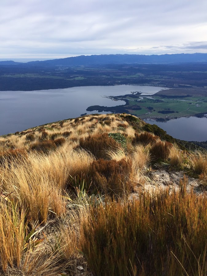
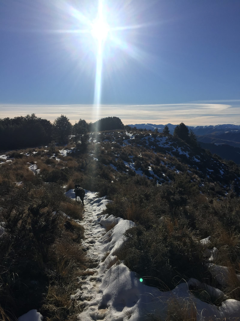
6/10/2018 2 Comments Mt Te Kinga - West Coast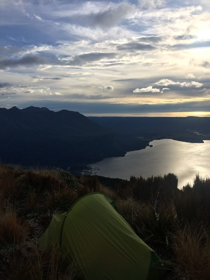 After being pushed west of Arthur's Pass due to bad weather on the other side of the divide, I was looking for a good overnighter before heading back to Christchurch at the end of a week of tramping in the area. I had initially planned on spending the week by myself but Instagram intervened and I ended up driving out towards Lake Brunner with a girl I had just met online and who my husband was convinced was probably going to be a 40 year old man. One of the hardest things I've found in the last few years is finding like minded women who genuinely enjoy the outdoors (and can carry a pack), so meeting up with Leila was a bit of a novelty after spending most of my tramping trips with a bunch of rowdy guys! We met in Arthurs Pass mid morning and were at the start of the track before lunchtime. There is plenty of parking and public toilets at the end of Cashmere Bay Road in Te Kinga and we left the car here amongst a few camper vans and a growing swarm of sand flies. The track heads more or less straight up the mountain and once we made it passed the more well worn portion leading to the lookout things got decidedly more interesting. I had read a story the night before about a couple getting lost on the descent from the summit after they started to lose light and at the time had been a bit bemused at how they managed this. I think we lost the track three or four times as we were diverted around fallen trees through dense west coast bush and I began to feel a little more sympathetic towards their situation. The track is essentially well marked but it pays to take your time locating it again when you hit these obstacles and maybe don't get distracted talking! The climb is just over 1000m of elevation in a reasonably short distance making the incline a whole lot of type two fun. As a day walk with a light pack this wouldn't present too much of a problem for most people but with tents and all of our other camping gear my legs were definitely feeling it after an hour. DOC suggests four hours to the summit and this is a pretty fair estimate especially if you're staying the night or know you'll need to take breaks on the way up. With no water at the top, we were hoping that we would find some on the way otherwise the old freeze dried cuisine wasn't going to go down too well. Luckily the track did eventually pass close to Jays Creek about 2/3 of the way up (see map below) and we were able to fill up everything we had before continuing on.  Once at 1196m the summit itself is still a good distance away and facing a pretty bracing wind we decided to turn back to find a flattish sheltered spot to pitch the tents. As it turned out this was probably the biggest challenge of the day - after I turned the wrong way trying to get to the Lake in the first place that is. I had a reasonably small one man tent but Leila's was a good deal bigger so some serious scouting had to be undertaken to find the all important level sleeping platform without a tonne of rocks scattered through it. We eventually located two passable (my door opened straight into a substantial flax bush) spots and set up camp for the night. Apparently the 30th of August is still very much winter and once the sun was gone even the freeze dried stuff was looking super appealing in all its hand warming glory. Despite being not so subtly stalked by a persistent Weka all evening it was hard not to enjoy the view of lights reflecting on the dark lake and the mountains surrounding us on all sides. On a totally clear night this would be a pretty great spot for star gazing and spotting "the pot" (that's a kiwi astrological term). Unfortunately there wasn't much of a sunrise which is probably for the best since I'd brought three spare batteries for my camera and forgotten my memory card. The trip back down to the car wasn't a lot quicker than the climb up since the track is reasonably steep the whole way so you can't get much of a stride on until near the end. Total time: 6.5 hours return Tent sites: questionable New Instagram friends that weren't serial killers: One (well so far so good) 
2 Comments
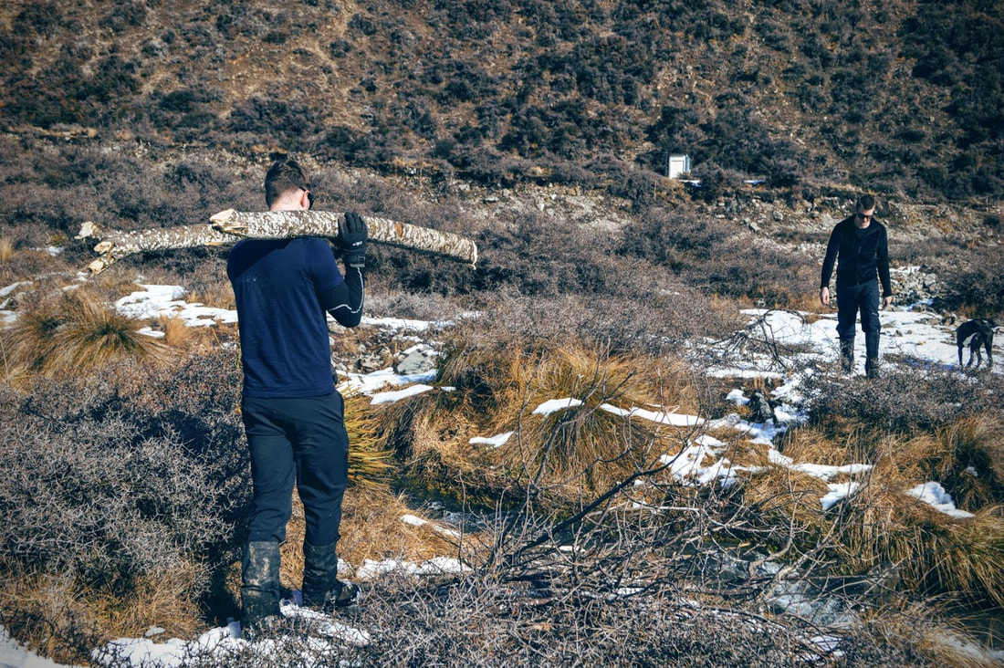
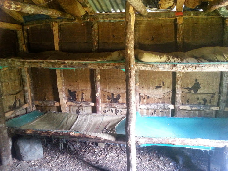
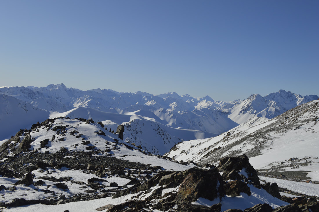
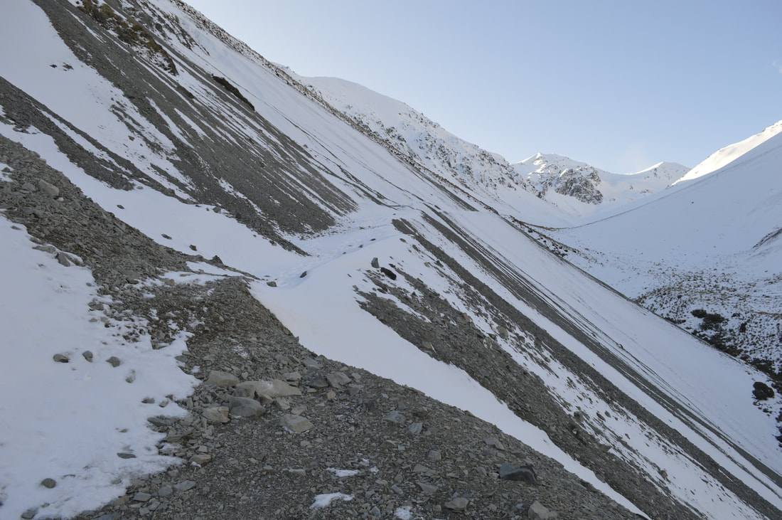
6/10/2018 2 Comments Manuka Hut - Hakatere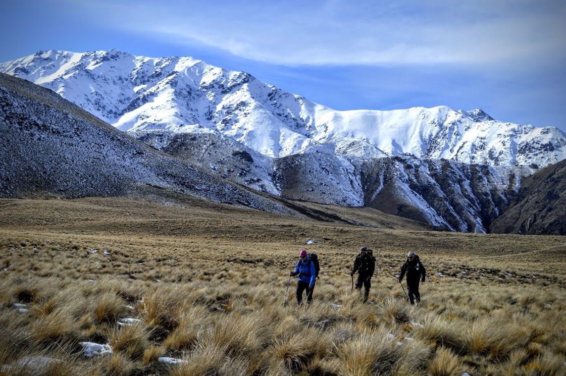 Not all trips need to be grueling expeditions through dense bush or up steep mountains. Sometimes it's nice to just load your pack up with a tonne of delicious food and head to a great little hut for the night with some mates. Manuka Hut is the perfect easy over-nighter with a very achievable 5km walk from the road end with fantastic views all the way. Head in via Hakatere Heron Road from Ashburton Gorge Road and follow the sign to the start of the track. If you have a grunty 4WD you might make it along the farm track to the actual track car park but we were deterred by a couple of feet of mud and left our vehicles at the gate. The track crosses farmland below Lake Emily before sidling around the base of Emily Hill. Here we found a good amount of snow still covering the hill side which made for a slippery time for some of us. From here follow the poled route down to the old 4WD track and around the corner to the hut. Although this makes up part of the Te Araroa Trail, the hut book showed not many people had been through that way over the winter months. The hut itself is a charming 6 bunk basic with a fire to one side and plenty of seating. The only thing it was lacking when we arrived was anything to actually burn. Having brought in all manner of wood cutting tools, we spent the afternoon scavenging dead trees and cutting down a few new ones to add to the hut's supplies. A quick scramble up onto the ridge immediately behind the hut offers a great vantage point to look across at the ridge to Mt Taylor and all the way back towards the Two Thumb Range on the far side of the Rangitata River. This would be an awesome spot to bring kids into or as an introduction to tramping for beginners. Go next level like one of our crew and carry your own kindling wood in for exceptionally good fire starting. Time: 1.5 hours each way Hut: Basic Points for replacing the fire wood you burn *An alternative route can be taken on foot or by bike up the Stour River Track. A car park can be found just over the bridge, 2km further on from the turn off to Woolshed Creek/Mt Somers. 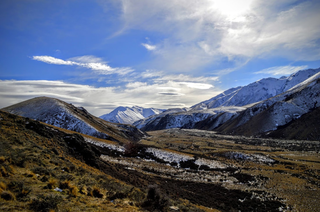 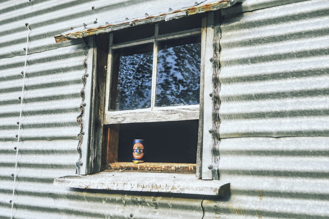 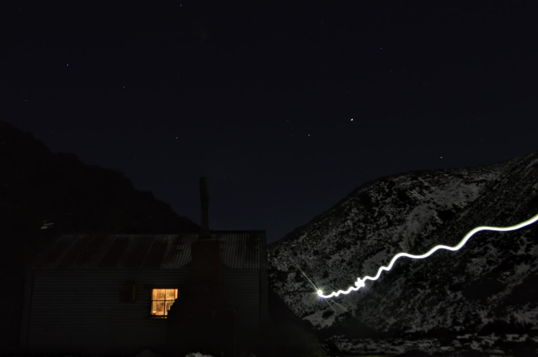 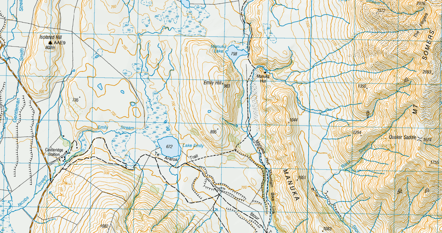 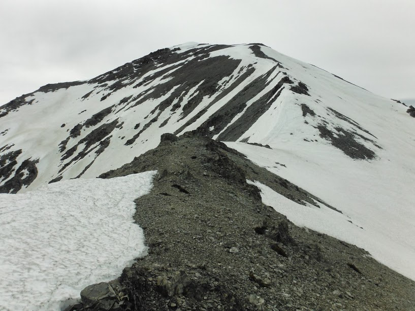 As part of the Torlesse Range, Castle Hill Peak offers views all the way from the Canterbury Plains to Porters Ski Field and Castle Hill Village. Just over an hour west of Christchurch along State Highway 73, Porters Pass marks the start of a relatively steep but enjoyable walk. In summer this is a non technical but challenging walk however in winter an ice axe and crampons are likely to be needed nearer the summit. There is a small gravel area to leave your car at when you reach the pass and the path begins as an indistinct route marked only by the occasional rock cairn. If you cannot locate the rock cairns, the ridge is still easily navigable as you head towards the obvious high point of Foggy Peak. Most of the height of this climb is gained in the journey from Porters Pass at 1000m to 1733m when you reach Foggy Peak. There is a lot of loose rock and deeper gravel once you get above the tussock layer which is slow on the way up but pretty fun coming back down. We set a leisurely pace as I was still recovering from the Spring Challenge a week earlier and my calf muscles weren't so keen on the incline initially. We reached Foggy Peak in a comfortable 1 hour 30 minutes. The trip from here is much easier on the legs and lungs as the ridge drops down to a wide saddle at 1600m where a convenient directional arrow fashioned out of large rocks indicates the correct way to traverse. A few patches of snow dusted the tops as we made our way north east towards the summit. The ridge peaks early at 1842m before another drop down precedes the real deal. The wind was beginning to pick up when we finally hit proper snow necessitating the donning of jackets and gloves before the final ascent. Two unknown persons had been about half an hour ahead of us since we left the road and we were looking forward to following their steps all the way to the top. Alas, two drunken polar bears couldn't have made more of a mess of the slope so we headed out onto clean snow and kicked our own path towards the trig. The ridge is not too narrow at this point and we made our way up the last 200m without any trouble. We were standing on the summit exactly 3 hours after leaving the car and just in time to greet two young guys heading back down the way we had just come. I kept the polar bear comment to myself and instead involved myself in a friendly conversation about weather, snow and other typical summit small talk. We found a clear patch of rocks to settle in for some fine Pak N Save cuisine and savoured our surroundings for a bit. The view from the top towards Mt Torlesse was interrupted only by patches of low lying cloud and we could see out to Lake Lyndon and Mt Enys behind us. At 1998m this was the highest mountain I had climbed to date and if I jumped high enough I could legitimately say I had been to 2000m finally - well almost. We demolished our bagels in a couple of minutes and were back on our way as the cold started to seep in through my soft shell. The return trip was fast and when we hit Foggy Peak again it was all down hill. The shingle and rock along the ridge isn't exactly a scree slope but it was definitely manageable to run and slide down large sections rather than trying to negotiate the steep terrain at a walking pace. The whole walk took only 5 hours and 10 minutes with a few stops along the way. The overcast weather held nicely all day with only occasional periods of gusty wind while we were near the top. This is a very achievable climb if you have a relatively good level of fitness and the snow will be all but gone by the end of October if you don't enjoy kicking steps on the edge of a ridge. 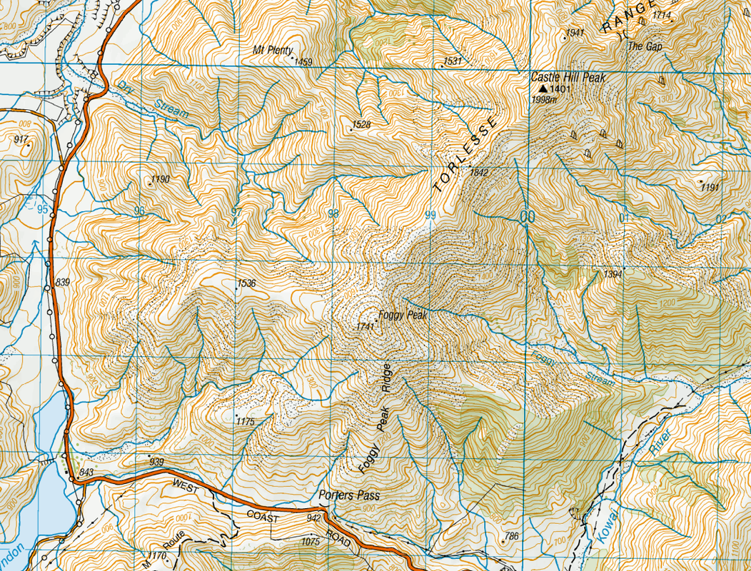
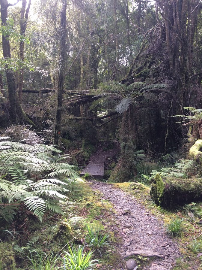
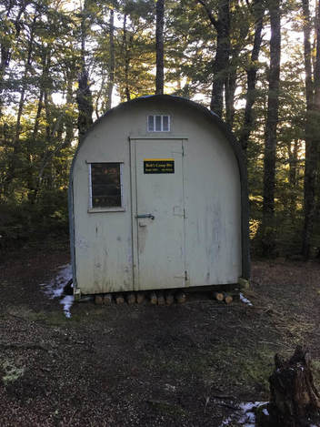
From here the track is above the bushline for a while giving stunning views in all directions before dropping down towards the intersection with the Whare route. The Whare route leads down to the popular, and much larger, Pinchgut Hut. I had been following plenty of footsteps in the snow up until this point which abruptly stopped when I turned west onto Bob’s Camp route. The route itself is well marked and easy to follow, with just the odd bit of windfall when I went through. The route drops down towards a small saddle before climbing gently up towards an area of open tops just above the biv site. The biv itself is located about 10 minutes from here in beech forest near a small stream. The hut is a cosy two-bunk affair that used to be located in Upper Salmon Creek before being relocated to its current site. There is a good camping area at the Biv so don’t be put off by the small size if you’re happy to tent it up. Water is available from the nearby stream (this may run dry at the height of summer). There is also a large outdoor fireplace that appears to get regular use (although I couldn’t find an axe when I visited). One of the great things about this area is that it is dog friendly so I was joined by my furry friend for the trip. Time: 2h 45m - 5 h one-way depending on your fitness Distance: Just under 10km with about 1000m ascent into the biv.  5/27/2018 4 Comments Crow Valley and Crow Hut Looking up valley towards Crow Hut The Crow Valley is the perfect weekend excursion into Arthur's Pass for those with limited time on their hands but wanting epic views and an awesome hut to spend the night. At only 4 hours walk from the road at Klondyke Corner, the 10 bunk hut is well situated high up the valley below Mt Rolleston at the end of an easy to follow route directly up the river. Half of our group had the luxury of a three day weekend and headed in on the Friday with more food than they would need for a week. The rest of us were parked on the Arthur's side of the river at a friendly 11am after having a few false starts leaving home that morning (the bacon was definitely worth gong back for). The sun was already out in full force as we began to pick our way up the main river bed towards the junction with the Crow Valley. There's enough water along the whole track that you can get away with a cup over a water bottle all the way to the hut. If you're heading in on a properly hot day then there are a few spots that would be perfect for a swim in both the Waimak and the Crow if you're brave enough. As we turned north we came across the track hugging the bottom of the spur and made our way around and through the forest. From here the track disappears in places but follow your nose and you'll find a few well placed rock cairns to help you navigate up the valley. We had plenty of time up our sleeves so it was a leisurely wander up until we hit snow and the last part of the track to the hut. This is the only section that gets a little bit steep and slippery in places but it's still pretty easy going. A slip just below the hut didn't bother me too much on the way in but a few stray boulders had me running on the return trip out the next day. This would be a great place not to hang around for too long.  Crow River not far from the hut While we had been walking in, the first half of our group had spent the day up the top of the valley practicing basic snow skills in the basin below Rome Ridge. This is where the Avalanche Peak route drops down and joins the Crow Valley from a scree slope just a little further to the north. This is an expert route but one I'd love to come back and have a go at with a bit more gear or less snow in summer. Our two groups converged on the hut late in the afternoon where a smorgasbord of culinary delights were presented as the challenge for the weekend was cooking gourmet hut food. Carrying in the non-stick fry pan turned out to be rather futile when we realised it was no longer very non-stick. Alas the pancakes were a huge fail but the sushi, tuna and wraps were bloody good. It was a full night with two other groups in the hut so a couple of the boys opted to sleep on the well appointed deck while the rest of us squeezed in on the bunks. Not that the sleeping conditions mattered in the end as a chorus of snoring kept most of us awake half the night and had me questioning why I choose to go away with boys at all. 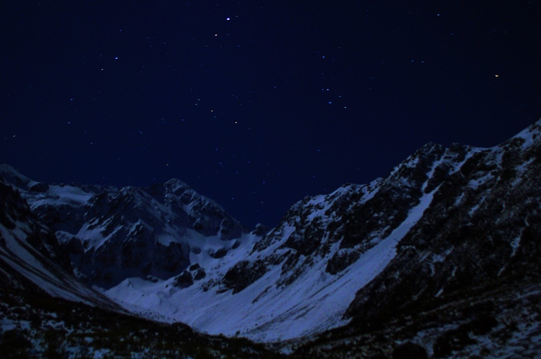 The trip back out to Klondyke Corner was pretty quick as much of the snow from the previous days had managed to melt leaving the track relatively clear the whole way. This is an easy 3-4 hours depending on how much time you want to dedicate to relaxing next to the river along the way. Once back at the car we made a slight detour via the Bealey Pub and later the Sheffield Pie Shop before heading back to Christchurch and real life again. *I repeated this trip with a group of girls from work a year later and we had the unfortunate (or fortunate depending on how you look at it) experience of being the sixth group to turn up to a very over full hut on a warm weekend in March. We ended up pitching a two man tent with a fly strung up beside it for seven of us to fit underneath. While we had an awesome night and made most of the hut inhabitants fairly jealous with our elaborate dinner set up, it was a good reminder to always be prepared with alternative means of shelter in easy to reach huts! We also found crossing the Waimak early after leaving the cars was reasonably challenging for the shorter members of the group on the way in as the river was flowing higher than our previous trip. I'd recommend linking up for the first crossing until you get a feel for the depth and speed which is quite deceptive and changes significantly in only a matter of hours. 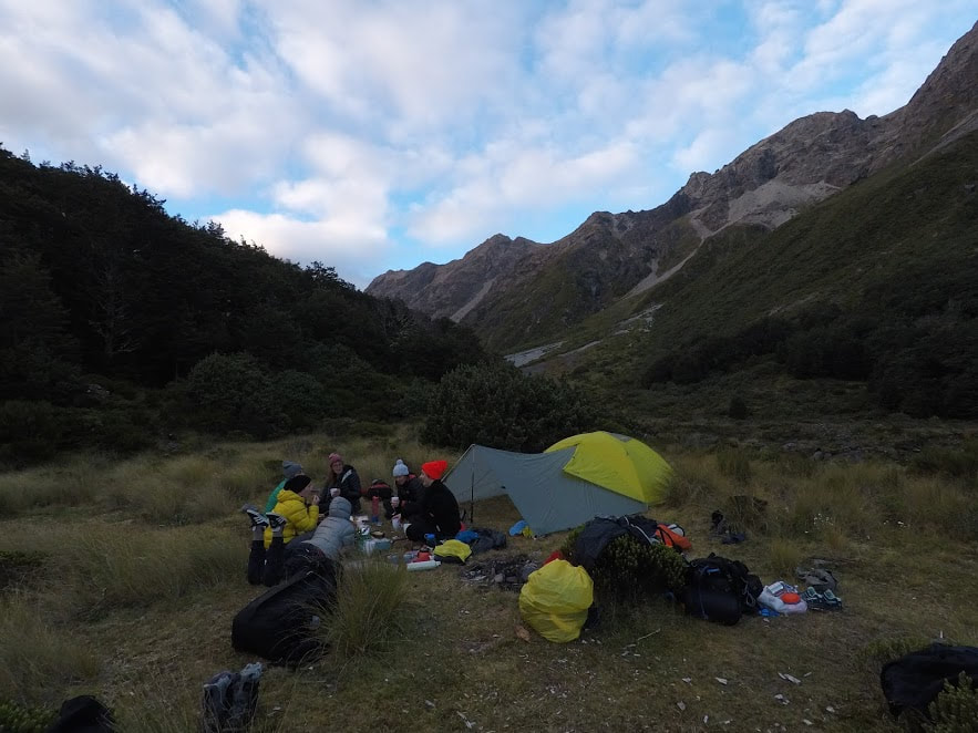 Epic tent modification time 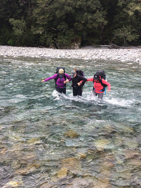 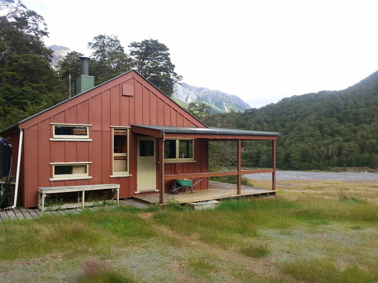
Hamilton Hut
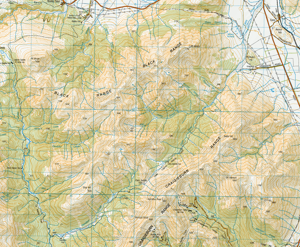
Most tramping trips don't begin with handing over your car keys to a complete stranger you just found wandering out of the bush in his undies. Thankfully Phil turned out to be a stand up guy and drove our car back to the other end of the track for us - also conveniently saving him a 12km mountain bike back to his own vehicle. The Cass Saddle to Lagoon Saddle track is an enjoyable and highly accessible 2-3 day walk in the Craigieburn and Black Ranges. The only issue being the considerable distance between the two track ends. We had driven to the Bealey Hut end beside the Arthur's Pass Wilderness Lodge and left Jeremy's single speed bike in the trees so he could retrieve the car the following day. Unfortunately, we were running pretty late leaving Christchurch after our puppy sitter fell through and we had left it to the last minute to purchase hut tickets. This put us at the Cass river end a little after 2pm negotiating a car swap and ready to hit the trail.
The first few kilometres are easy going along a 4wd track and then up the open river bed. Although there is a well worn path in places it is unnecessary to stick to it until after you pass the two major slips on the true right of the river. Large orange arrows direct you to where the track leaves the river in favour of the much cooler forest. A well maintained path allows for easy walking all the way to the Cass Saddle Hut. DOC suggests 4 hours for this leg of the journey but we arrived comfortably in 2.5. The hut itself is a cozy 3 bunker with a generous fire and separate receiving room for the loud sleepers.
From here we made our way out onto the open tussock of the saddle and our highest point for the day. In the colder months the area is an avalanche zone but there was nothing but rock and shingle above us as we ploughed along the track. Once across the saddle, you can look down at the Hamilton Hut away in the distance and smile because it's still two hours away. It could be worse though, and the four tourists we encountered heading in the opposite direction on our descent proved as much. The first two looked a little worse for wear and the second pair were barely moving up the slope. We gave them a friendly hello as we barrelled back down onto the flat of the valley. Once again we found ourselves following the river and before long it opened up to see the Hamilton sitting on a little rise in an open grassy field.
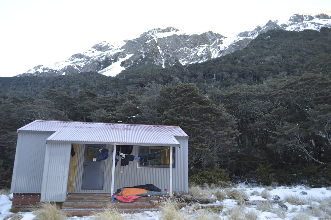
The 20 bunk hut has a beautiful big stone fireplace in the centre and generous living and cooking areas. We were delighted to find some evening reading material by way of a few issues of Wilderness magazine and settled in to watch the sun drop very slowly in the sky. Dinner consisted of noodles and Outdoor Gourmet Company Wild Mushroom and Lamb Risotto (I highly recommend). With no one else in the hut we had a tranquil sleep and awoke around 8am ready for the stroll out to the road end. Not being in any sort of hurry we took our time over breakfast and were just shouldering our pleasantly light packs before 9.30am. 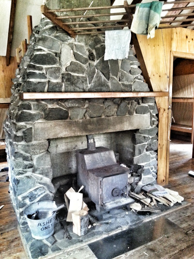
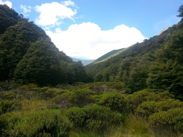
From the hut, the track winds a little further downstream and then across a wire bridge. We dropped our packs here and wandered up to Mirror Tarn, a 10 minute side trip that circles a small green pond - this may look better in the photo than it did in real life. The trip on to West Harper Hut took exactly 2 hours and we were glad for the mattresses back at the Hamilton once we peeked inside. The fire would be fantastic in winter but the old canvas bunks have definitely seen better days. After taking on some more fuel we kept trekking towards the Lagoon Saddle Shelter with an eye on the weather. Metservice had promised rain all weekend and we were waiting for it to eventuate.
With the exception of a German tourist walking the Te Araroa Trail, we were all alone wandering back towards the Bealey. It was another 2 hours to the Shelter, a tidy one bunk A-frame, and a further 1 hour 50 minutes to the track end. The rain caught us just as we disappeared back into the bush down the final spur. Thankfully our car was in fact waiting for us with keys included and we didn't have to track Phil down or try to walk back to Christchurch. Cass Road End to Hamilton Hut - 5 hours Hamilton Hut to Bealey Hut - 5 hours 50 minutes Hamilton Hut is serviced and requires 3 standard hut tickets or 1 serviced hut ticket per person. 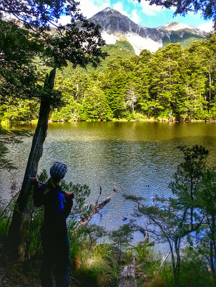
Mirror Tarn is well worth the side trip
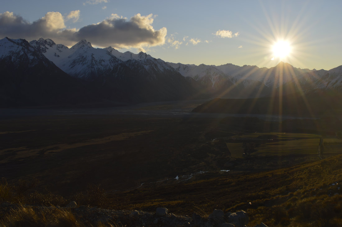
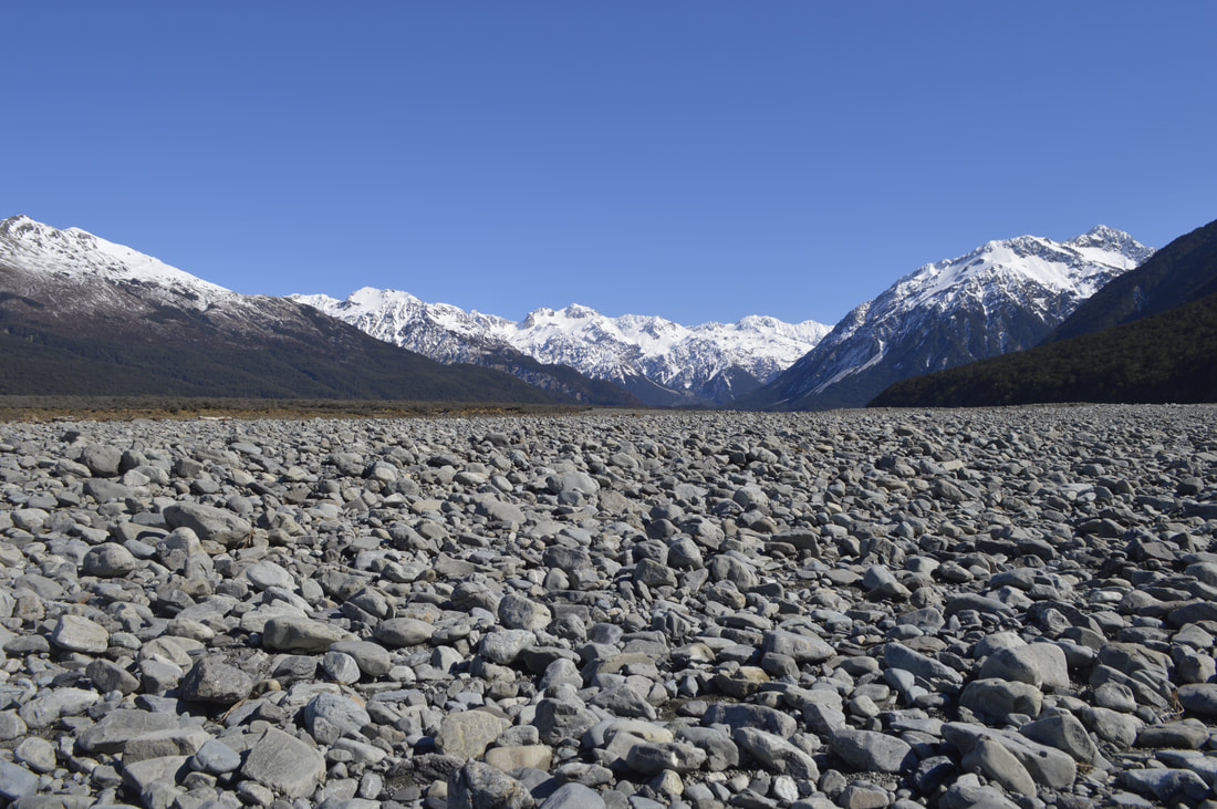
Looking across the Rangitata River towards Mt D'Archiac and the Two Thumbs Range
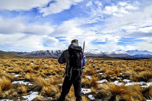
You know you're not off to the best start when you've already hit the snooze button three times on a Sunday morning. We had great intentions to climb Mt Taylor until we weren't on the road from Christchurch until 7.30am. A hasty flick through google maps had us changing our plans to nearby Mt Harper which we didn't know much about but looked pretty achievable. Slightly further up the Rangitata River towards Lake Clearwater and about 2 hours south west of Christchurch we decided that Harper in fact didn't have enough snow on it to make for much fun. Conveniently, this put us just up the road from Mt Potts which my husband assured me would be a great alternative.
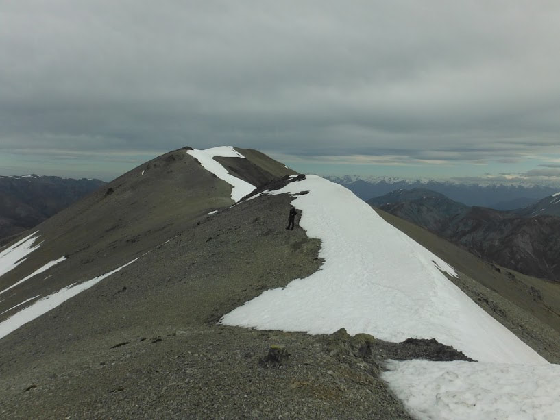
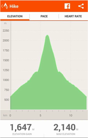
Mt Potts is a beautiful 2184m peak overlooking a valley so stunning it was the setting for Edoras in the second Lord of the Rings installment. The old, disused ski field road afforded us a leisurely path up to 1200m where we traded running shoes for our new mountaineering boots which were to be suitably broken in. This took us around 1 hour 30 mins with a few stops to remove layers etc before we turned to the more serious gradient towering above us. At this point I must reinforce that we had no way of knowing we had picked a snow slope that led steeply direct to the plateau between point 2152 and the summit itself. When we turned north east to begin our ascent I had in my mind that the first 500m would give way to some sort of leveling out where we could catch our breath before tackling the top third of the mountain. In reality we dragged ourselves up through a mix of knee deep powder and ice for the next 4.5 hours.
To add insult to incredibly tired legs we kept hitting large patches of ice which warranted putting crampons on after the first few hundred metres. This was actually a bit of a blessing as my cramponing skills leave a little to be desired. I've since found that I can in fact roll my ankle into an uncomfortable but effective position to have all 10 points biting into the ice. It was going on 4pm when we made one last exhausted push to the top of the ridge and sited the trig off to our left. We gave ourselves about 5 minutes to take some photos as a bitterly cold wind gusted across the tops and then we were on our way. Both of us had in mind a 2 hour trip back down to the ski field access road - the reality was somewhat faster. Thanks to my new found crampon confidence and the sand dune like nature of the slope, we more or less ran back down in 50 minutes. The terrain certainly wasn't technical but the snow was covered in some pretty thick ice towards the top so it was hard work zig zagging the last couple of hundred metres without slipping.
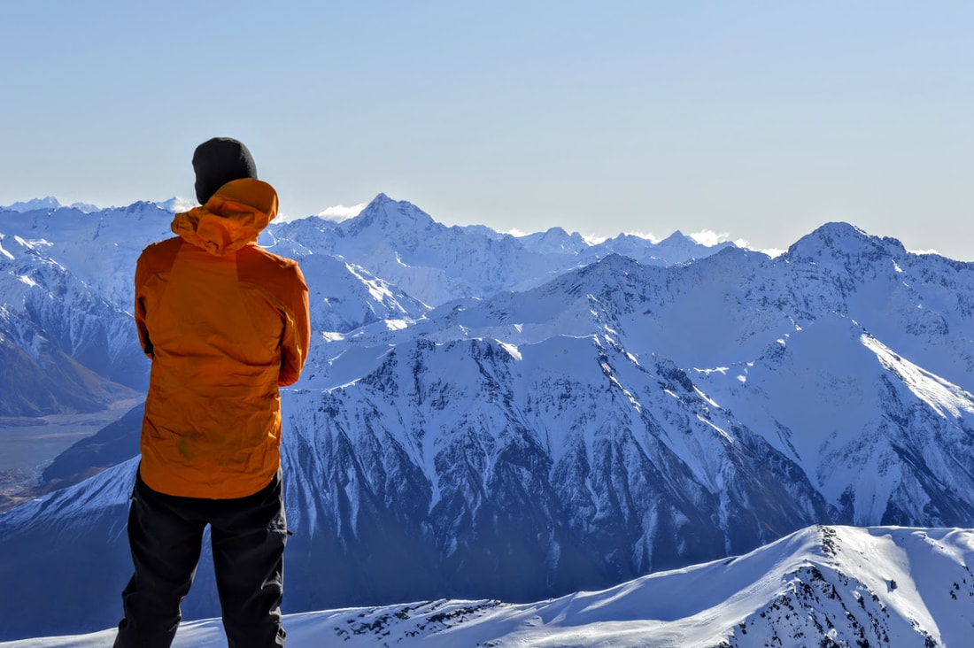
With the luxury of plenty of light left we made our way slowly back to the car while taking lots of photos of the impressive ranges across the river and further inland. This is a pretty magic part of the country and incredibly accessible for those who prefer the comfort of their car to punishing their bodies in search of a summit view.
Total time: 7 hours 45 minutes Ascent: 5 hours 40 minutes Access: From Christchurch drive south to Rakaia on SH1, turn at the Mobil and again at the South Rakaia Hotel to gain Thompson's Track. Head inland to Mt Somers Village and onward to Lake Clearwater. Continue on until you cross a bridge to the Mt Potts side of the river and on to the ski field access road opposite Mt Sunday. Grade: High level of fitness required. Ice axe and crampons definitely needed during winter months but a non-technical climb overall. 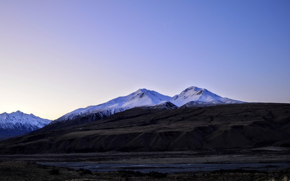
Mt Potts
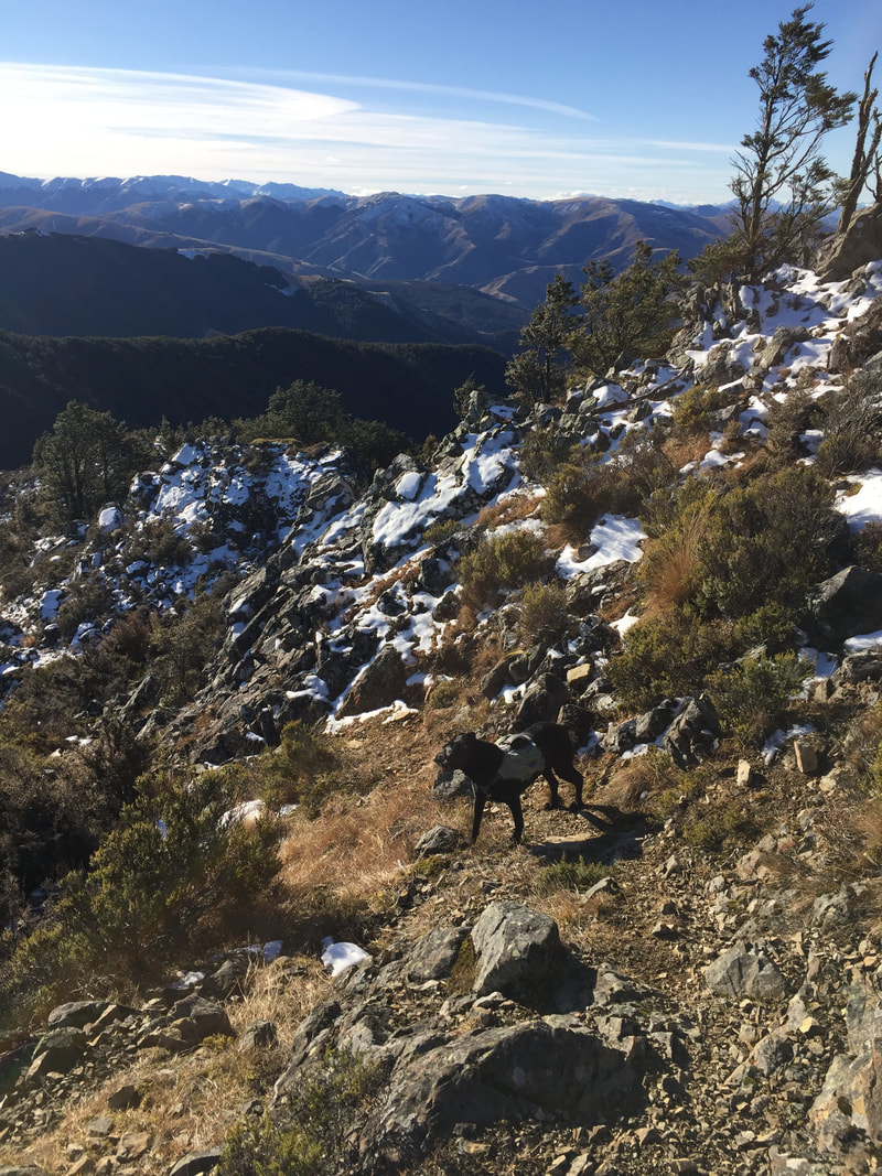
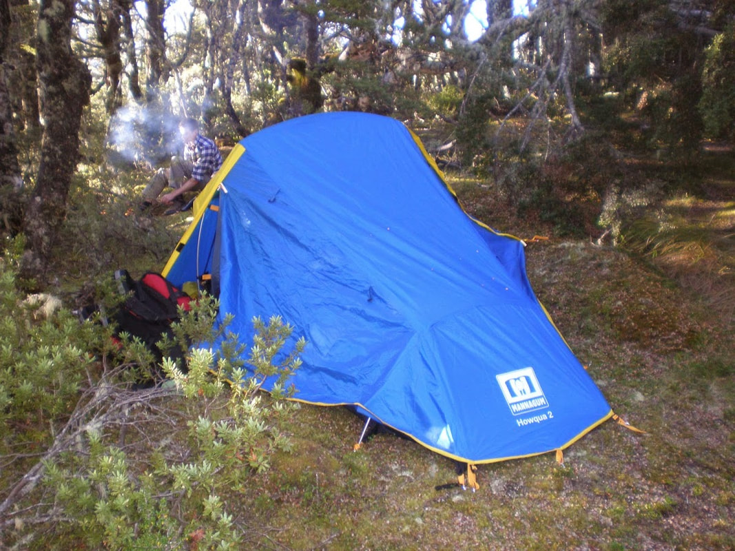
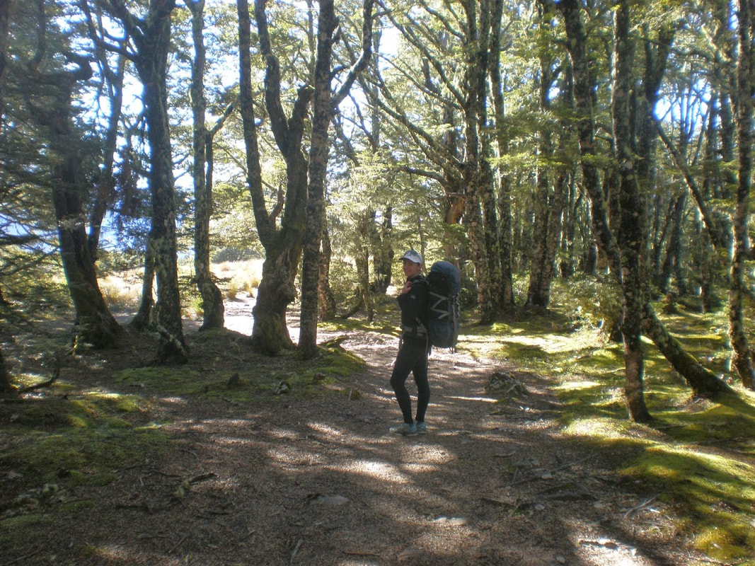
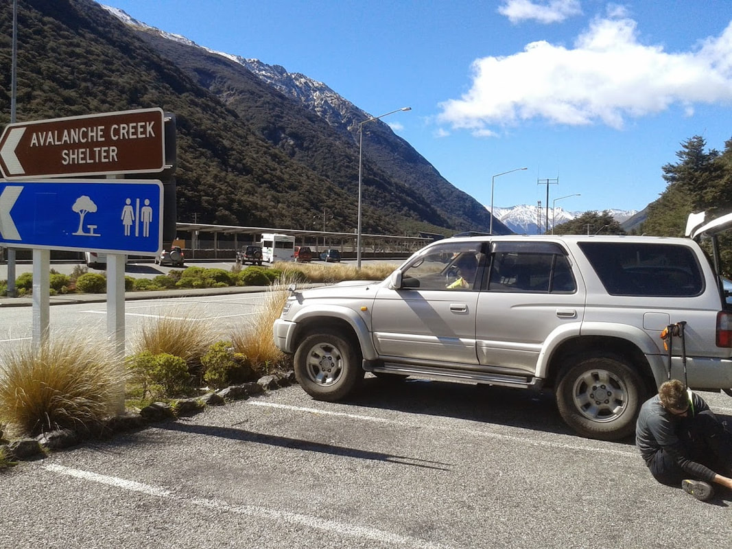
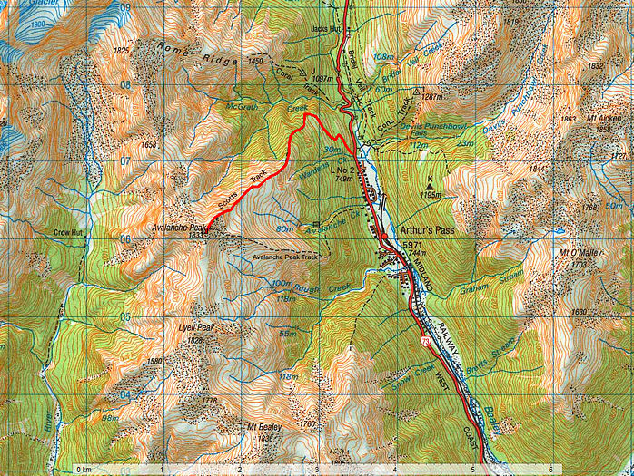
5/19/2018 4 Comments Bealey Spur, Arthurs Pass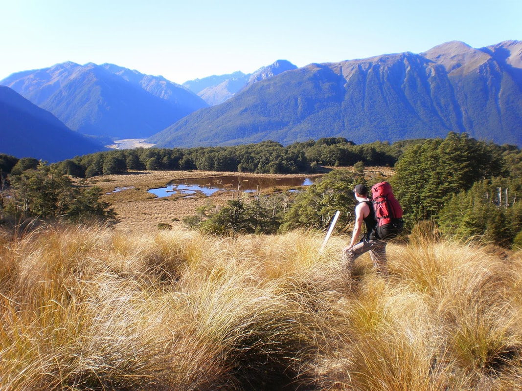 Bealey Spur is a great day trip or easy overnighter if you are looking for a beginner tramp. We decided to head up to Arthur's Pass and take on the the hill in order to try out the new tent we had just bought (because new gear right?!). Although an historic musterer's hut lies at the top of the track, it's two small bunks and cramped interior leave a little to be desired. There are plenty of places to pitch a tent and with far too much food in our packs we began walking in the early afternoon. The track is timed at around 3-4 hours return but without heavy packs most families could manage that time easily. We left the car just off State Highway 73 (14km south of Arthur's Pass Village) at Cloudesley Road. The track begins at the end of this road and winds gently up through the Beech Forest before opening out into tussock 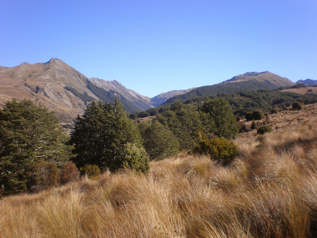 With beautiful weather and plenty of traffic on the track we took our time up the first part of the spur and stopped to chat to many of the tourists and locals coming back from a day trip to the hut. We planned to feast that night and both our packs were heavily weighed down by food and drink making for a slower ascent. When we reached the halfway point the landscape opens up into tussock land with tarns scattered across the hillside. These are fun to explore so long as you don't actually fall into the freezing water! From this vantage point you gain sweeping views of the Waimakariri River towards Klondyke Corner in the East and the Hawdon Valley in the West. After satisfying our photo needs we continued on up to Bealey Spur Hut at just over 1200m. Upon arrival we found that the hut had been taken over (at four in the afternoon) by two anti-social tourists. We had a quick look around and then made our way 200m further on to our camp site for the night. It was finally time to try out the mighty Mannagum Howqua and I jumped straight into setting up poles and ropes with complete disregard for the instructions. The tent was going to be our answer to tramping in areas where bunks in huts cannot always be guaranteed and was our first big gear purchase. It's incredibly lightweight at 2.3kg and Jeremy can actually sit up in it without hitting his head on the roof which is a bonus. Once the tent was up we lit a small fire and got the potatoes and bacon cooking for an early dinner. It was a relaxing evening and we managed to draw out the cooking and eating portion for a couple of hours. The night wasn't quite so peaceful with a band of sadistic Kea harassing the boys over at the hut all night. Those birds are incredibly loud on a windless night and we got far less sleep than we had hoped for. The tent proved a winner though with plenty of room for both of us and our packs neatly stuffed under the extended portion of the fly on either side. In the morning we made short work of packing up and missioning it down the hill to the car as we had to be back in Christchurch by lunchtime. Take your time on this walk as the scenery is fantastic and feel free to bring along your less experienced friends as the track is far more achievable than some of the walks closer to Arthur's Pass Village. 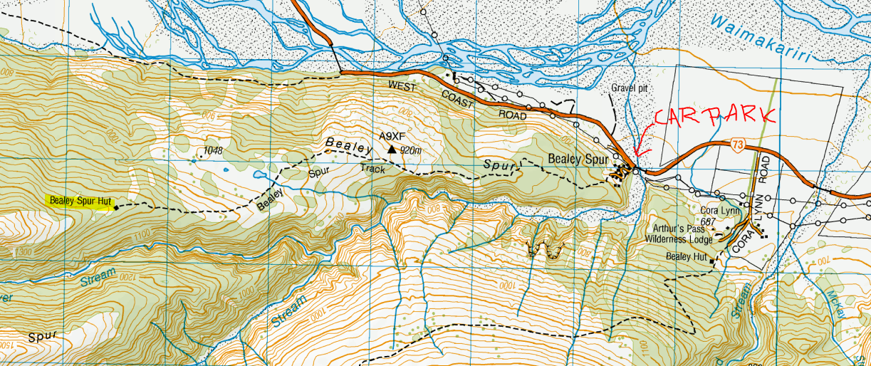 5/19/2018 1 Comment Avalanche Peak - Arthurs Pass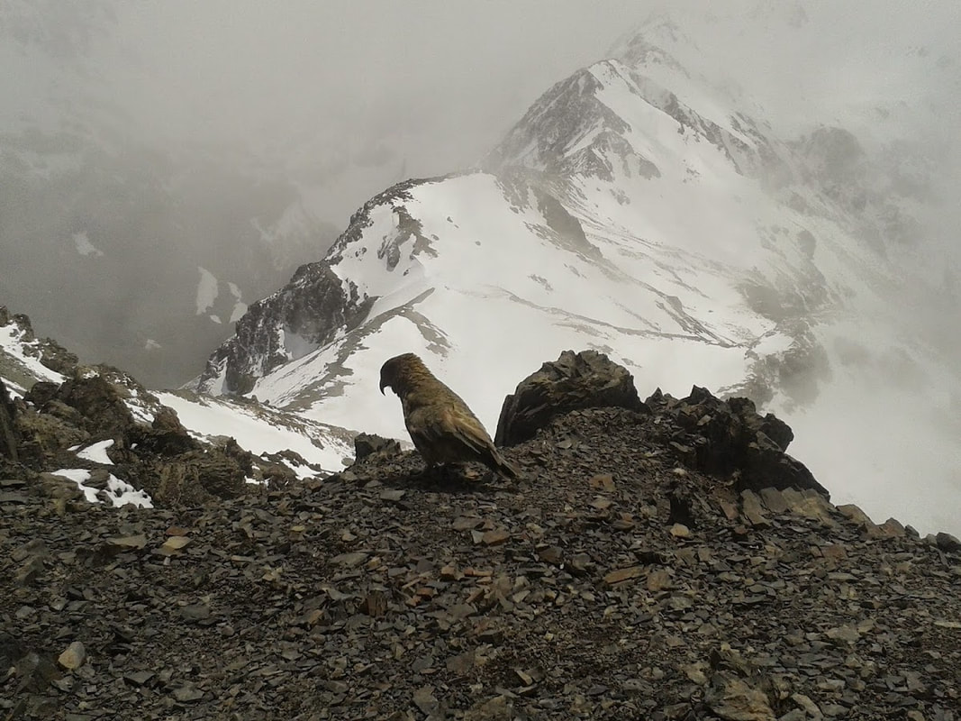 Beware of the local Kea, they have a taste for trekking poles and anything else you'll let them sink their beaks into! Avalanche Peak is a great little day trip for those who like breath taking views and punishing their quads. Starting right behind the Arthur's Pass visitors centre, the Avalanche Peak Track shoots straight up through some quite rocky terrain which is often snow covered before ending on a narrow ridge at 1833m. While this may not be the kind of walk you take your Grandma on as some sections will require all four limbs engaged as you scrabble your way towards the bush line, it's thoroughly enjoyable for anyone with a good level of fitness. Take plenty of water and something in the snack department to bribe yourself to keep going all the way to the summit (a cheeky Snickers Bar does it for me). I had set out with my husband and our very energetic friend Ollie from Christchurch at around 8am. The drive to Arthurs Pass Village is around an hour and a half and we parked just off the main road right beside the visitors centre. There was definitely snow on the tops so extra insulation layers were added to our packs before we set off for the ascent. You don't get much of a warm up and my legs were burning in the first five minutes - a feeling that thankfully wore off once we got into it. Conveniently, we took a moment to capture a few shots of the serene waterfall not long into the climb and let the body adjust to the impressive incline. It was 90 minutes to the bush line and also our first glimpse of snow. As the trees make way for tussock you can look back down the valley in both directions and up towards the summit which was well covered in the white stuff. We hadn't taken ice axes as the snow was fresh but the trekking poles came in handy on the steep slope as we made our way towards the top of the ridge. 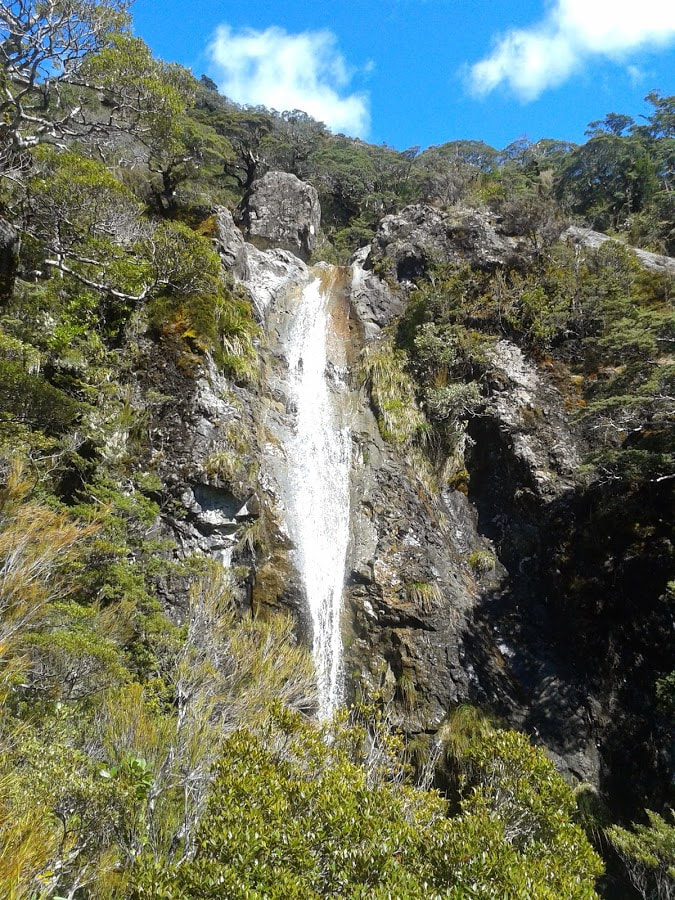 Some waterfall goodness Unfortunately we missed a good deal of the view as it started snowing as soon as we reached the summit, but Derek the friendly kea stepped up to entertain us. I wonder what tourists think of going all the way to the top of a mountain in New Zealand and finding a basically tame endangered bird. We let him destroy the mud basket on one of our poles while we ate lunch but he wasn't keen to follow us back down. The snow slope we had carefully made our way up half an hour earlier was much more quickly navigated on our butts on the return journey. You can make your way back down the way you have come or instead descend on the slightly gentler Scott's Track which returns you to the road just north of the township. Expect to take just as long to get back down unless you want to swing from the tree branches which significantly speeds up the descent. 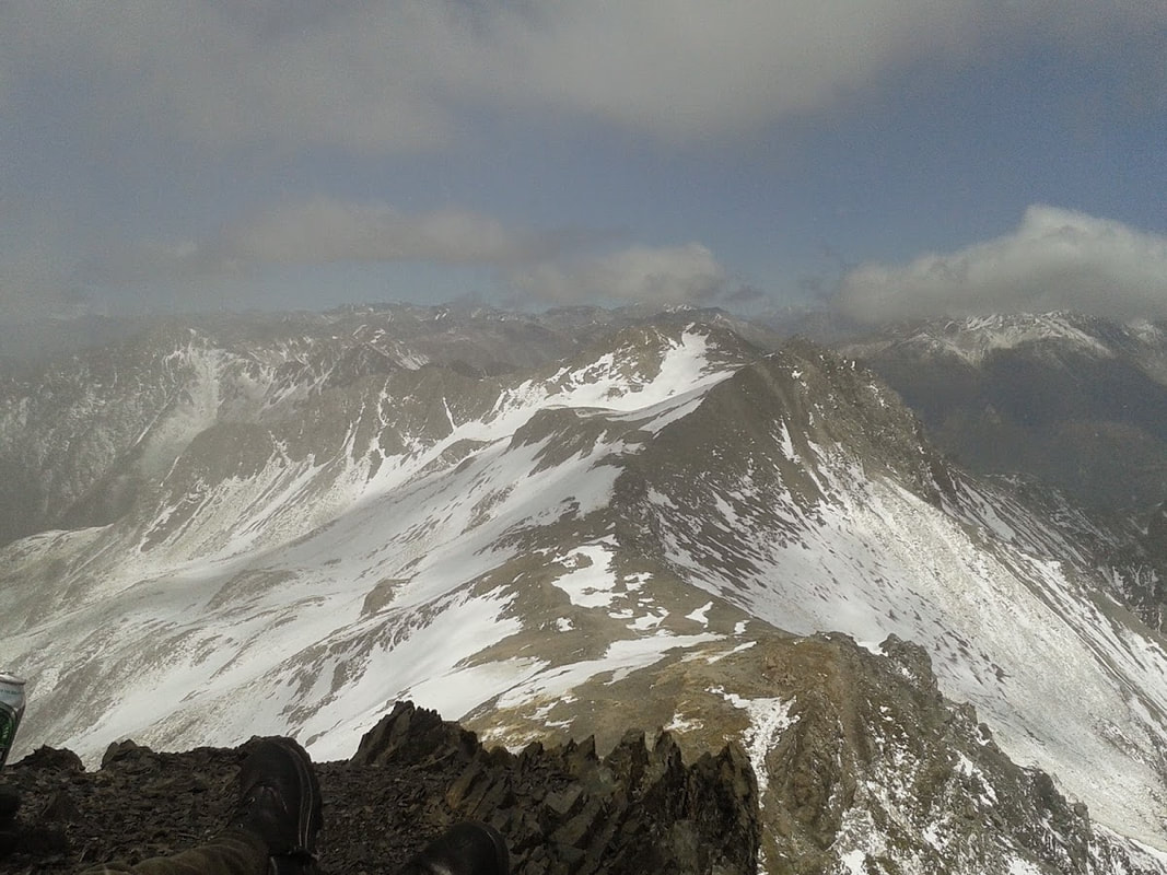 View from up top 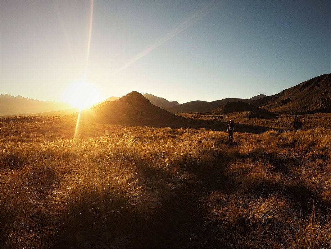 One of the hard things about hiking in New Zealand is there are plenty of places you're not allowed to take your dog. That can lead to all sorts of feelings of guilt, betrayal and separation anxiety which are no fun for anyone. Cue the Hakatere Conservation Area. The Te Araroa Trail runs straight through it and at only 90 minutes drive from Christchurch it's perfect for finding overnighters that are K9 friendly. Head south to Mt Somers before turning inland towards Lake Clearwater, turn right onto Hakatere/Heron Road and drive 3-4kms until just before the bridge where there's a small car park at the side of the road. You can also access Mystery Lake from Lake Clearwater and if you want to walk in and out the same way I'd recommend starting from the Lake instead. We planned to complete the loop from the lake, over the saddle to Boundary Creek Hut and out past the west side of Dog Hill so parking here made more sense. As work commitments meant not leaving town until 1pm and stopping for fuel and lunch on the way, we didn't actually get on the track until three in the afternoon. For some stupid reason both of us were confident in walking 16km from the car to Mystery Lake in the less than three hours of daylight we still had left - more on this shortly. The track begins by crossing the wide open grasslands of what used to be a high country station and the gradient is only very gradually uphill all the way to Paddle Hill Creek. There was plenty of water here at the end of April so I imagine it's running all year round. The heat was well and truly getting to our four legged companion at this stage so we had to rest up and let her cool off in the stream as we watched the sun dip even lower in the sky. 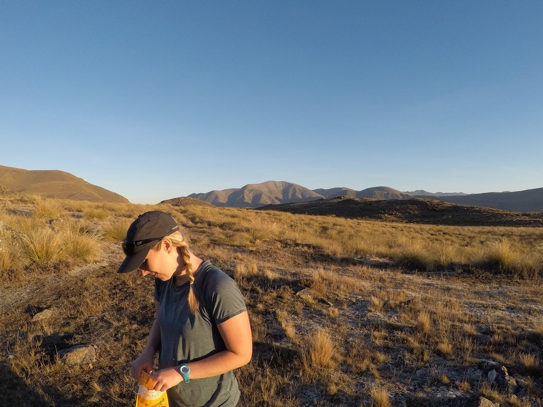 Once we were underway again we had to pick up the pace as we hadn't really planned on looking for a tent site in the dark. Again the track is relatively easy to follow here but it would be an interesting challenge in the dark or with snow on the ground so keep this in mind when planning your trip. You follow the Te Araroa Trail until the junction with Mystery Lake Track. These junctions are well sign posted with track distances and times which are pretty accurate for the average hiker. DOC suggests 5 hours into Mystery Lake from the road end and we took just under 3 at a pace that may as well have been jogging. The last section of track has a few short hills and then you pop out at the East end of the Lake. The low lying areas are quite swampy but there are some ideal tent sites just to the sides of the track about 50m from the lake edge. It was basically dark when we arrived so we didn't spend too long choosing somewhere to set up camp for the night. It was a crystal clear night which always means two things - breathtaking starry skies and bloody freezing! I made the most of practicing my night photography, downed a re-hydrated gourmet feast and tried to make the dog a bed out of something that wasn't my sleeping bag before retiring for the night. Staying right next to a lake with a Labrador was a fatal mistake and she was soaking wet by the time we got her in the tent which in turn made my sleeping bag soaking wet. I didn't get a lot of sleep in the end and as I write this a semi-new four season sleeping bag may have replaced my trusty but somewhat tired three-season version. In the morning we climbed up the hill with a hot cup of coffee to catch the sun as it rose and thaw out a little. Once the tent was packed away we headed east and up over the hill behind the lake. This links up with the Potts Hut Track after about a kilometre and takes an easy climb up to the top of the saddle. If you are coming up from the Boundary Creek side then you're in for a bit of a gut buster, give yourself plenty of time and take lots of water in summer. After dropping down and taking a slight detour to the hut we stopped for lunch and some shade by the river. The hut had been full of hunters overnight and a couple were still there when we arrived. Having to keep the two dogs apart we didn't hang around too long and hit the track again heading for the car early in the afternoon. The way back to the car from here is essentially a four wheel drive track although you would need good clearance to make it through. DOC puts the walk out at 5 hours and we shaved a good amount of time off that due to not really stopping the whole way. We were back at the car just after two with one seriously tired dog and a strong desire for fast food.
All in all a cool little circuit with beautiful sweeping views and a stunning campsite. Easy hiking but long distances so give yourself plenty of time on both days. |
CategoriesAll Arthurs Pass National Park Avalanche Peak Bealey Spur Bob's Camp Biv Cannibal Gorge Hut Canterbury Foothills Carroll Hut And Kelly Range Cass Saddle Lagoon Saddle Castle Hill Peak Crow Valley And Crow Hut Edwards - Stanley Rivers Fowlers Pass To Lake Guyon Gloriana Peak And Ada Pass Hut Hakatere Conservation Area Hanmer Springs Hope Kiwi Jollie Brook Circuit Kahurangi National Park Kepler Track Lake Sumner Forest Park Lathrop Saddle Little Mt Peel Manuka Hut Marlborough Maukuratawhai Mt Barrosa Mt Bruce Mt Cassidy Mt Potts Mt Princess Mt Somers Mt Tapuae-o-uenuku Mt Te Kinga Mt Torlesse Mystery Lake Nelson Lakes Packhorse Hut Poulter Hut Roys Peak St James Sylvia Tops Tablelands Circuit - Salisbury Lodge The Five Passes The Three Passes Travers-Sabine Circuit Tribulation Hut Waiau Pass And Blue Lake Wanaka West Coast |


 RSS Feed