|
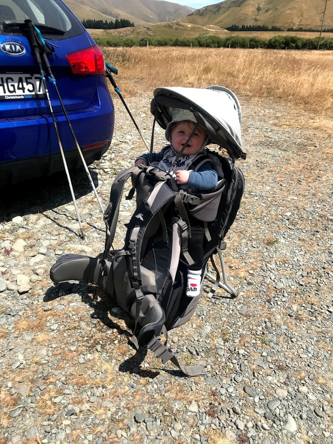
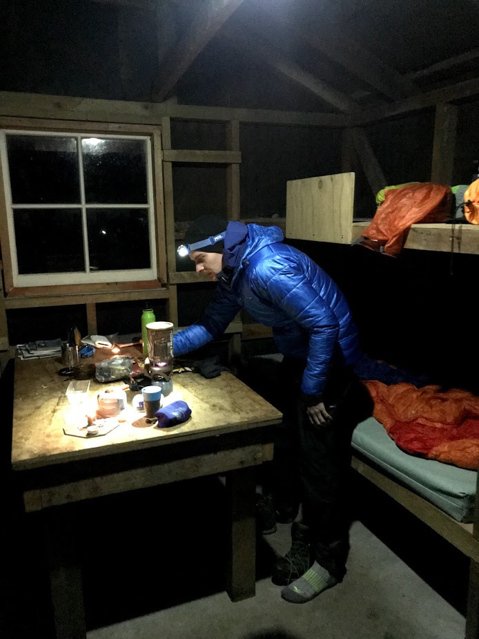
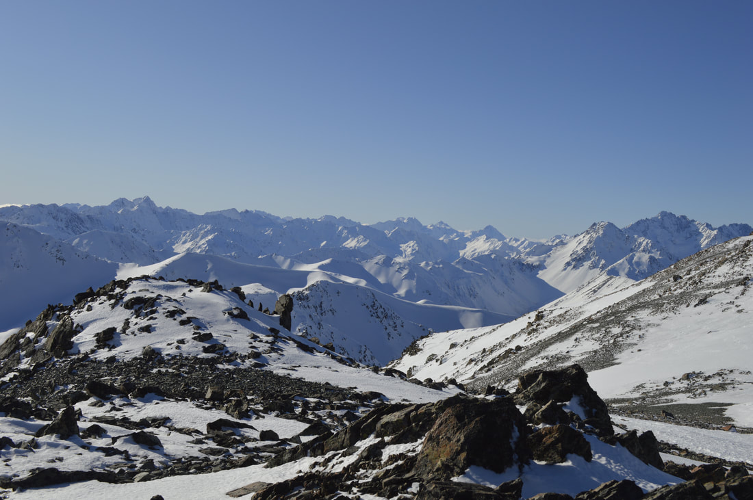
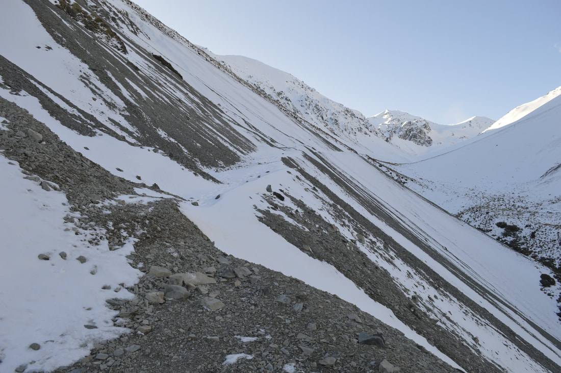
2/1/2020 1 Comment Mt Barrosa, Canterbury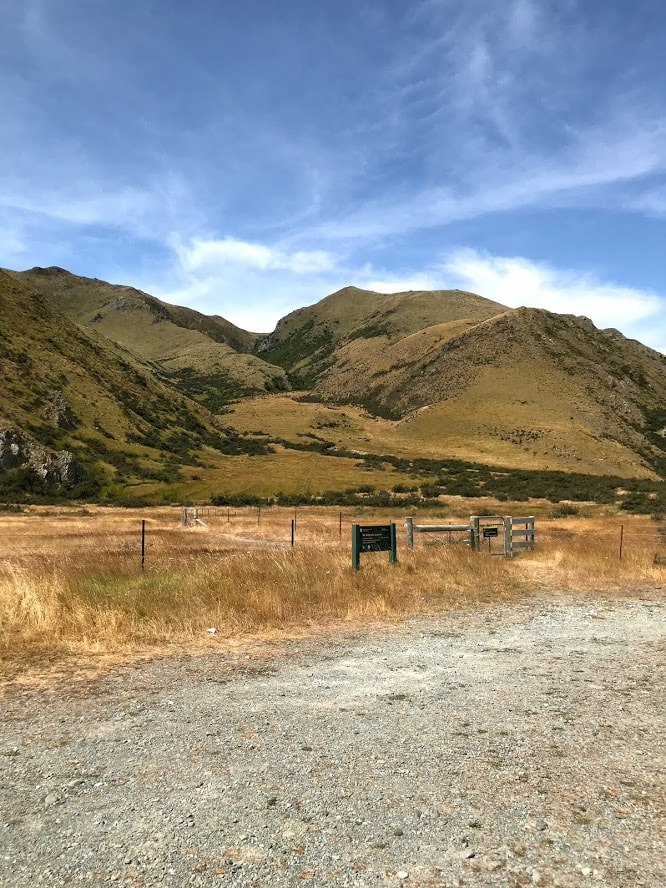 Looking up the start of the track from the car park If you're like us and have a dog and live in Canterbury then you'll appreciate how hard it can be to find new places to explore that are pooch friendly. Now that we've added a baby into the mix, finding appropriate weekend adventures has been somewhat more complex. On a positive note, it's meant we've had to look for and since discovered some really great tracks that had been right under our noses the last few years. Mt Barrosa is one of those little gems. Only 90 mins from the city and an awesome leg work out despite it's relatively short distance, I was surprised how much I enjoyed this track. I would highly recommend it to those with less time on their hands but wanting some decent elevation gains (840m to be exact) for trail running, hiking or serious dog walking. Just inland from the more well known summit of Mt Somers, Barrosa is a more achievable 1364m and the track begins right off Ashburton Gorge Road making access super easy. There is no toilet here so make sure to stop in Mt Somers village if you're less inclined to answer the call of nature in, ah, nature that is. You will also need to bring your own water as there is nowhere to fill up save for a stream at the beginning which I wouldn't rely on to be safe to drink. I went through a 2 litre bladder on a rather hot day just for reference. DOC puts the trip to the summit at 2.5 hours for 3.5km but I think most groups would be closer to the 2 hour mark if you're used to walking in the hills. This makes it possible to finish the whole trip in a morning then be back in town for Aunty Barbara's Poodle's 2nd Birthday with plenty of time to spare.  From Christchurch, head south to Rakaia and then inland along Thompsons Track and Tramway Road to Mt Somers Village 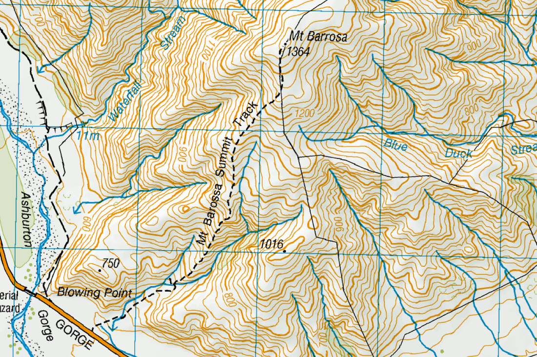 The first half of the climb is actually steeper and more challenging than the top half so hang in there if your lungs are feeling the burn early on! nWe packed the baby up into his carrier and set the dog off (under complete control of course) up the start of the track which climbs gently through grassy paddocks for the first 10 minutes. After crossing a small stream a large orange arrow directs you up the spur and off the 4WD track and straight into the climb. The slope is pretty relentless for the whole first hour which if you're a glass is half full kind of character then you'll be happy to get the elevation gain quickly behind you. Conversely, if you're a bit of a negative Nancy then go to your mind palace and try not to think about the quad burn, it'll be over soon. The track is clear and simple to follow if not a bit rough under foot in places. Eventually the gradient eases off and we had a short breather and a snack just passed the 1000m mark so the baby could have a roll around and eat some tussock. The track remains exposed along the ridge most of the way and the high winds made for a slightly more challenging ascent than on a calm day. It also stopped us from taking too many breaks and we finished the second half of the climb in one push. Towards the top of the mountain, you'll start to notice some pretty looking rocks scattered around the place. Barrosa and the Mt Somers area more generally are well known sites for discovering Agates, a rather novel reminder of their volcanic history. The summit itself was a little anti-climatic with no trig to signal the highest point but instead a rock garden of sorts to take in the expansive views from. Although the track here was easy to follow, a lack of route markings could make this significant;y more challenging in poor weather. You may want to carry a GPS or wait until you get a clear day to avoid wandering down the wrong spur on the return trip. The wind deterred us from staying too long and we made our way back down fairly quickly. The track is a little harder as you drop down through the steeper sections as the dry dirt and scree make for a slippery path. With a baby carrier to contend with, we took this part quite slowly and as a result were quite a bit longer getting back to the car than we would normally be just the two of us. If you're tossing up whether or not to carry trekking poles I think it's well worth it just for getting up and down that section of the ridge. All in all, we were still relatively quick with the total round trip taking 3 hrs 20 mins including stops. The little guy was still happy at the end, the dog was shattered so a pretty successful day trip as far as I'm concerned. If you're confident carrying a baby on your back up steep hills then this is a great option but unfortunately I wouldn't try it if you're not 100% confident in your fitness and/or footing. For those of you just rocking a day pack like a normal person then this is a fun little challenge that'll get your heart rate up but not ruin you for the rest of your weekend! 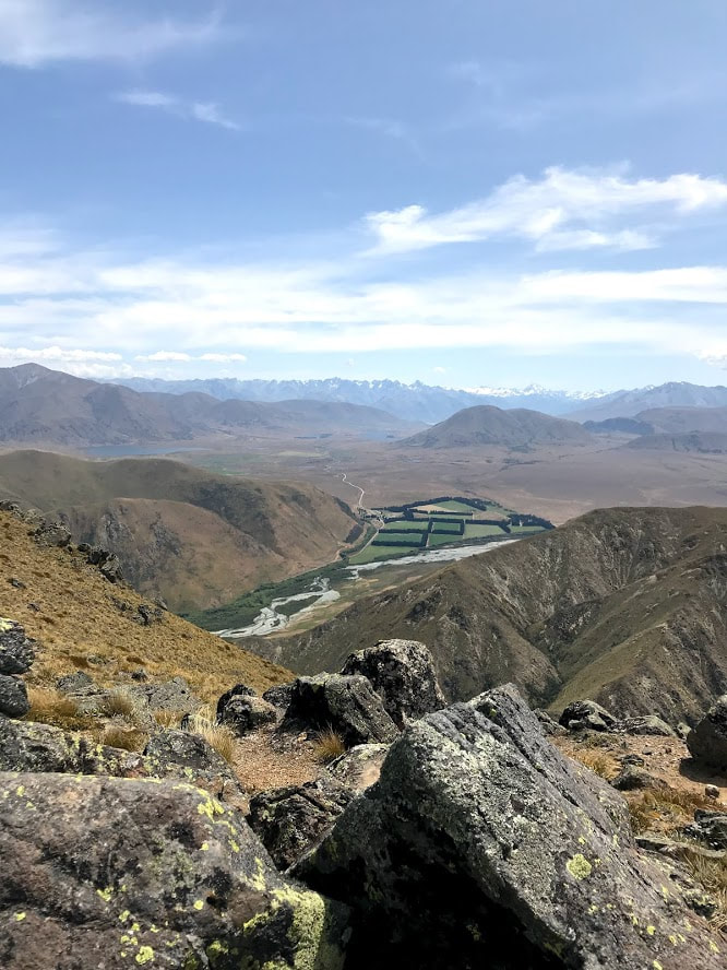 Lake Emma and Lake Clearwater in the distance 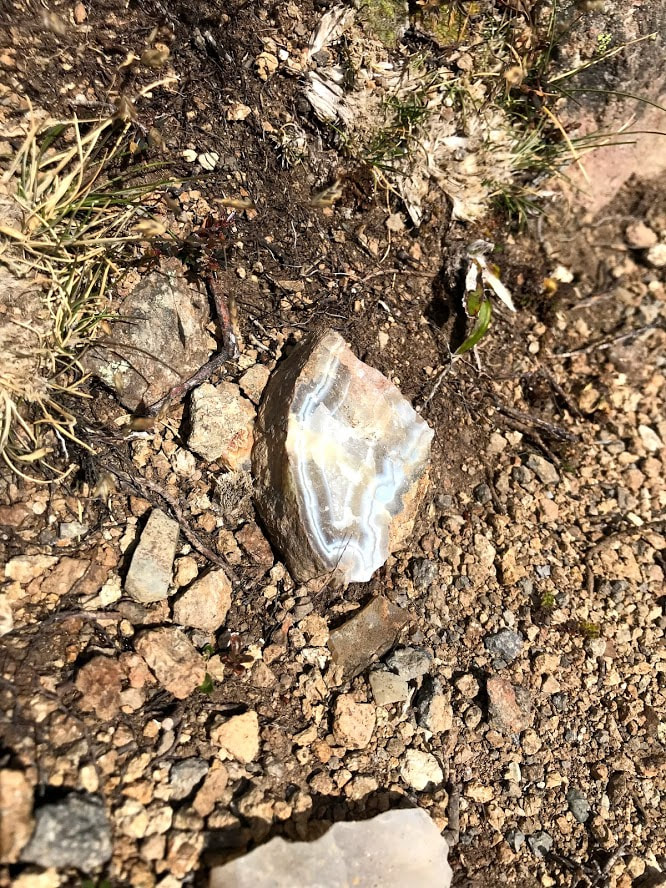 Agate spotting 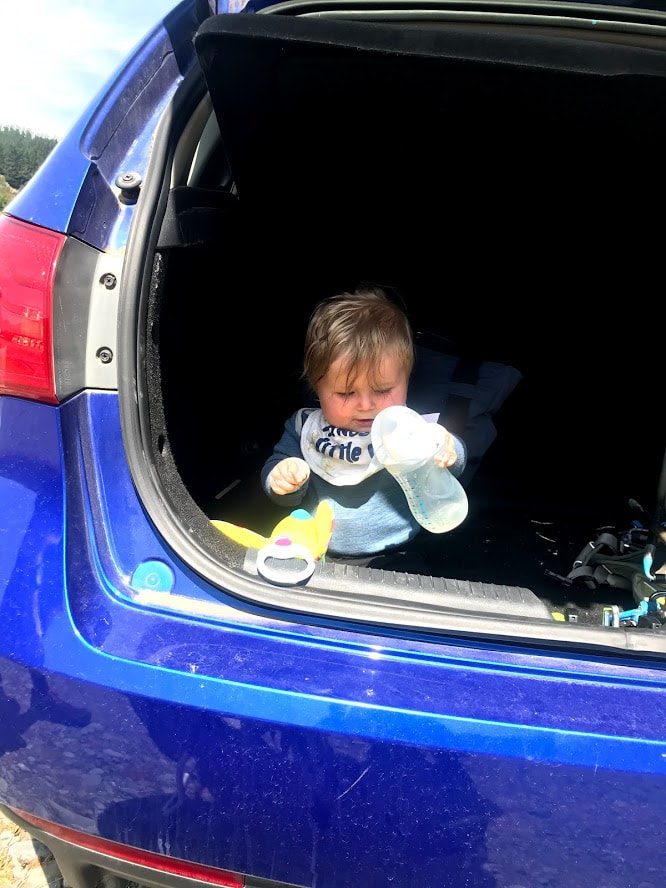 Keeping the baby entertained in the boot while getting ready
1 Comment
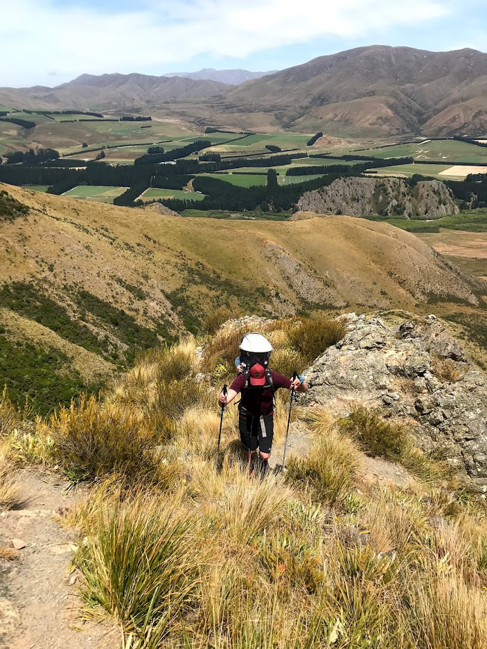
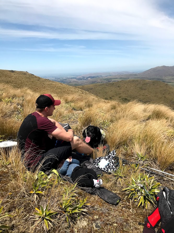
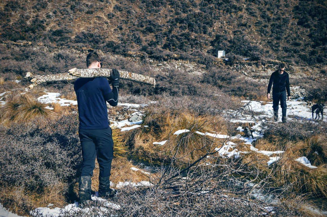
 Looking back towards the Rakaia River late in the afternoon Not every trip need be an epic expedition into gnarly territory, full of hardship and suffering (although we do enjoy a good bit of suffering from time to time!). Sometimes you're just looking for a quiet weekend away from the city with a pleasant amount of exercise coupled with some beautiful views. The walk into Tribulation Hut from the banks of the Rakaia River certainly ticks these boxes and is a great introductory walk for anyone with limited experience or little legs. The hut lies on the edge of the Hakatere Conservation Area and borders a working farm on the far side of the valley. Drive south from Christchurch to Rakaia and then follow the river inland past Mt Hutt on the south side of the river. Blackford road will turn to shingle part way down and has some small ford crossings so a 4WD would be preferable especially after rain. Parking can be found through a gate on the left hand side of the road just before the bridge over Redcliffe stream.  DOC puts the 10km walk (one way) at 3.5 hours and this is pretty fair on the way in as the track climbs a fairly rough route for the first 4km up the river. Although this is a poled route the track has been washed away in places and a few of the detours may take you a couple of minutes to find. Throughout the whole walk you should either be on fairly obvious tracks or see poles every 100m or so. This is by far the most challenging part of the walk and although you will encounter a few steep climbs they're over very quickly as the track deposits you on top of a wide grassy plateau. Redcliffe Saddle will open up in front of you and the track meanders gradually through tussock along the boundary fence with the neighbouring farm. Follow the poles another 5km before dropping down into the river bed just before the hut. This will be easy to cross at a low flow but be wary after heavy rain. Tribulation Hut is a tidy 6 bunk hut with a long drop and plenty of water access. It doesn't have a fire unfortunately so if you're heading here in winter you'll need a good sleeping bag. While the trip to the hut and back to the road end is pretty straight forward, some parties choose to climb nearby Rat Hill for a bit more of a challenge. The return trip to the car is a good deal quicker as you're heading mostly down hill or along the flat. Total Distance: 20km Total Time: 5-7hrs Pro Tip: Head back to Methven on your way out and get the Large Nachos from the Blue Pub 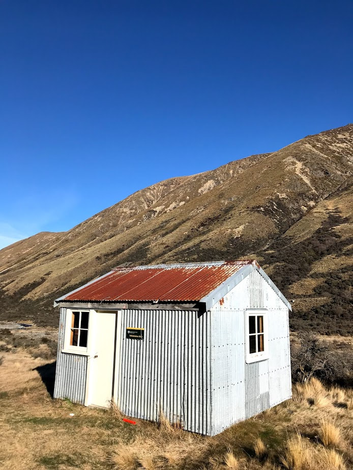 Tribulation Hut 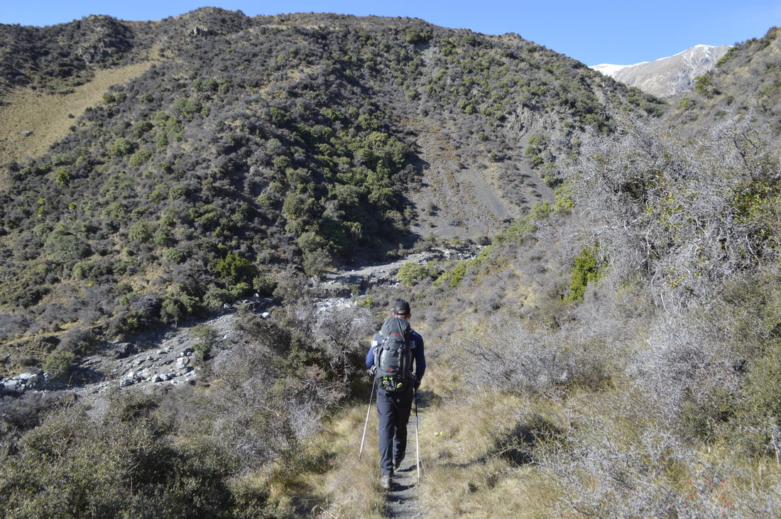 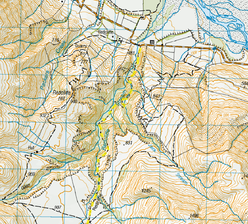 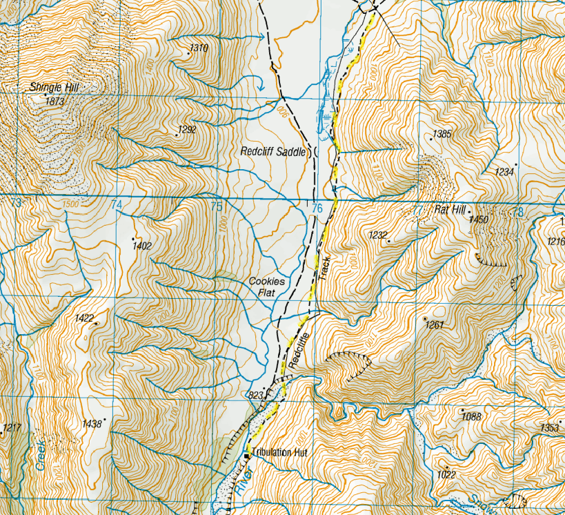 6/10/2018 2 Comments Manuka Hut - Hakatere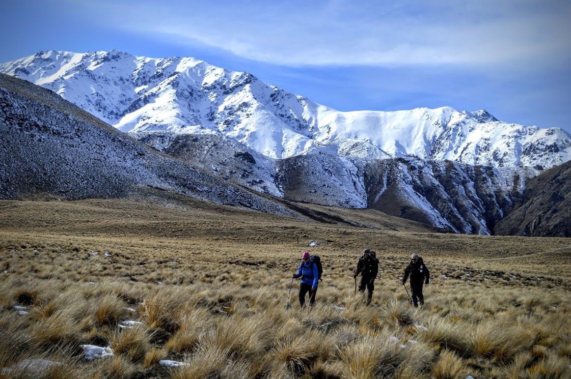 Not all trips need to be grueling expeditions through dense bush or up steep mountains. Sometimes it's nice to just load your pack up with a tonne of delicious food and head to a great little hut for the night with some mates. Manuka Hut is the perfect easy over-nighter with a very achievable 5km walk from the road end with fantastic views all the way. Head in via Hakatere Heron Road from Ashburton Gorge Road and follow the sign to the start of the track. If you have a grunty 4WD you might make it along the farm track to the actual track car park but we were deterred by a couple of feet of mud and left our vehicles at the gate. The track crosses farmland below Lake Emily before sidling around the base of Emily Hill. Here we found a good amount of snow still covering the hill side which made for a slippery time for some of us. From here follow the poled route down to the old 4WD track and around the corner to the hut. Although this makes up part of the Te Araroa Trail, the hut book showed not many people had been through that way over the winter months. The hut itself is a charming 6 bunk basic with a fire to one side and plenty of seating. The only thing it was lacking when we arrived was anything to actually burn. Having brought in all manner of wood cutting tools, we spent the afternoon scavenging dead trees and cutting down a few new ones to add to the hut's supplies. A quick scramble up onto the ridge immediately behind the hut offers a great vantage point to look across at the ridge to Mt Taylor and all the way back towards the Two Thumb Range on the far side of the Rangitata River. This would be an awesome spot to bring kids into or as an introduction to tramping for beginners. Go next level like one of our crew and carry your own kindling wood in for exceptionally good fire starting. Time: 1.5 hours each way Hut: Basic Points for replacing the fire wood you burn *An alternative route can be taken on foot or by bike up the Stour River Track. A car park can be found just over the bridge, 2km further on from the turn off to Woolshed Creek/Mt Somers. 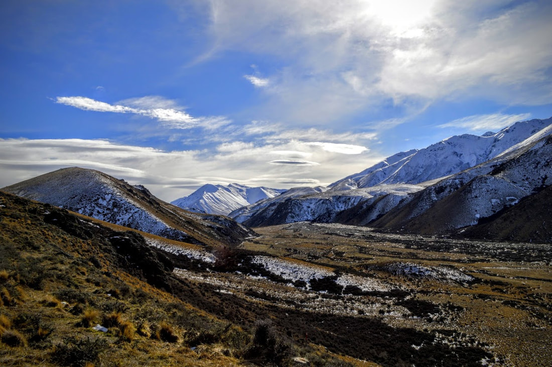  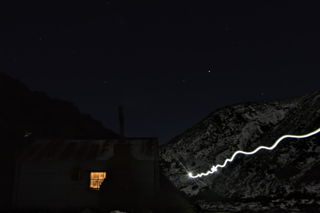  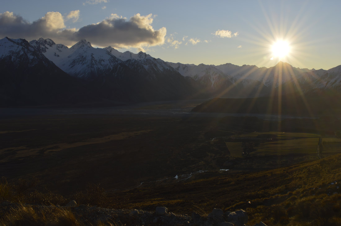
Looking across the Rangitata River towards Mt D'Archiac and the Two Thumbs Range
You know you're not off to the best start when you've already hit the snooze button three times on a Sunday morning. We had great intentions to climb Mt Taylor until we weren't on the road from Christchurch until 7.30am. A hasty flick through google maps had us changing our plans to nearby Mt Harper which we didn't know much about but looked pretty achievable. Slightly further up the Rangitata River towards Lake Clearwater and about 2 hours south west of Christchurch we decided that Harper in fact didn't have enough snow on it to make for much fun. Conveniently, this put us just up the road from Mt Potts which my husband assured me would be a great alternative.
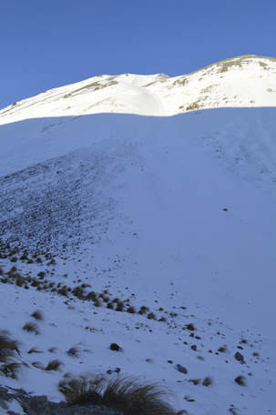
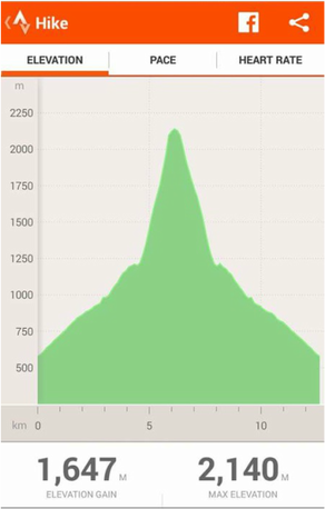
Mt Potts is a beautiful 2184m peak overlooking a valley so stunning it was the setting for Edoras in the second Lord of the Rings installment. The old, disused ski field road afforded us a leisurely path up to 1200m where we traded running shoes for our new mountaineering boots which were to be suitably broken in. This took us around 1 hour 30 mins with a few stops to remove layers etc before we turned to the more serious gradient towering above us. At this point I must reinforce that we had no way of knowing we had picked a snow slope that led steeply direct to the plateau between point 2152 and the summit itself. When we turned north east to begin our ascent I had in my mind that the first 500m would give way to some sort of leveling out where we could catch our breath before tackling the top third of the mountain. In reality we dragged ourselves up through a mix of knee deep powder and ice for the next 4.5 hours.
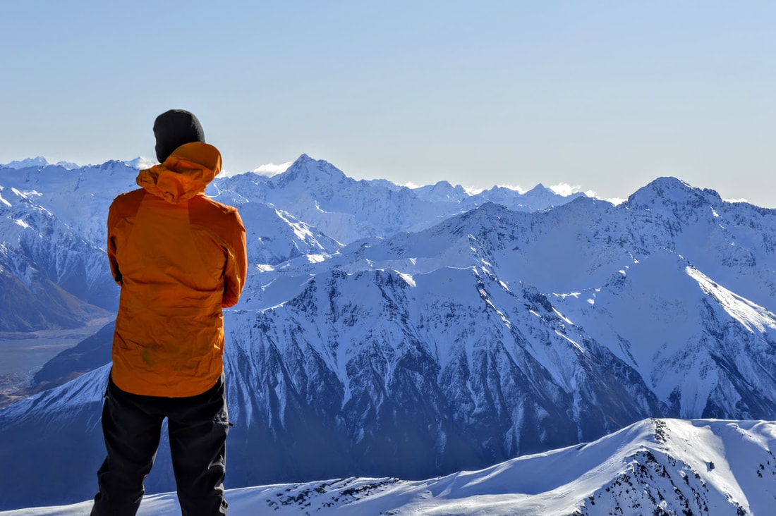
To add insult to incredibly tired legs we kept hitting large patches of ice which warranted putting crampons on after the first few hundred metres. This was actually a bit of a blessing as my cramponing skills leave a little to be desired. I've since found that I can in fact roll my ankle into an uncomfortable but effective position to have all 10 points biting into the ice. It was going on 4pm when we made one last exhausted push to the top of the ridge and sited the trig off to our left. We gave ourselves about 5 minutes to take some photos as a bitterly cold wind gusted across the tops and then we were on our way. Both of us had in mind a 2 hour trip back down to the ski field access road - the reality was somewhat faster. Thanks to my new found crampon confidence and the sand dune like nature of the slope, we more or less ran back down in 50 minutes. The terrain certainly wasn't technical but the snow was covered in some pretty thick ice towards the top so it was hard work zig zagging the last couple of hundred metres without slipping.
With the luxury of plenty of light left we made our way slowly back to the car while taking lots of photos of the impressive ranges across the river and further inland. This is a pretty magic part of the country and incredibly accessible for those who prefer the comfort of their car to punishing their bodies in search of a summit view.
Total time: 7 hours 45 minutes Ascent: 5 hours 40 minutes Access: From Christchurch drive south to Rakaia on SH1, turn at the Mobil and again at the South Rakaia Hotel to gain Thompson's Track. Head inland to Mt Somers Village and onward to Lake Clearwater. Continue on until you cross a bridge to the Mt Potts side of the river and on to the ski field access road opposite Mt Sunday. Grade: High level of fitness required. Ice axe and crampons definitely needed during winter months but a non-technical climb overall. 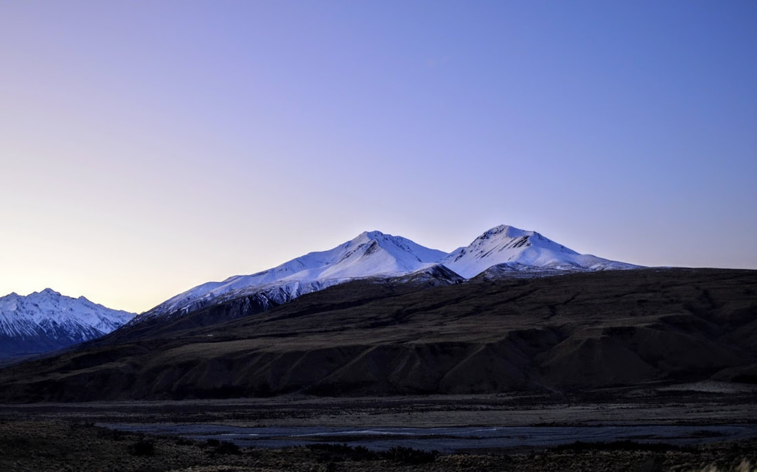
Mt Potts
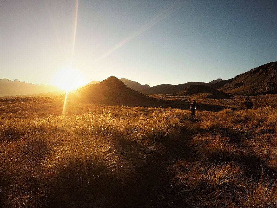 One of the hard things about hiking in New Zealand is there are plenty of places you're not allowed to take your dog. That can lead to all sorts of feelings of guilt, betrayal and separation anxiety which are no fun for anyone. Cue the Hakatere Conservation Area. The Te Araroa Trail runs straight through it and at only 90 minutes drive from Christchurch it's perfect for finding overnighters that are K9 friendly. Head south to Mt Somers before turning inland towards Lake Clearwater, turn right onto Hakatere/Heron Road and drive 3-4kms until just before the bridge where there's a small car park at the side of the road. You can also access Mystery Lake from Lake Clearwater and if you want to walk in and out the same way I'd recommend starting from the Lake instead. We planned to complete the loop from the lake, over the saddle to Boundary Creek Hut and out past the west side of Dog Hill so parking here made more sense. As work commitments meant not leaving town until 1pm and stopping for fuel and lunch on the way, we didn't actually get on the track until three in the afternoon. For some stupid reason both of us were confident in walking 16km from the car to Mystery Lake in the less than three hours of daylight we still had left - more on this shortly. The track begins by crossing the wide open grasslands of what used to be a high country station and the gradient is only very gradually uphill all the way to Paddle Hill Creek. There was plenty of water here at the end of April so I imagine it's running all year round. The heat was well and truly getting to our four legged companion at this stage so we had to rest up and let her cool off in the stream as we watched the sun dip even lower in the sky. 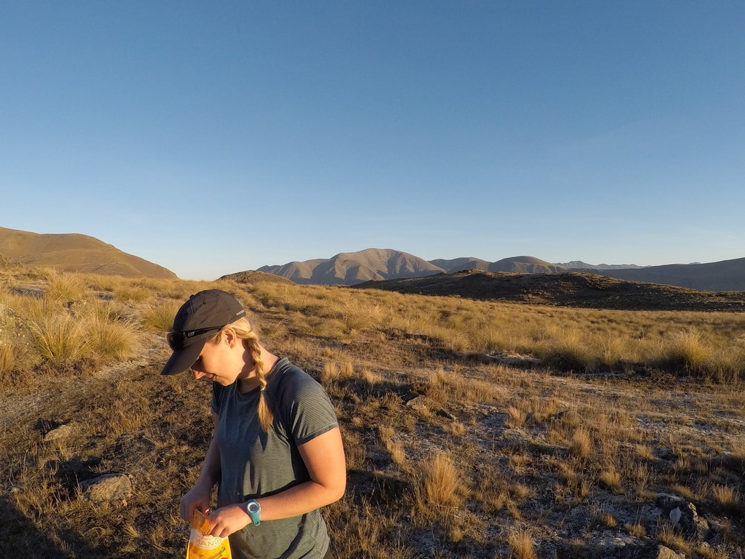 Once we were underway again we had to pick up the pace as we hadn't really planned on looking for a tent site in the dark. Again the track is relatively easy to follow here but it would be an interesting challenge in the dark or with snow on the ground so keep this in mind when planning your trip. You follow the Te Araroa Trail until the junction with Mystery Lake Track. These junctions are well sign posted with track distances and times which are pretty accurate for the average hiker. DOC suggests 5 hours into Mystery Lake from the road end and we took just under 3 at a pace that may as well have been jogging. The last section of track has a few short hills and then you pop out at the East end of the Lake. The low lying areas are quite swampy but there are some ideal tent sites just to the sides of the track about 50m from the lake edge. It was basically dark when we arrived so we didn't spend too long choosing somewhere to set up camp for the night. It was a crystal clear night which always means two things - breathtaking starry skies and bloody freezing! I made the most of practicing my night photography, downed a re-hydrated gourmet feast and tried to make the dog a bed out of something that wasn't my sleeping bag before retiring for the night. Staying right next to a lake with a Labrador was a fatal mistake and she was soaking wet by the time we got her in the tent which in turn made my sleeping bag soaking wet. I didn't get a lot of sleep in the end and as I write this a semi-new four season sleeping bag may have replaced my trusty but somewhat tired three-season version. In the morning we climbed up the hill with a hot cup of coffee to catch the sun as it rose and thaw out a little. Once the tent was packed away we headed east and up over the hill behind the lake. This links up with the Potts Hut Track after about a kilometre and takes an easy climb up to the top of the saddle. If you are coming up from the Boundary Creek side then you're in for a bit of a gut buster, give yourself plenty of time and take lots of water in summer. After dropping down and taking a slight detour to the hut we stopped for lunch and some shade by the river. The hut had been full of hunters overnight and a couple were still there when we arrived. Having to keep the two dogs apart we didn't hang around too long and hit the track again heading for the car early in the afternoon. The way back to the car from here is essentially a four wheel drive track although you would need good clearance to make it through. DOC puts the walk out at 5 hours and we shaved a good amount of time off that due to not really stopping the whole way. We were back at the car just after two with one seriously tired dog and a strong desire for fast food.
All in all a cool little circuit with beautiful sweeping views and a stunning campsite. Easy hiking but long distances so give yourself plenty of time on both days. |
CategoriesAll Arthurs Pass National Park Avalanche Peak Bealey Spur Bob's Camp Biv Cannibal Gorge Hut Canterbury Foothills Carroll Hut And Kelly Range Cass Saddle Lagoon Saddle Castle Hill Peak Crow Valley And Crow Hut Edwards - Stanley Rivers Fowlers Pass To Lake Guyon Gloriana Peak And Ada Pass Hut Hakatere Conservation Area Hanmer Springs Hope Kiwi Jollie Brook Circuit Kahurangi National Park Kepler Track Lake Sumner Forest Park Lathrop Saddle Little Mt Peel Manuka Hut Marlborough Maukuratawhai Mt Barrosa Mt Bruce Mt Cassidy Mt Potts Mt Princess Mt Somers Mt Tapuae-o-uenuku Mt Te Kinga Mt Torlesse Mystery Lake Nelson Lakes Packhorse Hut Poulter Hut Roys Peak St James Sylvia Tops Tablelands Circuit - Salisbury Lodge The Five Passes The Three Passes Travers-Sabine Circuit Tribulation Hut Waiau Pass And Blue Lake Wanaka West Coast |
 RSS Feed